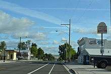
Imbler, Oregon
| Imbler, Oregon | |
|---|---|
| City | |
|
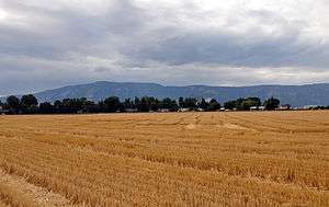
Fields near Imbler | |
 Location in Oregon | |
| Coordinates: 45°27′37″N 117°57′49″W / 45.46028°N 117.96361°WCoordinates: 45°27′37″N 117°57′49″W / 45.46028°N 117.96361°W | |
| Country | United States |
| State | Oregon |
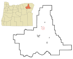
| County | Union |
| Incorporated | 1922 |
| Government | |
| • Mayor | Mike McLean |
| Area[1] | |
| • Total | 0.22 sq mi (0.57 km2) |
| • Land | 0.22 sq mi (0.57 km2) |
| • Water | 0 sq mi (0 km2) |
| Elevation | 2,725 ft (831 m) |
| Population (2010)[2] | |
| • Total | 306 |
| • Estimate (2012[3]) | 306 |
| • Density | 1,390.9/sq mi (537.0/km2) |
| Time zone | Pacific (UTC-8) |
| • Summer (DST) | Pacific (UTC-7) |
| ZIP code | 97841 |
| Area code(s) | 541 |
| FIPS code | 41-36050[2] |
| GNIS feature ID | 1143998[4] |
| Website | www.imbleroregon.com |
Imbler is a city in Union County, Oregon, United States. The population was 306 at the 2010 census.
History
Imbler was platted in 1891.[5] As Summerville declined, Imbler became the town serving locals in the northern Grande Ronde Valley.[5]
Geography
Imbler lies about 4 miles (6 km) southeast of Summerville at the intersection of Summerville Road with Oregon Route 82. The state highway connects Imbler with La Grande to the southwest and Elgin to the northeast. Flowing north slightly east of the city is the Grande Ronde River.[6]
According to the United States Census Bureau, the city has a total area of 0.22 square miles (0.57 km2), all of it land.[1]
Demographics
| Historical population | |||
|---|---|---|---|
| Census | Pop. | %± | |
| 1920 | 206 | — | |
| 1930 | 203 | −1.5% | |
| 1940 | 182 | −10.3% | |
| 1950 | 149 | −18.1% | |
| 1960 | 137 | −8.1% | |
| 1970 | 139 | 1.5% | |
| 1980 | 292 | 110.1% | |
| 1990 | 299 | 2.4% | |
| 2000 | 284 | −5.0% | |
| 2010 | 306 | 7.7% | |
| Est. 2015 | 306 | [7] | 0.0% |
2010 census
As of the census of 2010, there were 306 people, 114 households, and 90 families residing in the city. The population density was 1,390.9 inhabitants per square mile (537.0/km2). There were 119 housing units at an average density of 540.9 per square mile (208.8/km2). The racial makeup of the city was 93.8% White, 1.0% Native American, 1.3% Pacific Islander, 2.6% from other races, and 1.3% from two or more races. Hispanic or Latino of any race were 2.6% of the population.[2]
There were 114 households of which 36.0% had children under the age of 18 living with them, 69.3% were married couples living together, 7.0% had a female householder with no husband present, 2.6% had a male householder with no wife present, and 21.1% were non-families. 16.7% of all households were made up of individuals and 8.7% had someone living alone who was 65 years of age or older. The average household size was 2.68 and the average family size was 3.06.[2]
The median age in the city was 43 years. 24.5% of residents were under the age of 18; 6.8% were between the ages of 18 and 24; 24.2% were from 25 to 44; 34.3% were from 45 to 64; and 10.1% were 65 years of age or older. The gender makeup of the city was 50.3% male and 49.7% female.[2]
2000 census
As of the census of 2000, there were 284 people, 106 households, and 83 families residing in the city. The population density was 1,257.3 people per square mile (476.8/km²). There were 111 housing units at an average density of 491.4 per square mile (186.3/km²). The racial makeup of the city was 97.54% White, 0.35% Asian, 0.35% Pacific Islander, 1.41% from other races, and 0.35% from two or more races. Hispanic or Latino of any race were 1.41% of the population.[2]
There were 106 households out of which 47.2% had children under the age of 18 living with them, 65.1% were married couples living together, 13.2% had a female householder with no husband present, and 20.8% were non-families. 20.8% of all households were made up of individuals and 10.4% had someone living alone who was 65 years of age or older. The average household size was 2.68 and the average family size was 3.11.[2]
In the city the population was spread out with 31.3% under the age of 18, 6.7% from 18 to 24, 26.4% from 25 to 44, 25.4% from 45 to 64, and 10.2% who were 65 years of age or older. The median age was 37 years. For every 100 females there were 98.6 males. For every 100 females age 18 and over, there were 89.3 males.[2]
The median income for a household in the city was $40,385, and the median income for a family was $42,500. Males had a median income of $38,750 versus $25,938 for females. The per capita income for the city was $18,876. About 2.4% of families and 4.1% of the population were below the poverty line, including 2.3% of those under the age of 18 and 4.4% of those 65 or over.[2]
References
- 1 2 "US Gazetteer files 2010". United States Census Bureau. Archived from the original on January 24, 2012. Retrieved 2012-12-21.
- 1 2 3 4 5 6 7 8 9 "American FactFinder". United States Census Bureau. Retrieved 2012-12-21.
- ↑ "Population Estimates". United States Census Bureau. Archived from the original on June 17, 2013. Retrieved 2013-06-02.
- ↑ "US Board on Geographic Names". United States Geological Survey. 2007-10-25. Retrieved 2008-01-31.
- 1 2 Bailey, Barbara Ruth (1982). Main Street: Northeastern Oregon. Oregon Historical Society. pp. 27, 50. ISBN 0-87595-073-6.
- ↑ Oregon Road & Recreation Atlas (5th ed.). Santa Barbara, California: Benchmark Maps. 2012. p. 43. ISBN 978-0-929591-62-9.
- ↑ "Annual Estimates of the Resident Population for Incorporated Places: April 1, 2010 to July 1, 2015". Retrieved July 2, 2016.
- ↑ "Census of Population and Housing". Census.gov. Archived from the original on May 11, 2015. Retrieved June 4, 2015.
External links
- Entry for Imbler in the Oregon Blue Book
Municipalities and communities of Union County, Oregon, United States | ||
|---|---|---|
| Cities | 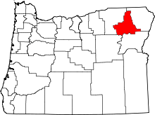 | |
| Unincorporated communities | ||
| Indian reservation | ||
| Ghost town | ||