Ince-in-Makerfield
| Ince-in-Makerfield | |
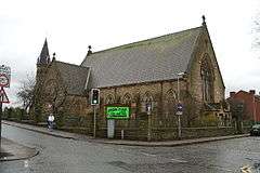 Christ Church, Ince-in-Makerfield |
|
 Ince-in-Makerfield |
|
| Population | 13,486 (2011 Census) |
|---|---|
| OS grid reference | SD565005 |
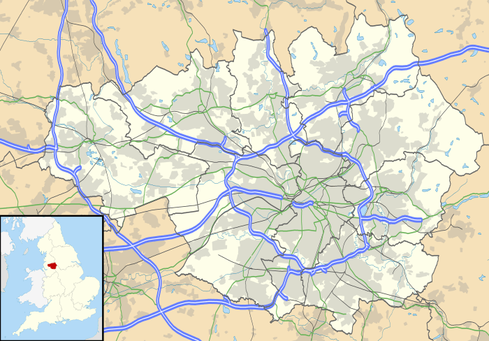
| Metropolitan borough | Wigan |
| Metropolitan county | Greater Manchester |
| Region | North West |
| Country | England |
| Sovereign state | United Kingdom |
| Post town | WIGAN |
| Postcode district | WN2/WN3 |
| Dialling code | 01942 |
| Police | Greater Manchester |
| Fire | Greater Manchester |
| Ambulance | North West |
| EU Parliament | North West England |
| UK Parliament | Wigan |
|
|
Coordinates: 53°32′25″N 2°35′56″W / 53.5402°N 2.5990°W
Ince-in-Makerfield or Ince is a regenerated township[1] in the Metropolitan Borough of Wigan, in Greater Manchester, England. The population of the Wigan ward at the 2011 census was 13,486.[2]
Historically in Lancashire, Ince is contiguous to Wigan and is a residential suburb. Divided by a railway line into two separate areas - Higher Ince and Lower Ince, from 1894 Ince was an urban district of the administrative county of Lancashire and in 1974 became part of the Metropolitan Borough of Wigan.
History
The earliest mention of the Manor of Ince and the Ince family dates from 1202 at which point it was under the barony of Newton in Makerfield (Newton le Willows). There were three halls in Ince, both the Manor of Ince and the original hall on Warrington Road were held by a family of the same name who also owned the Manor of Aspull and had close ties to the Hindley family, the lineage was replaced by the Gerard family by marriage in the reign of Henry IV who adopted the name Gerard family of Ince and the manor remained with them for several centuries until William Gerard sold it to the Earl of Balcarres at some point between 1796 and 1825, it was of timber framed construction.[3] A branch of the Gerard family lived at New Hall from about 1600 until the line died out with marriage to the Andertons of Euxton who adopted the name Ince Anderton and temporarily inhabited the hall from 1760-1818 before moving to Euxton Hall. The third also known as Ince Hall was originally a timber and plaster building built in the reign of James I off Manchester Road, it originally had a moat, Italian chimneys and an oak panelled interior but in 1854 was heavily damaged by fire and rebuilt in plain brick of no architectural merit and modernised inside.[4][5] All three halls were still standing in 1911 but none remain today.
The township covered 2,221 acres of mostly level ground. The underlying rocks contained strata of cannel and coal and many collieries were sunk, the early pits were 120 to 900 feet deep, and subsequently to 1,800 feet.[3] Its coal pits included Moss, Ince Hall, Rose Bridge and Ince Collieries. Mining left a legacy of spoil heaps and flashes which were known as the Wigan Alps.[6] Stone was also quarried and used to build bridges on the railway. Ince became heavily industrialised in the Industrial Revolution. The Leeds and Liverpool Canal, the North Union and Liverpool and Bury railways passed through the township and a cotton mill was built.[3]
Transport
Ince is served by Ince railway station on the Manchester to Southport line, however to distinguish it from Ince & Elton in Cheshire, on destination boards it is displayed as Ince(Manchester)[7]
Ince was once criss-crossed by railway lines on the London and North Western Railway's Warrington to Wigan, Eccles to Wigan, Wigan to St Helens and Springs Branch to Haigh and Aspull lines, the Lancashire and Yorkshire Railway's Bury to Liverpool line and the Great Central Railway line from Glazebrook to Wigan (on which Lower Ince station was located, between 1884 and 1964); as well as local colliery lines.[6]
The Leeds and Liverpool Canal passes through Higher Ince and 16 of the Wigan flight of locks are within the township.[6]
See also
References
- ↑ About the borough, Ince in Makefield, wigan.gov.uk, retrieved 18 December 2012
- ↑ "Wigan ward population 2011". Retrieved 10 January 2016.
- 1 2 3 "Ince", A Topographical Dictionary of England, British History Online, pp. 608–611, 1848, retrieved 3 June 2011
|first1=missing|last1=in Editors list (help) - ↑ http://www.british-history.ac.uk/report.aspx?compid=41387&strquery=ince
- ↑ Farrer, William; Brownbill, J (editors) (1907), "Ince", A History of the County of Lancaster, Volume 4, Victoria County History, pp. 101–106, retrieved 17 December 2012
- 1 2 3 Ashmore 1982, p. 101
- ↑ National Rail- Ince (Manchester) Railway Station
Bibliography
- Ashmore, Owen (1982), The Industrial archaeology of North-west England, Manchester University Press, ISBN 0-7190-0820-4
External links
| Wikimedia Commons has media related to Ince-in-Makerfield. |