Ingleside, Texas
| Ingleside, Texas | |
|---|---|
| City | |
 Location of Ingleside, Texas | |
 | |
| Coordinates: 27°52′27″N 97°12′30″W / 27.87417°N 97.20833°WCoordinates: 27°52′27″N 97°12′30″W / 27.87417°N 97.20833°W | |
| Country | United States |
| State | Texas |
| Counties | San Patricio, Nueces |
| Area | |
| • Total | 14.5 sq mi (37.6 km2) |
| • Land | 14.4 sq mi (37.3 km2) |
| • Water | 0.1 sq mi (0.3 km2) |
| Elevation | 13 ft (4 m) |
| Population (2000) | |
| • Total | 9,388 |
| • Density | 652.1/sq mi (251.8/km2) |
| Time zone | Central (CST) (UTC-6) |
| • Summer (DST) | CDT (UTC-5) |
| ZIP code | 78362 |
| Area code(s) | 361 |
| FIPS code | 48-36008[1] |
| GNIS feature ID | 1338470[2] |
Ingleside is a town in Nueces and San Patricio counties in the U.S. state of Texas. The population was 9,387 at the 2010 census.
Ingleside was the home to Naval Station Ingleside. On August 24, 2005, the BRAC Committee voted to close the base. In 2010, the main base property was turned over to the Port of Corpus Christi.
Geography
Ingleside is located at 27°52′27″N 97°12′30″W / 27.87417°N 97.20833°W (27.874070, -97.208379).[3] According to the United States Census Bureau, the city has a total area of 14.5 square miles (37.6 km²), of which 14.4 square miles (37.3 km²) is land and 0.1 square mile (0.3 km²) (0.76%) is water.
History
Ingleside is located on the south-east tip of San Patricio County. Situated on the Corpus Christi Bay. The early communities of Ingleside have been known as Old Ingleside, Inwood, Ingleside Cove, Ingleside-on-the-Bay, Palomas, Cove City and Cove. The earliest community began in 1854 when George C. Hatch purchased land on both sides of the bayou. He later acquired over 3,800 acres (15 km2) of land, which he sold to Walter Ingalls, Henry Nold, James Aware, John Pollard, John W. Vineyard and others. They built homes on the bayou and at Ingleside Cove. Local lore and legend credits John Vineyard with naming Ingleside, which means “Fireside.” Vineyard named Ingleside for his ancestral home in Scotland.
In 1855 George and Marcellus Turner settled in the area. In 1857 Marcellus obtained a grant for the first post office. A local general store was opened by George Hatch and Youngs L. Coeman. Henry Nold II operated the Ingleside Male and Female Academy, often referred to as Nold Academy. He operated the boarding school from 1857 until it was destroyed by Union soldiers in 1862. During this period of development, Ingleside’s primary industries were farming and ranching. In the 1880s, George Hatch and his son John Hatch introduced grape culture to the area which developed into a flourishing business. This business lasted until the 1930s when the vines were killed by blight. Steamships plied the waters of the bay between Corpus Christi and Ingleside, carrying trade goods.
The San Antonio and Aransas Pass Railway was completed in Aransas Pass in 1887, but bypassed Ingleside, and Palomas (also known as Loma) was established as a flag stop for the railroad. Residents moved to set up a new town site on the railroad in 1893, and in the early 1890s real estate developers built a large hotel on the cove. The dreamed-of boom never materialized, and the population during this period was listed as only thirty.
In 1909 developers Burton and Danforth laid out the present Ingleside town site, and in 1913 the Ingleside Common School District was formed. There were 80 students. In 1916 a hurricane destroyed many of the buildings that had built up in the town. Again growth in the area was stagnant. Grape production was begun again and was a booming industry between 1910 and 1920, fishing and vegetable production were the town’s economic mainstay until the vegetable sheds were closed in the 1950s.
In 1927, Humble Oil built a tank farm at Harbor City or Port Ingleside, and announced plans for a refinery in Ingleside. Construction boomed with the building of a housing complex, complete with paved streets and their own sewer for Humble employees. Ingleside experienced a period of growth and prosperity, the population grew to 1,125 and during this period two local newspapers, the Review and the Index, began publication. But Ingleside’s prosperity was short-lived. In 1944-1945 a labor dispute resulted in Humble closing the plant and putting it up for salvage sale. Brauer Corporation opened an aluminum fabrication plant in 1948, and Reynolds Metal followed suit in 1950, opening a plant only five miles away. DuPont followed and a local plant was built in 1973. Ingleside developed primarily as a residential area and was incorporated in 1951.
In 1954, the Corps of Engineers cut a channel, La Quinta Channel, through Ingleside Point, thus demarking an area known as Ingleside-on-the-Bay, where the United States Navy intended to open its Homeport in 1995.
The population of Ingleside grew steadily after 1972 and in 2000 Ingleside had a population of 9,388, including 3,200 active duty naval personnel.
Demographics
| Historical population | |||
|---|---|---|---|
| Census | Pop. | %± | |
| 1960 | 3,022 | — | |
| 1970 | 3,763 | 24.5% | |
| 1980 | 5,436 | 44.5% | |
| 1990 | 5,696 | 4.8% | |
| 2000 | 9,388 | 64.8% | |
| 2010 | 9,387 | 0.0% | |
| Est. 2015 | 9,695 | [4] | 3.3% |
2000 Census data
As of the census[1] of 2000, there were 9,388 people, 2,980 households, and 2,226 families residing in the city. The population density was 652.1 people per square mile (251.7/km²). There were 3,268 housing units at an average density of 227.0 per square mile (87.6/km²). The racial makeup of the city was 77.56% White, 5.60% African American, 0.88% Native American, 1.86% Asian, 0.27% Pacific Islander, 10.18% from other races, and 3.64% from two or more races. Hispanic or Latino of any race were 27.71% of the population.
There were 2,980 households out of which 45.4% had children under the age of 18 living with them, 60.7% were married couples living together, 9.5% had a female householder with no husband present, and 25.3% were non-families. 20.0% of all households were made up of individuals and 5.5% had someone living alone who was 65 years of age or older. The average household size was 2.87 and the average family size was 3.33.
In the city the population was 29.8% under the age of 18, 15.9% from 18 to 24, 33.3% from 25 to 44, 15.1% from 45 to 64, and 5.9% who were 65 years of age or older. The median age was 28 years. For every 100 females there were 119.7 males. For every 100 females age 18 and over, there were 126.6 males. The median income for a household in the city was $37,789, and the median income for a family was $42,247. Males had a median income of $30,051 versus $20,847 for females. The per capita income for the city was $16,050. About 7.2% of families and 19.2% of the population were below the poverty line, including 12.9% of those under age 18 and 9.8% of those age 65 or over.
Area attractions
Cove Park. This park is located on Hwy. 1069 going toward the bay and has a public boat ramp.
Faith Park. Near the Jr. High and High School. The Garden Center meeting room and kitchen is available for reservation by calling City Hall.
Ingleside Swimming Pool. Located on Mustang Dr., pool hours are from 12:00 pm to 7:30 pm Tuesday thru Saturday and Sundays from 1:00 pm to 6:00 pm. The park is closed on Mondays.
Ingleside On The Bay. A public boat ramp is included in the park which is located on Ebony and Woodhaven.
Live Oak Park. This park has a pond and disc golf, picnic area, barbecue pits, swings and slides.
N.O. Park. This complex offers a covered 10 x 20 picnic shelter, barbecue pits, horseshoe pits, pavilion with game tables, concession and restrooms skate park, 7 soccer fields, butterfly garden, birding deck, hike/bike/fitness trail, tot-lot playscale and multi-purpose lighted field.
Oak Park. Located on 8th St. is a semi-residential park. Here you will find playground, tables and benches within the park.
Whitney Lake. This 50 plus acre project will include several bird watching areas, extended docks over marsh areas, observation platforms and many other amenities. It also provide wintering and migratory habitat for waterfowl, shorebirds, wading birds, and other species.
Education
The City of Ingleside is served by the Ingleside Independent School District.
References
- 1 2 "American FactFinder". United States Census Bureau. Retrieved 2008-01-31.
- ↑ "US Board on Geographic Names". United States Geological Survey. 2007-10-25. Retrieved 2008-01-31.
- ↑ "US Gazetteer files: 2010, 2000, and 1990". United States Census Bureau. 2011-02-12. Retrieved 2011-04-23.
- ↑ "Annual Estimates of the Resident Population for Incorporated Places: April 1, 2010 to July 1, 2015". Retrieved July 2, 2016.
- ↑ "Census of Population and Housing". Census.gov. Retrieved June 4, 2015.
External links
Municipalities and communities of Nueces County, Texas, United States | ||
|---|---|---|
| Cities | 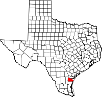 | |
| Town | ||
| CDPs | ||
| Other unincorporated communities | ||
| Footnotes | ‡This populated place also has portions in an adjacent county or counties | |
Municipalities and communities of San Patricio County, Texas, United States | ||
|---|---|---|
| Cities |  | |
| Towns | ||
| CDPs | ||
| Footnotes | ‡This populated place also has portions in an adjacent county or counties | |