Interstate 585
| ||||
|---|---|---|---|---|
| Route information | ||||
| Maintained by SCDOT | ||||
| Length: | 2.25 mi[1] (3.62 km) | |||
| Existed: | 1962 – present | |||
| Major junctions | ||||
| South end: |
| |||
| North end: |
| |||
| Location | ||||
| Counties: | Spartanburg | |||
| Highway system | ||||
| ||||
.svg.png)
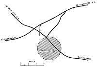
Interstate 585 (I-585) is a spur route of Interstate 85, which connects Spartanburg, South Carolina in the United States.
Route description
I-585 is co-signed the entire length with US 176 and it uses US 176's exit number system instead of its own. Between exits 23 (I-85 Business) and 25B (US 221) the road is a freeway but has substandard or no shoulders. To the south of exit 25B, US 176 becomes boulevard grade, where I-585 ends.
History
This highway was once connected to Interstate 85 from opening until 1995; that year, I-85 was moved north to bypass Spartanburg, leaving I-585 an orphan, segregated from the rest of the Interstate Highway system. There is a project underway to extend I-585 along US 176 to I-85's new location.[2] The ramps from I-585 Southbound to Business Loop 85 North and South opened on October 9, 2006. The Ramp from I-585 Northbound to Business Loop 85 Northbound is open and the Southbound Business Loop 85 entrance is open. The ramp from Business Loop 85 Southbound to I-585 Northbound is open (it is now a large fly-over ramp that overpasses the East Campus Boulevard exit), and the ramp from Business Loop 85 Southbound to I-585 Southbound has been re-opened as well.
The ramp from Business Loop 85 Northbound to I-585 Southbound is open, and there is no ramp from Business Loop 85 Northbound to I-585 Northbound. The entrance from I-85 Business Loop Southbound to I-585 Northbound adds a lane to I-585 Northbound traffic just in front of the USCU Campus that eventually turns into the "exit only" for I-85 Bypass Northbound. Currently, I-585/US 176 remains a freeway until the interchange with the I-85 bypass. This interchange is not a freeway interchange. Some cars on I-585 must cross oncoming traffic in order to access a certain direction of I-85 Bypass, but the I-85 Bypass traffic has only a normal diamond interchange.
There also is a traffic signal right before this interchange, which represents the official end of this freeway. The ramps connecting East Campus Boulevard, the main road of the USCU campus, have been upgraded to meet Interstate Highway standards and are now open, connecting campus traffic with I-585 North and Southbound. The Valley Falls Road Interchange has also been completed and all ramps leading to and from I-585 North and Southbound are open. The Northbound I-585 entrance from East Campus Boulevard turns into the "exit only" for Valley Falls Road.
Exit list
The entire route is in Spartanburg County.
| Location | mi[3] | km | Exit | Destinations | Notes | |
|---|---|---|---|---|---|---|
| | 0.0 | 0.0 | Future northern terminus; west end of US 176 overlap, at-grade interchange | |||
| | 0.8 | 1.3 | Valley Falls Road | Exit open, not formally part of I-585 | ||
| | 1.3 | 2.1 | East Campus Boulevard – USC Upstate | Exit open, not formally part of I-585 | ||
| | 1.7 | 2.7 | 23 | Signed as exits 23A (south) and 23B (north) | ||
| | 2.8 | 4.5 | 24 | California Avenue | ||
| | 3.3 | 5.3 | 25A | North end of SC 9 overlap | ||
| Spartanburg | 3.6 | 5.8 | 25B | |||
| 3.6 | 5.8 | — | Continuation as US 176/SC 9 | |||
1.000 mi = 1.609 km; 1.000 km = 0.621 mi
| ||||||
Interstate 585 Business
| |
|---|---|
| Location: | Spartanburg, South Carolina |
| Length: | 1.60 mi[4] (2.57 km) |
| Existed: | 1959–Unknown |
Interstate 585 Business (I-585 Bus) was a boulevard-grade business spur of I-585 along Pine Street, between Whitney Road (US 221) and St. John Street (US 29). It ran concurrently with US 176 and SC 9. Sometime between 2000 and 2012, the route was removed, with no current state or federal maps listing it, nor any physical signage.
See also
 South Carolina portal
 U.S. Roads portal
References
- ↑ "Route Log and Finder List - Interstate System: Table 2". FHWA. Retrieved 2007-10-04.
- ↑ "Interstate 585". Retrieved 5 October 2014.
- ↑ Google (May 20, 2013). "Interstate 585" (Map). Google Maps. Google. Retrieved May 20, 2013.
- ↑ Google (May 19, 2013). "Business Spur 585" (Map). Google Maps. Google. Retrieved May 19, 2013.
External links
 Media related to Interstate 585 at Wikimedia Commons
- Mapmikey's South Carolina Highways Page: I-385
- I-585 at SouthEastRoads.com
- I-585 at Interstate-Guide.com
- Interstate 585 (3 Digit Interstates)
| ||