Interstate 85 in Georgia
| |||||||
|---|---|---|---|---|---|---|---|
_map.svg.png) | |||||||
| Route information | |||||||
| Maintained by GDOT | |||||||
| Length: | 179.9 mi[1] (289.5 km) | ||||||
| Existed: | 1960[2] – present | ||||||
| Major junctions | |||||||
| South end: |
| ||||||
| North end: |
| ||||||
| Location | |||||||
| Counties: | Harris, Troup, Meriwether, Coweta, Fulton, Clayton, DeKalb, Gwinnett, Barrow, Jackson, Banks, Franklin, Hart | ||||||
| Highway system | |||||||
| |||||||

Interstate 85 (I-85) is a major Interstate Highway that travels northeast-to-southwest in the U.S. state of Georgia. It enters the state at the Alabama state line near West Point, and Lanett, Alabama, traveling through the Atlanta metropolitan area and to the South Carolina state line, where it crosses the Savannah River near Lake Hartwell. I-85 connects northern Georgia with Montgomery, Alabama, to the southwest, and with South Carolina, North Carolina, and Virginia to the northeast. Within Georgia, I-85 is also designated as the unsigned State Route 403 (SR 403).
I-85 in Georgia usually travels roughly parallel with the route of U.S. Route 29 (US 29). However, from Atlanta northeast to South Carolina, I-85 ventures away from that route, traveling about halfway between US 29 and the combination of US 23 and US 123.
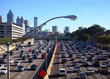
Within the City of Atlanta, I-85 has a concurrency with I-75 known as the "Downtown Connector". After splitting from Downtown Connector, it is known as Northeast Expressway until its junction with I-285 (Atlanta's perimeter).
Route description
Alabama state line to Interstate 185
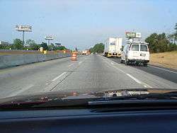
I-85 enters the state of Georgia from Alabama via twin bridges over the Chattahoochee River, and then it immediately skirts the town of West Point, with Kia's multibillion-dollar plant located adjacent to the freeway just east of West Point. After leaving West Point, I-85 enters the LaGrange area, the first large town in Georgia on its route to the northeast. Northeast of LaGrange, I-85 has an interchange with the long spur freeway, I-185, to the Columbus, Georgia Metropolitan Area. This is the only connection between Columbus and the Interstate Highway System.
From Interstate 185 through Atlanta
From LaGrange, I-85 heads northeastward towards Atlanta. Before reaching Atlanta, the highway runs through a recently widened stretch that includes six to eight lanes between exits 35 and 77, passing near the suburbs of Moreland, Newnan, Fairburn, Union City, College Park and East Point as well as intersecting I-285 at its southwest end and providing access to Hartsfield-Jackson Atlanta International Airport. I-85 then runs along the northwestern boundary of the airport, providing access to the domestic terminal. (This airport is bounded on all sides by I-85, I-75, and I-285, all of which provide highway access to the airport.)
At the southwestern edge of Atlanta's city limits, I-85 merges with I-75 to form the Downtown Connector, which is 12 to 14 lanes wide. At the southern edge of downtown Atlanta, this freeway has an interchange with the major east-west Interstate Highway, I-20. The two freeways then skirt the eastern edge of downtown, running due north, passing through the Georgia Tech campus and the Atlantic Station section of Atlanta before the two highways split, with I-75 exits via the right three lanes and then heads northwest while I-85 uses the left three lanes and then heads northeast.
Atlanta to South Carolina state line
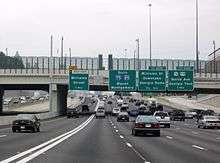
Heading northbound after the Brookwood Interchange with I-75, I-85 is routed along a ten lane wide viaduct from the Buford Highway Connector (exit 86) to State Route 400 (SR 400, exit 87). Continuing northeast of Atlanta, I-85 continues through the northeastern suburbs, bypassing Chamblee and Doraville, where there is another intersection with I-285 (nicknamed Spaghetti Junction). The Interstate then travels through the northeastern suburbs of Atlanta, including Lilburn, Duluth, Lawrenceville. The Interstate has freeway interchanges with SR 316 in Norcross and I-985 in Suwanee, which provides a link to Gainesville. I-85 then leaves the Atlanta area, continuing to travel through rural northeast Georgia. At Lake Hartwell—which was formed by the damming of the Savannah River—I-85 crosses into South Carolina.
Express lanes
I-85 has the first and currently the only express lanes in Georgia, located in Gwinnett and DeKalb counties; they were originally HOV lanes. From Chamblee–Tucker Road (exit 94) to Old Peachtree Road (exit 109), travelers that utilize the converted 15.5-mile (24.9 km) lanes will be charged a toll varying from 10 to 90 cents per mile (6.2–55.9 ¢/km), depending on traffic conditions and usage. Though not signed on the freeway, they are HOT lanes, which means travelers with three or more occupants, vanpools, motorcycles, and buses are exempt from toll charges. Tolls are collected using an electronic toll collection system. All travelers that use the lane must have a Peach Pass sticker to avoid fines.[3][4] Starting in November 2014, SunPass (Florida) and NC Quick Pass (North Carolina) are interoperable with Peach Pass, allowing motorists with those transponders to use the express lanes.
Funds generated from the express lanes will be used to defray the costs of construction, operations and maintenance of the lanes. Long term revenue allocation is being studied and a decision about future excess revenues will be made later in the project process.[5]
Proponents for the express lanes say it is to provide commuters with a more reliable, free-flow commute option; complement the state’s multi-modal approach to managing traffic demand; and establish the vision for a future system of HOT lanes in the region.[3] Detractors point out that existing infrastructure was reused for the express lanes and that commute times on the non-paying travel lanes have doubled since implementation.[6][7]
History
Originally constructed as a four- to six-lane expressway in the 1950s, the stretch of I-85 between the southern merge with I-75 and North Druid Hills Road was reconstructed as part of the Georgia Department of Transportation's Freeing the Freeways program. This project included rebuilding all overpasses, new HOV-ready ramps (with the system implemented in 1996), and a widening of freeway capacity. Concurrent with this project was the construction of the Civic Center MARTA Station as part of the West Peachtree Street overpass, which opened in December 1981.
The 30-mile (48 km) section between LaGrange and Newnan was incomplete for a much-longer time that the rest of I-85 in Georgia and required a two-lane detour on Hwy 27 & Hwy 29 between those cities. The northern section between Newnan and Grantville was completed first, then the stretch further south to LaGrange was completed in 1977.[8]
The portion of the highway from the Buford Highway Connector to SR 400 was constructed during the early 1980s, and was designed as a replacement for the original four-lane routing of I-85 (now SR 13). In addition, the new viaduct was designed to accommodate connections to the SR 400 tollway (then in planning), HOV lanes, and a bridge carrying the MARTA North Line (then under construction).[9]
Until 2000, the state of Georgia used the sequential interchange numbering system on all of its Interstate Highways. The first exit on each highway would begin with the number 1 and increase numerically with each exit. In 2000, the Georgia Department of Transportation switched to a mileage-based exit system, in which the exit number corresponded to the nearest milepost.[10][11]
On October 1, 2011, GDOT converted the 16.0-mile (25.7 km) HOV lanes in Northern Atlanta into express/HOT lanes.[3]
From Atlanta, I-85 north was originally slated to be built through the city of Athens to provide an easy link between the capital city and the University of Georgia. However, then-Gov. Ernest Vandiver worked to make sure the highway traversed his home county of Franklin, a stretch that now bears his name. At the time, he promised equivalent access for Athens and Gainesville.[12] It was not until the completion of SR 316 in the 1990s that there was finally a relatively quick, multi-lane expressway connecting Athens and Atlanta, (US 78 is also multi-lane between Athens and Atlanta but it is not expressway-grade) although SR 316 still is largely at-grade.
Exit list
| County | Location | mi | km | Old exit | New exit | Destinations | Notes | |
|---|---|---|---|---|---|---|---|---|
| Alabama state line | 0.0 | 0.0 | ||||||
| Harris |
No major junctions | |||||||
| Troup | West Point | 1 | 2 | |||||
| | 6 | KIA Boulevard | Kia Car Plant | |||||
| | 2 | 13 | To Pegasus Parkway, an industrial and recreational bypass around Downtown LaGrange. | |||||
| LaGrange | 3 | 14 | SR 1 is unsigned with US 27 | |||||
| 4 | 18 | |||||||
| | 5 | 21 | To Fort Benning | |||||
| Hogansville | 6 | 28 | ||||||
| Meriwether |
No major junctions | |||||||
| Coweta | Grantville | 7 | 35 | SR 14 is unsigned with US 29 | ||||
| Newnan | 8 | 41 | To SR 16 | |||||
| 9 | 47 | To business district | ||||||
| | 10 | 51 | ||||||
| | 11 | 56 | Collinsworth Road – Palmetto, Tyrone | |||||
| Fulton | Fairburn | 12 | 61 | |||||
| Union City | 13 | 64 | ||||||
| College Park | 14 | 66 | Flat Shoals Rd | To Georgia Military College | ||||
| | 15 | 68 | Northbound exit and southbound entrance; split into I-285 north (Birmingham, Chattanooga) and I-285 east (International Terminal, Macon) | |||||
| | 16A | 69A | ||||||
| College Park | 16B | 69B | ||||||
| 17 | 70 | Southbound exit and northbound entrance; to International Terminal | ||||||
| Clayton | | 18 | 71 | |||||
| Fulton | College Park | 18A | 72 | |||||
| East Point | 19 | 73 | Virginia Avenue – Air Cargo, College Park | Signed as exits 73A (east) and 73B (west) northbound | ||||
| 20 | 74 | Southbound exit and northbound entrance | ||||||
| Hapeville | 21 | 75 | Sylvan Road, Central Avenue – Hapeville | |||||
| Atlanta | 22 | 76 | Cleveland Avenue – East Point | To Atlanta Technical College | ||||
| 23 | 77 | Southbound exit and northbound entrance | ||||||
| 24 | 77 | Northbound exit and southbound entrance | ||||||
| 87 | Southern end of I-75 concurrency along the Downtown Connector; freeway uses I-75 mileposts and exit numbers; HOV lanes to and from I-75 to the south (no HOV ramps to or from I-85 to the south) | |||||||
| 88 | 243 | |||||||
| 89 | 244 | University Avenue, Pryor Street | ||||||
| 90 | 245 | Abernathy Boulevard, Capitol Avenue – Turner Field | Northbound exit and southbound entrance | |||||
| 91 | 246 | Fulton Street, Central Avenue – Georgia State University, Turner Field | ||||||
| 92 | 247 | |||||||
| — | — | Memorial Drive | HOV ramps for northbound exit and southbound entrance | |||||
| 93 | 248A | ML King Jr. Drive – State Capitol, Turner Field | Southbound exit and northbound entrance | |||||
| 94 | 248B | Edgewood Avenue, Auburn Avenue, J.W. Dobbs Avenue | Northbound exit and southbound entrance | |||||
| 96 | 248C | |||||||
| 95 | 248D | Jesse Hill Drive, J.W. Dobbs Avenue, Edgewood Avenue | Southbound exit and northbound entrance | |||||
| — | — | Piedmont Avenue | HOV ramps for northbound exit and southbound entrance | |||||
| 97 | 249A | Courtland Street – Georgia State University | Southbound exit only | |||||
| 98 | 249B | Pine Street, Peachtree Street – Civic Center | Northbound exit only | |||||
| 99 | 249C | Williams Street – World Congress Center, Georgia Dome, Aquarium | No northbound exit; additional HOV ramps for southbound exit and northbound entrance | |||||
| 100 | 249D | Northbound exit and southbound entrance | ||||||
| 100 | 249D | Southbound exit and northbound entrance | ||||||
| 101 | 250 | 10th Street, 14th Street – Georgia Tech | Northbound exit and southbound entrance | |||||
| 251A | 17th Street – Midtown | Northbound exit only | ||||||
| 26 | 84 | 17th Street, 14th Street, 10th Street | Southbound exit only, to Georgia Tech | |||||
| 27 | 85 | Northern end of I-75 concurrency along the Downtown Connector | ||||||
| 28 | 86 | Northbound exit and southbound entrance | ||||||
| — | — | Lindbergh Drive | HOV-only ramps; southbound exit and northbound entrance | |||||
| 29 | 87 | Northbound exit and southbound entrance | ||||||
| 28 | 86 | Southbound exit and northbound entrance | ||||||
| 30 | 88 | Cheshire Bridge Road/Lenox Road | Southbound exit and northbound entrance | |||||
| DeKalb | | 31 | 89 | To Oglethorpe University | ||||
| | 32 | 91 | To DeKalb-Peachtree Airport and Emory University | |||||
| | 33 | 93 | Shallowford Road – Doraville | To Briarcliff Road | ||||
| | 34 | 94 | Chamblee–Tucker Road, Mercer University | |||||
| | 35 | 95 | Signed as exits 95A (east, Macon, Augusta) and 95B (west, Chattanooga, Birmingham) southbound | |||||
| | 36 | 96 | Northcrest Road, Pleasantdale Road | |||||
| Gwinnett | Norcross | 37 | 99 | |||||
| 38 | 101 | Indian Trail–Lilburn Road | ||||||
| | 39 | 102 | ||||||
| | 39A | 103 | Steve Reynolds Boulevard | Northbound exit and southbound entrance | ||||
| | 40 | 104 | Pleasant Hill Road | Gwinnett Place Mall | ||||
| | 42 | 105 | Northbound exit only | |||||
| | 41 | 106 | No southbound exit; additional northbound exit and southbound entrance ramps for direct HOT/express lane access | |||||
| | 42 | 107 | Southbound exit only | |||||
| | 108 | Sugarloaf Parkway | Southbound exit is combined with exit 109 | |||||
| | 43 | 109 | Old Peachtree Road | |||||
| | 44 | 111 | ||||||
| | 45 | 113 | Northbound exit and southbound entrance, to Buford Dam and Lake Lanier Islands | |||||
| | 46 | 115 | Mall of Georgia | |||||
| | 47 | 120 | Hamilton Mill Road/Hamilton Mill Parkway | |||||
| Barrow | Braselton | 48 | 126 | |||||
| Jackson | 49 | 129 | ||||||
| Jefferson | 50 | 137 | ||||||
| | 51 | 140 | ||||||
| Commerce | 52 | 147 | ||||||
| Banks | | 53 | 149 | |||||
| | 54 | 154 | ||||||
| Franklin | | 55 | 160 | |||||
| | 56 | 164 | ||||||
| | 57 | 166 | ||||||
| Lavonia | 58 | 173 | ||||||
| Hart | | 59 | 177 | |||||
| South Carolina state line | 179.9 | 289.5 | Continuation into South Carolina | |||||
1.000 mi = 1.609 km; 1.000 km = 0.621 mi
| ||||||||
Auxiliary routes
- I-185 is a spur from near LaGrange south to Columbus.
- I-285 is the busy beltway around Atlanta.
- I-485 was to run east and north from downtown Atlanta to the south end of SR 400, and then north along SR 400 to I-285.
- I-985 is a spur from near Buford northeast to Gainesville.
See also
.svg.png) Georgia (U.S. state) portal
Georgia (U.S. state) portal U.S. Roads portal
References
- ↑ Adderly, Kevin (January 27, 2016). "Table 1: Main Routes of the Dwight D. Eisenhower National System of Interstate and Defense Highways as of December 31, 2015". Route Log and Finder List. Federal Highway Administration. Retrieved May 5, 2016.
- ↑ State Highway Department of Georgia (1960). State Highway System and Other Principal Connection Roads (PDF) (Map) (1960–61 ed.). Scale not given. Atlanta: State Highway Department of Georgia. OCLC 5673161. Retrieved July 12, 2016. (Corrected to June 1, 1960.)
- 1 2 3 Georgia Department of Transportation. "I-85 Express Lanes". Georgia Department of Transportation. Retrieved November 19, 2011.
- ↑ "100,000th Peach Pass Issued for Controversial HOT Lanes". The Atlanta Journal-Constitution. Retrieved November 19, 2011.
- ↑ Georgia Department of Transportation. "I-85 Express Lanes: FAQ". Georgia Department of Transportation. Retrieved November 19, 2011.
- ↑ McKee, Don. "Commuters getting hot about HOT lanes in metro Atlanta". The Marietta Daily Journal. Retrieved November 19, 2011.
- ↑ "HOT Lane Unhappiness: Some Drivers Say Congestion Worse". The Atlanta Journal-Constitution. Retrieved November 19, 2011.
- ↑ "I-85 completed between LaGrange & Grantville".
- ↑ "State Route 13 Page". Peach State Roads. Archived from the original on May 23, 2007. Retrieved May 27, 2007.
- ↑ Georgia Department of Transportation. "Georgia's Interstate Exit Numbers". Georgia Department of Transportation. Retrieved April 30, 2007.
- ↑ Georgia Department of Transportation. "Interstate 20 Exit Renumbering Page". Georgia Department of Transportation. Retrieved April 30, 2007.
- ↑ Lavender, Rick. "Interstate 85 Through Hall? It Very Nearly Was Gov. Ernest Vandiver Redirected Highway Plans in 1950s". The Times. Gainsville, GA. Retrieved May 5, 2016.
External links
 Media related to Interstate 85 in Georgia at Wikimedia Commons
| Previous state: Alabama |
Georgia | Next state: South Carolina |
| ||