Jacksonboro, South Carolina
| Jacksonboro, South Carolina | |
|---|---|
| Census-designated place | |
 Jacksonboro  Jacksonboro | |
| Coordinates: 32°46′13″N 80°27′16″W / 32.77028°N 80.45444°WCoordinates: 32°46′13″N 80°27′16″W / 32.77028°N 80.45444°W | |
| Country | United States |
| State | South Carolina |
| County | Colleton |
| Area[1] | |
| • Total | 14.465 sq mi (37.46 km2) |
| • Land | 14.465 sq mi (37.46 km2) |
| • Water | 0 sq mi (0 km2) |
| Elevation | 23 ft (7 m) |
| Population (2010)[2] | |
| • Total | 478 |
| • Density | 33/sq mi (12.8/km2) |
| Time zone | Eastern (EST) (UTC-5) |
| • Summer (DST) | EDT (UTC-4) |
| ZIP code | 29446 |
| Area code(s) | 843 |
| GNIS feature ID | 1246146[3] |
Jacksonboro is an unincorporated community and census-designated place located in southeastern Colleton County, South Carolina, United States, along the west side of the Edisto River.[3] Jacksonboro serves as a primary junction along U.S. Highway 17 between Charleston 32 miles (51 km) to the east and Beaufort 41 miles (66 km) to the southwest. Walterboro, the Colleton County seat, is 16 miles (26 km) to the northwest via South Carolina Highway 64. The population of Jacksonboro was 478 as of the 2010 census.[2]
The Pon Pon Chapel was listed in the National Register of Historic Places in 1972.[4]
References
- ↑ "US Gazetteer files: 2010, 2000, and 1990". United States Census Bureau. 2011-02-12. Retrieved 2011-04-23.
- 1 2 "Geographic Identifiers: 2010 Census Summary File 1 (G001): Jacksonboro town, South Carolina". U.S. Census Bureau, American Factfinder. Retrieved July 2, 2015.
- 1 2 "Jacksonboro, South Carolina". Geographic Names Information System. United States Geological Survey.
- ↑ National Park Service (2010-07-09). "National Register Information System". National Register of Historic Places. National Park Service.
Municipalities and communities of Colleton County, South Carolina, United States | ||
|---|---|---|
| City |  | |
| Towns | ||
| CDPs | ||
| Unincorporated communities | ||
The Lowcountry of South Carolina | ||
|---|---|---|
| Counties | 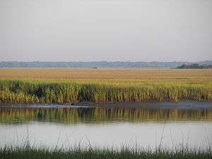 | |
| Major communities | ||
| Sea Islands | ||
| History & culture | ||
| Military installations | ||
| Natural areas | ||
| Other articles | ||
This article is issued from Wikipedia - version of the 7/31/2016. The text is available under the Creative Commons Attribution/Share Alike but additional terms may apply for the media files.