Jeanerette, Louisiana
| Jeanerette, Louisiana | |
| City | |
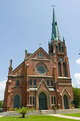
 St. John the Evangelist Roman Catholic Church, Jeanerette | |
| Nickname: Sugar City | |
| Country | United States |
|---|---|
| State | Louisiana |
| Parish | Iberia |
| Elevation | 16 ft (4.9 m) |
| Coordinates | 29°54′59″N 91°40′21″W / 29.91639°N 91.67250°WCoordinates: 29°54′59″N 91°40′21″W / 29.91639°N 91.67250°W |
| Area | 2.2 sq mi (5.7 km2) |
| - land | 2.2 sq mi (6 km2) |
| - water | 0.0 sq mi (0 km2), 0% |
| Population | 5,530 (2010) |
| Mayor | Aprill F. Foulcard (D) (elected 2013 to succeed Timothy S. de'Clouet, who died)[1][2] |
| Timezone | CST (UTC-6) |
| - summer (DST) | CDT (UTC-5) |
| ZIP code | 70544 |
| Area code | 337 |
|
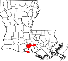
Location of Jeanerette in Louisiana | |
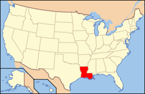
 Location of Louisiana in the United States | |
Jeanerette is a small city in Iberia Parish, Louisiana, United States. Known as "Sugar City", it had a population of 5,530 at the 2010 census, a decrease of 467 from the 2000 tabulation of 5,997. It is two thirds African American.[3]
Jeanerette is the part of the Lafayette, Louisiana Metropolitan Statistical Area.
History
Early years
In the 18th century, the land on which Jeanerette now lies was originally procured from the Spanish government by Pierre Zerangue. Zerangue received an “order of survey and settlement” from Spain for 1,052 acres (4.26 km2). Under Spanish law, if someone occupied a piece of property for two years they could apply for title to the land under an “order of survey settlement.” Nicholas Provost secured the property from the present day experimental farm to the St. Mary Parish line. He engaged in sugar cultivation until his death in 1816.
The town derived its name from John W. Jeanerette, a native of South Carolina who went to the area in the 1820s. First he worked as a tutor for a planter's family, as did numerous educated young adults from northern states, then opened a store and saloon. Having saved some money, about 1830 Jeanerette purchased Pine Grove Plantation, formerly known as Beau Pré (meaning Lovely Meadow/pasture).[4]
Jeanerette offered a portion of his house to be used as a mail depository for the local inhabitants. Later John Jeanerette was appointed the town's first postmaster (he dropped his middle initial.) The name Jeanerette afterward stuck for the post office and town.[4]
Civil War
During the American Civil War, Confederate forces under Generals Richard Taylor and Henry Sibley withdrew from Franklin and on April 14, 1863, reached Jeanerette, twelve miles (19 km) south of New Iberia. A soldier, Arthur W. Hyatt, describes the difficult march:
"Thus we had marched about twenty-six miles in fifteen hours and fought a battle in the bargain. But such terrible hard marching I never witnessed before. Our feet are all blistered and swollen, and we have had scarcely anything to eat – what with hunger, thirst, mud, rain, marching, fighting, dust, etc., etc., we are perfectly worn out."[5] The night after Hyatt's report, the "weather turned unusually cool, and the men got very little sleep."[6]
As Taylor retreated, his army grew smaller. Winters explains that "a number of his men lived in the area through which they now traveled, and many of them slipped away to visit their families. Many of the Louisiana men were conscripts and were serving under duress." Many of the forces deserted with their arms and remained at their homes. Taylor lamented the lack of discipline among the troops. Quite a few from Sibley's Texas brigades also deserted and returned home.[6]
The successful Union general, Nathaniel P. Banks, bivouaced near Jeanerette. Winters reports that some of the Union forces "confiscated a large batch of Louisiana rum . . . and made things lively. . . . After a struggle, the drunk and riotous men were quieted and the weary troops . . . settled down for the night."[6]
Incorporation
Jeanerette was incorporated as a town in 1878 and Joseph E. Provost became the first mayor; its economy was based on the cypress lumber and sugar industries. Its nickname has been "Sugar City".[7] Although its major growth was after the Civil War, it has some surviving antebellum houses in the city and region.
Sugarcane continues as a key factor in the economy, with three active sugar mills, one of which was located within the city until it was closed, dismantled, and its equipment sold in the first decade of the 21st century. Jeanerette is the home of manufacturers of equipment for the cultivation, harvesting and processing of sugarcane. Today, additional sources of income include oil and natural gas, salt, carbon black, a garment distribution center, and fishing.[8]
Jeanerette was the home of Paul N. Cyr, Huey P. Long's lieutenant governor and political opponent. Cyr had a dental office there.
Geography
Jeanerette is located at 29°54′59″N 91°40′21″W / 29.91639°N 91.67250°W (29.916438, −91.672483).[9]
According to the United States Census Bureau, the city has a total area of 2.2 square miles (5.7 km2), all land.
Demographics
| Historical population | |||
|---|---|---|---|
| Census | Pop. | %± | |
| 1880 | 698 | — | |
| 1890 | 1,309 | 87.5% | |
| 1900 | 1,905 | 45.5% | |
| 1910 | 2,206 | 15.8% | |
| 1920 | 2,512 | 13.9% | |
| 1930 | 2,228 | −11.3% | |
| 1940 | 3,362 | 50.9% | |
| 1950 | 4,692 | 39.6% | |
| 1960 | 5,568 | 18.7% | |
| 1970 | 6,322 | 13.5% | |
| 1980 | 6,511 | 3.0% | |
| 1990 | 6,205 | −4.7% | |
| 2000 | 5,997 | −3.4% | |
| 2010 | 5,530 | −7.8% | |
| Est. 2015 | 5,527 | [10] | −0.1% |
As of the census[12] of 2000, there were 5,997 people, 2,057 households, and 1,513 families residing in the city. The population density was 2,712.0 people per square mile (1,047.7/km²). There were 2,272 housing units at an average density of 1,027.5 per square mile (396.9/km²). The racial makeup of the city was 38.34% White, 59.70% African American, 0.23% Native American, 0.17% Asian, 0.02% Pacific Islander, 0.58% from other races, and 0.97% from two or more races. Hispanic or Latino of any race were 1.43% of the population.
There were 2,057 households out of which 35.7% had children under the age of 18 living with them, 42.2% were married couples living together, 26.2% had a female householder with no husband present, and 26.4% were non-families. 24.0% of all households were made up of individuals and 10.8% had someone living alone who was 65 years of age or older. The average household size was 2.92 and the average family size was 3.46.
In the city the population was spread out with 31.6% under the age of 18, 10.7% from 18 to 24, 24.9% from 25 to 44, 20.4% from 45 to 64, and 12.4% who were 65 years of age or older. The median age was 32 years. For every 100 females there were 86.1 males. For every 100 females age 18 and over, there were 80.9 males.
The median income for a household in the city was $22,888, and the median income for a family was $26,810. Males had a median income of $36,170 versus $15,000 for females. The per capita income for the city was $11,871. About 31.2% of families and 34.2% of the population were below the poverty line, including 46.7% of those under age 18 and 23.3% of those age 65 or over.
Notable people
- Bret Allain—current District 21 state senator; St. Mary Parish sugar cane farmer
- Stuart Bishop—State representative for Lafayette Parish, was born in Jeanerette.
- Patrick T. Caffery—former member of the United States House of Representatives from Louisiana's 3rd congressional district and a New Iberia lawyer, is interred at Beau Pre Cemetery in Jeanerette.
- Terrel Castle—AEK Athens Basketball Player
- Simone B. Champagne— former state representative for Iberia and Vermilion parishes; financial officer of the City of Youngsville, Louisiana
- Paul N. Cyr, Jeanerette dentist who served as lieutenant governor from 1928 to 1932 under Huey Long
- Hiram Eugene—NFL Player
- Troy Hebert—Commissioner of the Louisiana Office of Alcohol and Tobacco Control; former member of both houses of the Louisiana State Legislature
- Arthur Lee Verret—longest standing Mayor of Jeanerette – (24) twenty four years
Dr. Ned Doffoney,Ed.D..Educator,served as founding Chancellor of South Louisiana Community College
Education
Iberia Parish School System serves Jeanerette.[13] Area secondary schools include:
- Jeanerette High School (9–12) (in a nearby unincorporated area)
- Jeanerette Middle School (7–8) (Jeanerette)
Jeanerette Elementary School is public and K–6. In addition St. Charles Elementary School, K-6, is also in Jeanerette.
The school system previously operated Canal Elementary School (K-2) in Jeanerette.[14]
The Bureau of Indian Affairs sponsors the Chitimacha Day School southwest of Jeanerette in the Charenton community of unincorporated St. Mary Parish.[15]
St. Joseph School, a private Catholic school, served grades K–8 until May, 2011.
Climate
The climate in this area is characterized by hot, humid summers and generally mild to cool winters. According to the Köppen Climate Classification system, Jeanerette has a humid subtropical climate, abbreviated "Cfa" on climate maps.[16]
References
- ↑ Mayor April Foulcard is listed among the state and local officials who have endorsed the reelection in 2014 of Democrat U.S. Senator Mary Landrieu.
- ↑ "Landrieu's GOP Endorsements Pale In Comparison To 2008 Election". thehayride.com. Retrieved September 12, 2014.
- ↑ "Jeanerette (city), Louisiana". quickfacts.census.gov. Retrieved November 26, 2012.
- 1 2 "History of Jeanerette", Jeanerette, LA Official Website, accessed 23 December 2009.
- ↑ John D. Winters, The Civil War in Louisiana, Baton Rouge: Louisiana State University Press, 1963, ISBN 0-8071-0834-0, p. 230
- 1 2 3 Winters, p. 231
- ↑ "History of Jeanerette", Jeanerette, LA Official Website, accessed 23 Dec 2009
- ↑ www.jeanerettemuseum.com "A little history about Jeanerette", Jeanerette Museum
- ↑ "US Gazetteer files: 2010, 2000, and 1990". United States Census Bureau. 2011-02-12. Retrieved 2011-04-23.
- ↑ "Annual Estimates of the Resident Population for Incorporated Places: April 1, 2010 to July 1, 2015". Retrieved July 2, 2016.
- ↑ "Census of Population and Housing". Census.gov. Retrieved June 4, 2015.
- ↑ "American FactFinder". United States Census Bureau. Retrieved 2008-01-31.
- ↑ "Feeder School Information." Iberia Parish School System. Retrieved on September 7, 2011.
- ↑ "Schools." Iberia Parish School System. April 13, 2008. Retrieved on September 8, 2011.
- ↑ "Bureau of Indian Education", Bureau of Indian Affairs
- ↑ Climate Summary for Jeanerette, Louisiana
External links
| Wikimedia Commons has media related to Jeanerette, Louisiana. |

