Kenitra
| Kenitra القنيطرة / Qniṭra | ||
|---|---|---|
|
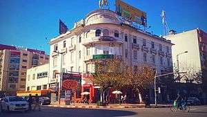
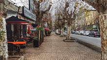
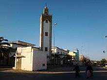
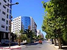
Avenue Mohamed Diouri, Avenue Mohamed V, Kenitra | ||
| ||
 Kenitra Location in Morocco | ||
| Coordinates: 34°15′N 6°35′W / 34.250°N 6.583°W | ||
| Country |
| |
| Region | Rabat-Salé-Kénitra | |
| Province | Province of Kénitra | |
| Founded | 1912 | |
| Government | ||
| • Mayor | Aziz Rabbah (PJD) (2009) | |
| Area | ||
| • Total | 76 km2 (29 sq mi) | |
| Population (2014) | ||
| • Total | 431,282 | |
| Time zone | WET (UTC+0) | |
| • Summer (DST) | WEST (UTC+1) | |
| Website | http://www.alkenitra.com/ | |
Kenitra (Moroccan Arabic: قْنيطره, Qniṭra; Arabic: القنيطرة, al-Qonayṭéra, the little bridge) is a city in northern Morocco, formerly (1932–1956) known as Port Lyautey. It is a port on the Sbu river, has a population in 2014 of 431,282,[1] is one of the three main cities of the Rabat-Salé-Kénitra region and the Chef-lieu of the Province of Kénitra. During the Cold War Kenitra's U.S. Naval Air Facility served as a stopping point in North Africa.
History
Ancient History
The history of the city begins with the foundation of a trading-post by the Phoenicians, known back then as Thamusida. Under the Antonine dynasty, a Venus temple was built there.
Before the French protectorate, there was only a kasbah in the area where the modern city can today be found.
French Protectorate and modern of times
In March 1912 the French government and the Sultan of Morocco, Abd al-Hafid, signed the Treaty of Fez. Because of his growing unpopularity, the Sultan asked the French government for protection against the Berber rebel tribes surrounding Fez. France appointed Hubert Lyautey resident-general in Morocco.
General Lyautey restored peace and order to the country after crushing the tribal uprising. After safely moving the Sultan from Fez to the current capital city, Rabat, Lyautey began his task of civilian administration.
One of the first preoccupations of General Lyautey was to build ports along the inhabitable Atlantic coast where there were no natural harbors. He established Kenitra in 1912 as a French military fort and town. The port at Kenitra, at the mouth of the Sebou river, was opened in 1913.[2] It soon became the best river port in Morocco.[3] Kenitra draws its name from a culvert built at Fouarat lake upstream of the kasbah. This culvert was destroyed in 1928. In 1933, the French officially named the locale "Port Lyautey".
It was renamed "Kenitra" in 1956 as Morocco gained its independence. Kenitra has grown rapidly to be a shipping centre for agricultural produce (mainly fruit), fish, timber, and lead and zinc ores. The city’s industrial area lies upstream of the port.
U.S. Naval Base
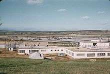
In November 1942, after Operation Torch, the Americans captured the Port Lyautey French fighter base as a military base, named Craw Field. The Navy ran the base until 1947, when the State Department negotiated reversion of control to France. In 1950, a $23,000,000 expansion was authorized, but then the Korean War diverted resources. In the 1950s, nearly 10,000 persons were on the base making it the largest aggregation of Americans in any one overseas base outside Japan. Later, the base at Kenitra was expanded to become a U.S. Naval Air Station.[4]
The base was shared by both the USA and Morocco through the Cold War. A small Navy communications out-station at Sidi Yahia closed in the late 1970s. The Air Station was closed in 1991.
Climate
| Climate data for Kenitra | |||||||||||||
|---|---|---|---|---|---|---|---|---|---|---|---|---|---|
| Month | Jan | Feb | Mar | Apr | May | Jun | Jul | Aug | Sep | Oct | Nov | Dec | Year |
| Average high °C (°F) | 17.3 (63.1) |
18.1 (64.6) |
19.5 (67.1) |
20.6 (69.1) |
22.8 (73) |
24.8 (76.6) |
27.4 (81.3) |
27.9 (82.2) |
27.1 (80.8) |
24.7 (76.5) |
21.1 (70) |
18.0 (64.4) |
22.4 (72.3) |
| Daily mean °C (°F) | 12.3 (54.1) |
13.3 (55.9) |
14.4 (57.9) |
15.7 (60.3) |
18.1 (64.6) |
20.6 (69.1) |
23.0 (73.4) |
23.3 (73.9) |
22.2 (72) |
19.4 (66.9) |
15.9 (60.6) |
13.0 (55.4) |
17.6 (63.7) |
| Average low °C (°F) | 7.2 (45) |
8.5 (47.3) |
9.3 (48.7) |
10.9 (51.6) |
13.4 (56.1) |
16.3 (61.3) |
18.6 (65.5) |
18.7 (65.7) |
17.4 (63.3) |
14.1 (57.4) |
10.7 (51.3) |
8.0 (46.4) |
12.8 (55) |
| Average precipitation mm (inches) | 97.6 (3.843) |
94.6 (3.724) |
74.9 (2.949) |
67.3 (2.65) |
37.8 (1.488) |
5.8 (0.228) |
0.4 (0.016) |
0.6 (0.024) |
10.7 (0.421) |
63.0 (2.48) |
130.0 (5.118) |
135.9 (5.35) |
718.6 (28.291) |
| Average precipitation days | 12.3 | 12.7 | 12.2 | 11.0 | 7.6 | 2.9 | 0.3 | 0.7 | 2.8 | 8.6 | 13.3 | 14.0 | 98.4 |
| Mean monthly sunshine hours | 165.0 | 170.4 | 229.8 | 255.8 | 296.7 | 302.9 | 326.5 | 312.8 | 263.8 | 227.2 | 174.6 | 161.4 | 2,886.9 |
| Source: NOAA[5] | |||||||||||||
Population
| 1982 | 1994 | 2004 | 2010 | 2014 |
|---|---|---|---|---|
| 188,194 | 292,453 | 359,142 | 931,027 | 1,061,432 |
Areas and neighborhoods
- Médina
- Khabazate
- La Cigogne
- La cité
- Modern city
- Mimosa
- Ville Haute
- Popular districts
- Saknia
- Ouled Oujih
- Maghrib al Arabi
- Residential districts
- Bir Rami
- Ismailia
- Val fleury
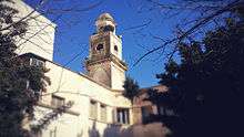
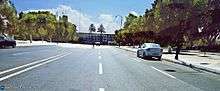
| Pictures | ||
 Province de Kenitra | ||
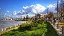
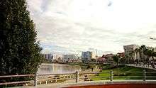 Corniche kenitra Sebou | 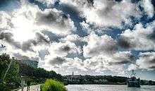 Corniche Sebou kenitra | |
 Corniche Sebou Kenitra | 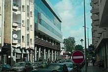 Kenitra Nafora | |
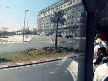 Kenitra Bd md 5 | 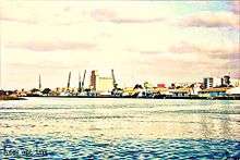 Fleuve Sebou | siège de la province de Kenitra |
 Bd My Abdelaziz | ||
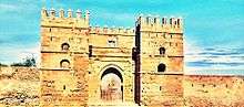 Kasba de Mehdia | 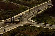 Route entre la Kasbah et Mehdia | |
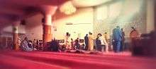
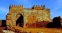 Kasbah de Mehdia |  Mosquée Mchich | |
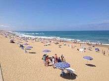 Plage De Mehdia | ||
 Corniche kenitra sebou |  Parc Saknia | 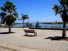 Corniche Kenitra |
Education
Primary and secondary schools
There is a French international school, Groupe scolaire Honoré-de-Balzac, serving moyenne section through collège (junior high school).[6]
Colleges and universities
- Université Ibn Tofail (UIT)
- ENCG Kénitra (École Nationale de Commerce et de Gestion de Kénitra)
- HECI Kénitra (Hautes Etudes Commerciales et Informatiques)
- ENSA Kénitra (École Nationale des Sciences Appliquées de Kénitra)
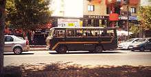
Transportation
The National Route 1 and the A1 motorway pass through Kenitra and connect it to Rabat-Salé in the south-west and to Larache in the north-east.
The city is served by two railway stations: Kenitra-Ville and Kenitra-Medina. A shuttle train, TNR, connects the city, every 30 minutes, to Rabat and Casablanca.
A high-speed rail line to Tangier is planned to be completed in 2018.[7] (See Kenitra–Tangier high-speed rail line.)
Sports
Kenitra Athletic Club, KAC
In 1938, a group of Kenitra natives created KAC.
This group of soccer lovers wanted to resist French domination in sports in Morocco.
The team, made entirely of Kenitra natives, succeeded in reaching the premier Moroccan soccer league in 1956. In 1960, KAC won its first championship league of Morocco. KAC embarked in a journey of glories by winning the 1973-81-82 championship leagues and the 1961 throne cup.
Ahmed Souiri was a long-time manager and coach. KAC has produced many international players.
Bouliahiaoui and Khalifa were among the players who helped the Moroccan national soccer team qualify for the second round of the World Cup finals in Mexico in 1986. Mohammed Boussati still holds a national record of goals by scoring 25 goals in one soccer championship season in 1981-82.
Its home is the Kenitra Municipal Stadium which has a capacity of 15,000 people.[8]
Ajax Kenitra
The local indoor soccer club, managed by Mohammed Nhaida, has represented Morocco in many international indoor soccer tournaments.
Natives from Kenitra
Kenitra was the birthplace of:
- Saïd Aouita, Olympic athlete
- Amina Aït Hammou, Olympic athlete
- Youssef Chippo, International football player
- Margie Cox, American R&B Singer
- Mohamed Sijelmassi, writer and physician
See also
Notes and references
- ↑ "Population légale d'après les résultats du RGPH 2014 sur le Bulletin officiel N° 6354". hcp.ma (in Arabic). Retrieved 2015-07-11.
- ↑ Kénitra depuis 1912 (French)
- ↑ In Morocco by Edith Wharton, New York: Charles Scribner's Sons 1920
- ↑ History of Port Lyautey
- ↑ "Kenitra Climate Normals 1961–1990". National Oceanic and Atmospheric Administration. Retrieved March 16, 2015.
- ↑ "Groupe scolaire Honoré-de-Balzac." AEFE. Retrieved on June 16, 2016.
- ↑ "Morocco awards Tangier-Kenitra high-speed line contract", railway-technology.com, 8 April 2013.
- ↑ StadiumDB
External links
| Wikimedia Commons has media related to Kenitra. |
- Entry in Lexicorient
- BTS Genie Informatique Lycee Technique Ibn Sina
- Pictures of U.S. Naval base facilities in Kenitra
- Histoire de Kenitra / Port-Lyautey en images de 1911 au 1956
Coordinates: 34°15′N 6°35′W / 34.250°N 6.583°W
Capital: Rabat | |
| Provinces and Prefectures | |
| Cities | |