Temara
| Temara تمارة ⵜⵎⴰⵔⴰ | |
|---|---|
 | |
 Temara Location in Morocco | |
| Coordinates: 33°55′36″N 6°54′44″W / 33.92667°N 6.91222°W | |
| Country |
|
| Region | Rabat-Salé-Kénitra |
| Population (2014) | |
| • Total | 312,828 |
| • Density | 18,450/sq mi (7,124/km2) |
| Time zone | WET (UTC+0) |
| • Summer (DST) | WEST (UTC+1) |
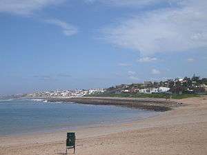
Temara (Arabic: تمارة; Berber: ⵜⵎⴰⵔⴰ) is a coastal city in Morocco. [1] It is located in the region of Rabat-Salé-Kénitra, directly south of Rabat on the Atlantic coast, in the suburban area of the capital. The city has 313,510 inhabitants as of 2014. It is twinned with Saint Germain en Laye, France. The city has beaches and a small pleasure port.
History
Temara was founded in the twelfth century (1130–1163) by the Almohad Sultan Abd al-Mu'min, who built a mosque there. Five centuries later, Mulai Ismail built the current wall and made from Temara a ribat (casern) around Said mosque. Later, Mulay Abd ar-Rahman (1822–1859) and Mulay Abdul Aziz (1894–1908), completed (Kasbah of the Udayas) as religious and military camps.
Economy
Temara is close to Morocco's two main cities, Rabat, the capital, and economic center Casablanca.
Two main zones share the essence of the industrial units in the city of Temara. The first is in the direction of Casablanca, and, with a total area of 120 hectares, extensible to 300 Ha work 55 industrial units in this zone, contains the more clean industry sectors (textiles, packaging, printing, food). The second industrial zone is at the other end of town, in the direction of Rabat. It is the industrial zone Attasnia, which, with a total of 20 hectares, contains 23 industrial units (such as textiles, electronics, chemicals).
Population
The population was at first constituted by Zaer tribes and different tribes of Oudayas (Military groups from different regions of Morocco were established by the Sultan, as exchange of their Military service to the Sultan they had the right to cultivate the land). Now the population was diversified by all ethnicities in Morocco: Arabs, Amazighs, Rifs, Chleuhs, Hassanis.
External links
- (Arabic) Temara City
References
Coordinates: 33°55′36″N 6°54′44″W / 33.92667°N 6.91222°W
Capital: Rabat | |
| Provinces and Prefectures | |
| Cities | |