Kanaga Island

Location in Alaska
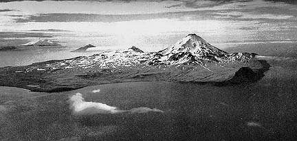
Kanaga Island
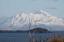
Kanaga Island view with Telephoto from Adak, AK
(Aleut: Kanaga[1]) is a part of the Andreanof Islands group of the Aleutian Islands in Alaska. The island measures 30 miles (48 kilometres) long and between 4–8 miles (6.4–12.9 km) wide with an area of 142 sq mi (368 km2), making it the 42nd largest island in the United States. The island's most notable feature is Mount Kanaga, a 4,288-foot-high (1,307 m) volcano which last erupted in 1995.
References
"Kanaga Island". Encyclopædia Britannica. Retrieved July 7, 2005.
- ↑ Bergsland, K. (1994). Aleut Dictionary. Fairbanks: Alaska Native Language Center.
Coordinates: 51°44′21″N 177°26′38″W / 51.73917°N 177.44389°W
This article is issued from Wikipedia - version of the 11/6/2016. The text is available under the Creative Commons Attribution/Share Alike but additional terms may apply for the media files.