Kudobin Islands
| Kudobin | |
| Kudobin Islands Archipelago | |
| Island | |
| Country | United States |
|---|---|
| State | Alaska |
| Borough | Aleutians East |
| Elevation | 13 m (43 ft) [1] |
| Coordinates | 56°01′21″N 160°55′20″W / 56.02250°N 160.92222°WCoordinates: 56°01′21″N 160°55′20″W / 56.02250°N 160.92222°W [1] |
| Lowest point | |
| - elevation | 0 ft (0 m) |
| Length | 8 mi (13 km) [1] |
| Timezone | AKST (UTC-9) |
| - summer (DST) | AKDT (UTC-8) |
| ZIP code | 99... |
| Area code | +1 907 |
| USGS GNIS | 1405002 |
| Topo map | USGS Alaska |
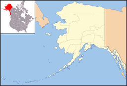 Location of Kudobin Islands in Alaska
| |
| [1] | |
The Kudobin Islands are a group of small islands in the Bering Sea, near the coast of Alaska, 13 miles (21 km) West of Port Moller; Bristol Bay Low. The group includes a cluster of other small coastal islands, Walrus and Kritskoi Islands, forming a geographical whole.[1]
The Kudobin Islands are located close to Nelson Lagoon. The largest island is about 13.5 km long. km (1 mile) wide. The islands are flat, the highest point on theme being only 4m.
Etymology
These coastal islands were surveyed by Andrew Khudobin (IRN, one of Captain Fyodor Petrovich Litke's naval officers in 1828. Khudobin named the group "Ile aux Loups" or "Wolf Island," according to Lutke. Lutke (1836, p. 263) called the group "Khoudobine." Its present name, "Khudobin Island", was given in 1882 by W. H. Dall, USC&GS.[1]
References
- 1 2 3 4 5 6 "Kudobin Islands". Geographic Names Information System. United States Geological Survey. Retrieved 2009-05-04.