Kang Meas District
| Kang Meas ស្រុកគងមាស | |
|---|---|
| District (srok) | |
|
Victims of the Khmer Rouge preserved in a memorial stupa | |
 Kang Meas Location in Cambodia | |
| Coordinates: 11°56′35″N 105°16′14″E / 11.94306°N 105.27056°E | |
| Country |
|
| Province | Kampong Cham |
| Communes | 11 |
| Villages | 93 |
| Population (1998)[1] | |
| • Total | 91,212 |
| Time zone | +7 |
| Geocode | 0307 |

Kang Meas District (Khmer: ស្រុកគងមាស; "Ring of Gold") is a district (srok) located in Kampong Cham Province, Cambodia. The district capital is Peam Chi Kang town located some 13 kilometres south of the town of Prey Toteung on National Highway 7 and is 110 kilometres by road from Phnom Penh. National road 70 provides access to the district from the highway and meets provincial road 223 at the district capital. This long relatively narrow district parallels the northern bank of the Mekong for about 40 kilometres between Kampong Cham (city) and Mukh Kampul District in Kandal Province.[2] As the district is low-lying, much of the land area of the district is inundated when the Mekong rises during the wet season.[3]
History
Between 1974 and 1978, two pagodas (wat in Khmer) in Kang Meas district were used as prisons and killing fields by the Khmer Rouge. According to a mapping team who surveyed the region in 1995 and 1996 Wat O Trau Kuon and Wat Nikroath in Peam Chi Kang commune were used as a district prison and regional prison respectively. O Trau Kuon was the main Democratic Kampuchea district prison from 1974 until 1978. Initial victims at this site were soldiers from the army of Lon Nol and then New People who were brought to Kang Meas District from Phnom Penh. Victims were executed at the mass graves close to the Wat. District authorities reported 467 mass graves at this site and estimated that 32,690 victims were executed there.[4] The graves were excavated in 1982 and the remains placed in a memorial stupa near the pagoda.[4]
Wat Nikroath was used as a prison from 1975 when New People were invited to the pagoda to receive food. They were then imprisoned and later executed. District officials recorded 186 mass graves at the site containing an estimated 11,160 victims. Monks from the pagoda reported that they have found names written in blood on the walls when they returned after the fall of the Khmer Rouge. These have now been covered with fresh paint.[4]
Location
Kang Meas district is in south western Kampong Cham Province. Reading from the north clockwise, Kang Meas shares a border with Cheung Prey and Prey Chhor districts to the north and the district of Kampong Siem to the east. The Mekong River forms the southern boundary of the district and the district boundary includes the river itself to midstream. The Mekong island of Kaoh Andaet is also part of the district. Across the river to the south are Koh Southin and Srei Santhor districts. To the east are Ksach Kandal and Mukh Kampul districts of Kandal Province and Batheay District of Kampong Cham to the north east.[5]
Administration
The Kang Meas district governor reports to His Excellency Hun Neng, the Governor of Kampong Cham. The following table shows the villages of Kang Meas district by commune.
| Khum (Commune) | Phum (Villages) |
|---|---|
| Angkor Ban | Angkor Ban Ti Muoy, Angkor Ban Ti Pir, Angkor Ban Ti Bei, Angkor Ban Ti Buon, Angkor Ban Ti Pram, Angkor Ban Ti Prammuoy, Angkor Ban Ti Prampir, Angkor Ban Ti Prambei, Angkor Ban Ti Prambuon |
| Kang Ta Noeng | Phun Ti Muoy, Phum Ti Pir, Phum Ti Bei, Phum Ti Buon, Phum Ti Pram, Phum Ti Prammuoy, Phum Ti Prampir, Phum Ti Prambei, Phum Ti Prambuon |
| Khchau | Thlok Chrov, Svay Poan Ti Muoy, Svay Poan Ti Pir, Ou Popel, Khchau Ti Muoy, Khchau Ti Pir, Khchau Ti Bei, Varint Ti Muoy, Varint Ti Pir, Varint Ti Bei |
| Peam Chi Kang | Damnak Chrey, Damnak Svay, Peam Chi Kang, Sach Sou, Sambuor Meas Ka, Sambuor Meas Kha, Kaoh Touch |
| Preaek Koy | Preaek Koy, Anlong Kokir, Kong Chey, Kouhe, Me Sar, Ou Svay Lech, Ou Svay Kaeut |
| Preaek Krabau | Pou Sala Ti Muoy, Pou Sala Ti Pir, Peam Knong, Preaek Andoung, Preaek Krabau, Ou Kandaol, Andoung Ta Ong, Andoung Dai, Tuek Chenh, Chamkar Ovloek |
| Reay Pay | Kanlaeng Run, Boeng Totea, Tuol Vihear, Tuol Bei, Reay Pay Leu, Reay Pay Kraom, Preaek Pranak, Kok Krabei |
| Roka ar | Preaek Liv Ti Muoy, Preaek Liv Ti Pir, Preaek Liv Ti Bei, Preaek Liv Ti Buon, Chrouy Krabau Ti Muoy, Chrouy Krabau Ti Pir, Svay Sranaoh Ti Muoy, Svay Sranaoh Ti Pir, Roka ar |
| Roka Koy | Roka Koy Ka, Roka Koy Kha, Phum Thmei Ka, PhumThmei Kha, Pongro, Svay Ta Haen, Damnak L'et |
| Sdau | Khpob Leu, Khpob Kraom, Sdau, Lvea Leu, Lvea Kraom, Anlong Kokir |
| Sour Kong | Kaoh Ta Ngao Ti Muoy, Kaoh Ta Ngao Ti Pir, Kaoh Ta Ngao Ti Bei, Boeng Sang Kaeut, Boeng Sang Lech, Kdei, Souken, Boeng Trav, Preaek Kruos, Anlong Ak Lech, Anlong Ak Kaeut |
Demographics
The district is subdivided into 11 communes (khum) and 93 villages (phum).[6] According to the 1998 Census, the population of the district was 91,212 persons in 17,661 households in 1998. With a population of over 90,000 people, Kang Meas has an average population size for districts in Kampong Cham province. The average household size in Kang Meas is 5.2 persons per household, the same as the rural average for Cambodia. The sex ratio in the district is 91.2%, with significantly more females than males.[7]
References
- ↑ General Population Census of Cambodia, 1998: Village Gazetteer. National Institute of Statistics. February 2000. pp. 43–44.
- ↑ Total Road Atlas of Cambodia 2006 (3rd ed.). Total Cambodge. 2006. p. 44.
- ↑ "Flood Analysis with RADARSAT-1 Data Recorder" (PDF). UNOSAT. 19 August 2008. Retrieved 2009-02-02.
- 1 2 3 "Report on CGP mapping team visit to Kampong Cham province" (PDF). Documentation Centre of Cambodia. 26 February 1996. Retrieved 2009-02-01.
- ↑ "Kampong Cham Provincial Resources". Ministry of Commerce. Archived from the original on January 5, 2009. Retrieved 2009-01-25.
- ↑ "Kampong Cham Administration". Royal Government of Cambodia. Retrieved 2009-01-20.
- ↑ General Population Census of Cambodia, 1998: Village Gazetteer. National Institute of Statistics. February 2000. pp. 32–73.
External links
| Capital city | 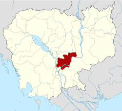 | |
|---|---|---|
| Districts | ||
Coordinates: 11°56′35″N 105°16′14″E / 11.94306°N 105.27056°E