Kapatagan, Lanao del Sur
| Kapatagan | |
|---|---|
| Municipality | |
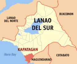 Map of Lanao del Sur with Kapatagan highlighted | |
.svg.png) Kapatagan Location within the Philippines | |
| Coordinates: 07°27′N 124°08′E / 7.450°N 124.133°ECoordinates: 07°27′N 124°08′E / 7.450°N 124.133°E | |
| Country | Philippines |
| Region | Autonomous Region in Muslim Mindanao (ARMM) |
| Province | Lanao del Sur |
| Barangays | 15 |
| Government[1] | |
| • Mayor | Nhazruddin Maglangit |
| Area | |
| • Total | 288.13 km2 (111.25 sq mi) |
| Population (2010)[2] | |
| • Total | 13,432 |
| • Density | 47/km2 (120/sq mi) |
| Time zone | PST (UTC+8) |
| ZIP code | 9700 |
| Dialing code | +63 (0)63 |
| Income class | 4th |
Kapatagan is a fourth class municipality in the province of Lanao del Sur, Philippines. According to the 2010 census, it has a population of 13,432 people.[2]
Barangays
Kapatagan is politically subdivided into 15 barangays.
- Bakikis
- Barao
- Bongabong
- Daguan
- Inudaran
- Kabaniakawan
- Kapatagan
- Lusain
- Matimos
- Minimao
- Pinantao.[3]
- Salaman
- Sigayan
- Tabuan
- Upper Igabay
Demographics
| Population census of Kapatagan | ||
|---|---|---|
| Year | Pop. | ±% p.a. |
| 1990 | 5,784 | — |
| 1995 | 6,702 | +2.80% |
| 2000 | 7,804 | +3.32% |
| 2007 | 19,598 | +13.54% |
| 2010 | 13,432 | −12.85% |
| Source: National Statistics Office[2] | ||
References
- ↑ "Official City/Municipal 2013 Election Results". Intramuros, Manila, Philippines: Commission on Elections (COMELEC). 1 July 2013. Retrieved 5 September 2013.
- 1 2 3 "Total Population by Province, City, Municipality and Barangay: as of May 1, 2010" (PDF). 2010 Census of Population and Housing. National Statistics Office. Retrieved 20 June 2014.
- ↑ (Txt message - Pinantao is an old town before kapatagan municipality)
External links
- Philippine Standard Geographic Code
- Philippine Census Information
- Local Governance Performance Management System
 |
Balabagan | Marogong | | |
| Illana Bay | |
Matanog, Maguindanao | ||
| ||||
| | ||||
| Sugat Bay |
This article is issued from Wikipedia - version of the 11/1/2016. The text is available under the Creative Commons Attribution/Share Alike but additional terms may apply for the media files.