Lumbaca-Unayan, Lanao del Sur
| Lumbaca-Unayan | |
|---|---|
| Municipality | |
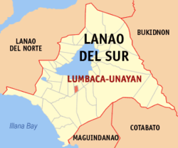 Map of Lanao del Sur with Lumbaca-Unayan highlighted | |
.svg.png) Lumbaca-Unayan Location within the Philippines | |
| Coordinates: 07°46′N 124°15′E / 7.767°N 124.250°ECoordinates: 07°46′N 124°15′E / 7.767°N 124.250°E | |
| Country | Philippines |
| Region | Autonomous Region in Muslim Mindanao (ARMM) |
| Province | Lanao del Sur |
| Founded | 2005 |
| Barangays | 9 |
| Government[1] | |
| • Mayor | OIC Aminodin Sulayman Cali |
| Area | |
| • Total | 42.28 km2 (16.32 sq mi) |
| Population (2010)[2] | |
| • Total | 6,279 |
| • Density | 150/km2 (380/sq mi) |
| Time zone | PST (UTC+8) |
| ZIP code | 9708 |
| Dialing code | +63 (0)63 |
| Income class | 6th |
Lumbaca-Unayan is a sixth class municipality in the province of Lanao del Sur, Philippines. According to the 2010 census, it has a population of 6,279 people.[2] It was created from Lumbatan in 2005.
Barangays
Lumbaca-Unayan is politically subdivided into 9 barangays.
- Bangon
- Proper Beta
- Calalon (formerly Ka_alawan)
- Calipapa
- Dilausan
- Dimapaok
- Lumbaca-Dilausan
- Oriental Beta
- Tringun
History
In 2005, nine barangays of Pat ka Apo sa Macadar in Lumbatan were made into Lumbaca-Unayan, a separate municipality among nine Princess of Unayan (e.g.in Meranau terms: 1. Andong sa Macadar 2. Ungklan sa Bita,3. Sana Lumbayanague, 4. Uyoda sa Madamba, 5. Inoda sa Ganassi, 6. Ayor sa Linindingan, 7. inkini sa Tubaran, 8.Togon sa Kadinguilan, 9. Dadauba sa Biabi 10. BOrowa Pagayawan).
Demographics
| Population census of Lumbaca-Unayan | ||
|---|---|---|
| Year | Pop. | ±% p.a. |
| 2007 | 11,766 | — |
| 2010 | 6,279 | −20.43% |
| Source: National Statistics Office[2] | ||
References
- ↑ "Official City/Municipal 2013 Election Results". Intramuros, Manila, Philippines: Commission on Elections (COMELEC). 1 July 2013. Retrieved 5 September 2013.
- 1 2 3 "Total Population by Province, City, Municipality and Barangay: as of May 1, 2010" (PDF). 2010 Census of Population and Housing. National Statistics Office. Retrieved 20 June 2014.
External links
- Philippine Standard Geographic Code
- Philippine Census Information
- Local Governance Performance Management System
 |
Lumbatan | | ||
| Bayang | |
Lumbatan | ||
| ||||
| | ||||
| Marogong | |
Sultan Dumalondong |
This article is issued from Wikipedia - version of the 11/18/2016. The text is available under the Creative Commons Attribution/Share Alike but additional terms may apply for the media files.