Karuvarakundu
| Karuvarakundu | |
|---|---|
| small town | |
|
Karuvarakkundu | |
 Karuvarakundu  Karuvarakundu Location in Kerala, India | |
| Coordinates: 11°7′0″N 76°20′0″E / 11.11667°N 76.33333°ECoordinates: 11°7′0″N 76°20′0″E / 11.11667°N 76.33333°E | |
| Country |
|
| State | Kerala |
| District | Malappuram |
| Area[1] | |
| • Total | 64.20 km2 (24.79 sq mi) |
| Population (2001)[2] | |
| • Total | 36,956 |
| • Density | 580/km2 (1,500/sq mi) |
| Languages | |
| • Official | Malayalam, English |
| Time zone | IST (UTC+5:30) |
| PIN | 676523 |
| Telephone code | 04931 |
| Vehicle registration | KL-71,KL-10. |
| Lok Sabha constituency | wayanad |
| Vidhan Sabha constituency | Wandoor |
| Climate | 15 to 40 C (Köppen) |
| Website |
{{URL|example.com|optional display text}} |
.JPG)
.JPG)

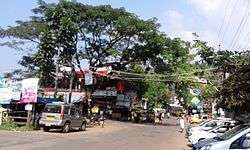
Karuvarakundu is small town in the eastern part of Malappuram district, Kerala, India. It is situated 32 kilometres (20 mi) from Manjeri and 10 kilometres (6 mi) each from Melattur and Kalikavu. The Olippuzha River flows through the town,[3] which is a tributary of the Kadalundipuzha.[4] Karuvarakundu is very near to the Western Ghats and hence prone to landslides.[5] There are many tea and rubber plantations in and around Karuvarakundu. The name Karuvarakundu means habitat of the blacksmith, indicating the town's history as a metalworking centre.[6] Nilambur is very near from here.We can find some reference on Karuvarakundu in MT's famous novel ARABIPONNU.
History
“Karu” means Iron ore the place from where iron ore was excavated came to be known as karu varum kundu, after this name shorted to Karuvarakundu.There are historical references that this place had ancient relation with iron.Evidences tell us that the people engaged in iron ore mining had the family name Aripanikkar. Karuvarakundu can be termed as the Jamshedpur of south India.History reveals that swords and utensils made of iron were made here and exported to countries like Egypt Rome Denmark.Two thousand years ago the Malabar’s riot of 1921 had its impact on Karuvarakundu. On 20 August 1921 the news of British firing at a mosque in Tirurangadi spread in karuvarakundu and people protested against the British on the next day, people attacked the police station and seized weapons.The mob set the police station and the tourist Bungalowon fire. The next day the British army came to karuvarakundu to fight the rioters.They set up there barrack first at chembankunnu and later at cambinkunnu which is now the Karuvarakundu Govt Higher Secondary School.
Geography
Karuvarakundu is slopey area which lies close to the forest with lot of wills.Karuvarakudu is one of the main agricultural areas of Malappuram district.The Western Ghats which at height of 1250 metre above sea level is in the south east of Karuvarakundu Panchayath. Olipuzhariver the lengthiest river flowing through karuvarakundu is originated from this point.Another river kallanpuzha which flows through karuvarakundu is originated at a highest of 1050m. This two rivers are the two main sources culture heritage of this place. KT Manumusliyar who has a great Scholar is a part of karuvarakundu.Karuvarakundu Gramapanchayath is in wandoor Block which is a part of Nilambur Taluk of Malappuram district. The area of Karuvarakundu Grama Panchayath is an area of 64.2 km2 which includes Kerala estate sharing borders with Amaranbalam, Chokkad, Puthur (Palakkad) Panchayath in the north, Puthur Panchayath in the east, Alanallur (Palakkad) Edappatta Panchayath in the south and Kalikavu, Tuvvur, Chokkad on the west side .
Suburbs and Villages
- Chengode Bridge, Eanadi and Arimanal Bridge
- Kerala Village, Punnakkad Junction and Gopalaparamba
- Iringattiri Bridge, Puthanazhi and Edapatta
Tourist Attractions
- KERALAMKUNDU waterfall
- CHERUMB ECHO VILLEGE
- Many rivers at Cherumbu ecotourism project area
- Many temples in Ayyappankavu area
- Thareeqath Dargah of late Hyderabadi saint
- Baroda waterfall
- Trucking sites
For More Information Related Tourism,Kindly check the Facebook page -Karuvarakundu Tourism
Important Landmarks
- Keralamkundu Waterfall
- DNIC Arts and Science college
- Alsalama Hospital
- Kapa Special School
- St.Mary's Sunday School
- B.B.Panchami Auditorium
- Clara Nivas Convent
- Kalakuthilamma Muthappan Temple
- Kerala Estate
- jisniya oil mill
- GHSS karuvarakundu
Culture
Karuvarakundu village is a predominantly Muslim populated area. Hindus exist in comparatively smaller numbers. So the culture of the locality is based upon Muslim traditions. Duff Muttu, Kolkali and Aravanamuttu are common folk arts of this locality. There are many libraries attached to mosques giving a rich source of Islamic studies. Most of the books are written in Arabi-Malayalam which is a version of the Malayalam language written in Arabic script. People gather in mosques for the evening prayer and continue to sit there after the prayers discussing social and cultural issues. Business and family issues are also sorted out during these evening meetings. The Hindu minority of this area keeps their rich traditions by celebrating various festivals in their temples. Hindu rituals are done here with a regular devotion like other parts of Kerala.[7]
Transportation
Karuvarakundu village is well connected via road to the nearest towns Manjeri, Perinthalmanna and Nilambur. State Highway 39 (SH 39) between Perumbilavu and Nilambur passes through Karuvarakundu. It is also well connected to the National Highway No.966 which connects Palakkad and Coimbatore. The nearest airport is at Kozhikode. The nearest railway stations are at Tuvvur and Melattur.
References
- ↑ "Table 1 - Demographic Particulars - 1991" (PDF). Panchayat Statistics. Government of Kerala. Retrieved 29 May 2009.
- ↑ "Panchayat wise Population Details (2001 census)". Malappuram district official website. Retrieved 29 May 2009.
- ↑ Hitchcock, R. H. (1983). Peasant revolt in Malabar: a history of the Malabar rebellion, 1921. Usha. p. 65. OCLC 15692976.
- ↑ Kerala District Gazetteers: Kozhikode. vol. 5. Superintendent of Govt. Presses. 1986. p. 9.
- ↑ "Floods batter Adivasi areas of Nilambur" (PDF). Disasters Update. National Institute of Disaster Management, Ministry of Home Affairs (India). 17 July 2007. Retrieved 29 May 2009.
- ↑ Proceedings - Indian History Congress. Indian History Congress. 60: 1204. 2000. OCLC 1752882. Missing or empty
|title=(help) - ↑ http://www.malappuram.net/art-and-culture.htm
External links
| Wikimedia Commons has media related to Karuvarakundu. |