Keedysville, Maryland
| Town of Keedysville, Maryland | |
|---|---|
| Town | |
 Location of Keedysville, Maryland | |
| Coordinates: 39°29′19″N 77°41′55″W / 39.48861°N 77.69861°WCoordinates: 39°29′19″N 77°41′55″W / 39.48861°N 77.69861°W | |
| Country | United States |
| State | Maryland |
| County | Washington |
| Area[1] | |
| • Total | 0.92 sq mi (2.38 km2) |
| • Land | 0.92 sq mi (2.38 km2) |
| • Water | 0 sq mi (0 km2) |
| Elevation | 394 ft (120 m) |
| Population (2010)[2] | |
| • Total | 1,152 |
| • Estimate (2012[3]) | 1,163 |
| • Density | 1,252.2/sq mi (483.5/km2) |
| Time zone | Eastern (EST) (UTC-5) |
| • Summer (DST) | EDT (UTC-4) |
| ZIP code | 21756 |
| Area code(s) | 301 |
| FIPS code | 24-43100 |
| GNIS feature ID | 0585283 |
| Website | http://www.keedysvillemd.com/ |
Keedysville is a town in Washington County, Maryland, United States. The population was 1,152 at the 2010 census.
History
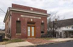
The Baltimore & Ohio Railroad Bridge, Antietam Creek, Baker Farm, Doub Farm, Geeting Farm, Hills, Dales and The Vinyard, Hitt's Mill and Houses, Hoffman Farm, Keedysville Historic District, and Nicodemus Mill Complex are listed on the National Register of Historic Places.[4]
Geography
Keedysville is located at 39°29′19″N 77°41′55″W / 39.48861°N 77.69861°W (39.488634, -77.698488).[5]
According to the United States Census Bureau, the town has a total area of 0.92 square miles (2.38 km2), all of it land.[1]
Keedysville is underlain by the Tomstown Dolomite, a carbonic rock formation of the Cambrian. The Tomstown is known for producing most of the caves in Washington County, especially in the area surrounding Keedysville. The area was once home to eight different caves, several of which were discovered during quarrying operations to remove rock for highway construction. The most famous of these caves, Crystal Grottoes, was discovered in 1920 and is now the only show-cave in Maryland.
The high concentration of caves in this area may be related to increased drainage of ground water. The watertable in this locality is drained by the Little Antietam Creek and its tributaries, and many of these caves can be found in the cliffs and along the broken plateau east of town.
Climate
The climate in this area is characterized by hot, humid summers and generally mild to cool winters. According to the Köppen Climate Classification system, Keedysville has a humid subtropical climate, abbreviated "Cfa" on climate maps.[6]
Demographics
| Historical population | |||
|---|---|---|---|
| Census | Pop. | %± | |
| 1880 | 389 | — | |
| 1890 | 420 | 8.0% | |
| 1900 | 426 | 1.4% | |
| 1910 | 367 | −13.8% | |
| 1920 | 394 | 7.4% | |
| 1930 | 393 | −0.3% | |
| 1940 | 404 | 2.8% | |
| 1950 | 417 | 3.2% | |
| 1960 | 433 | 3.8% | |
| 1970 | 431 | −0.5% | |
| 1980 | 476 | 10.4% | |
| 1990 | 464 | −2.5% | |
| 2000 | 482 | 3.9% | |
| 2010 | 1,152 | 139.0% | |
| Est. 2015 | 1,159 | [7] | 0.6% |
2010 census
As of the census[2] of 2010, there were 1,152 people, 391 households, and 319 families residing in the town. The population density was 1,252.2 inhabitants per square mile (483.5/km2). There were 407 housing units at an average density of 442.4 per square mile (170.8/km2). The racial makeup of the town was 94.5% White, 3.5% African American, 0.2% Asian, 0.8% from other races, and 1.0% from two or more races. Hispanic or Latino of any race were 2.9% of the population.
There were 391 households of which 41.9% had children under the age of 18 living with them, 71.4% were married couples living together, 7.9% had a female householder with no husband present, 2.3% had a male householder with no wife present, and 18.4% were non-families. 14.1% of all households were made up of individuals and 4.3% had someone living alone who was 65 years of age or older. The average household size was 2.95 and the average family size was 3.24.
The median age in the town was 37.2 years. 28.2% of residents were under the age of 18; 6.6% were between the ages of 18 and 24; 28.2% were from 25 to 44; 28.4% were from 45 to 64; and 8.6% were 65 years of age or older. The gender makeup of the town was 50.8% male and 49.2% female.
2000 census
As of the census[9] of 2000, there were 482 people, 172 households, and 131 families residing in the town. The population density was 565.7 people per square mile (218.9/km²). There were 188 housing units at an average density of 220.6 per square mile (85.4/km²). The racial makeup of the town was 98.96% White, 0.21% African American, 0.21% Asian, and 0.62% from two or more races. Hispanic or Latino of any race were 1.24% of the population.
There were 172 households out of which 41.3% had children under the age of 18 living with them, 69.2% were married couples living together, 5.8% had a female householder with no husband present, and 23.3% were non-families. 20.9% of all households were made up of individuals and 8.1% had someone living alone who was 65 years of age or older. The average household size was 2.80 and the average family size was 3.27.
In the town the population was spread out with 28.6% under the age of 18, 6.4% from 18 to 24, 31.1% from 25 to 44, 25.5% from 45 to 64, and 8.3% who were 65 years of age or older. The median age was 35 years. For every 100 females there were 95.1 males. For every 100 females age 18 and over, there were 93.3 males.
The median income for a household in the town was $53,250, and the median income for a family was $61,607. Males had a median income of $43,438 versus $30,938 for females. The per capita income for the town was $19,911. None of the families and 1.3% of the population were living below the poverty line, including no under eighteens and 8.8% of those over 64.
References
- 1 2 "US Gazetteer files 2010". United States Census Bureau. Retrieved 2013-01-25.
- 1 2 "American FactFinder". United States Census Bureau. Retrieved 2013-01-25.
- ↑ "Population Estimates". United States Census Bureau. Retrieved 2013-06-26.
- ↑ National Park Service (2010-07-09). "National Register Information System". National Register of Historic Places. National Park Service.
- ↑ "US Gazetteer files: 2010, 2000, and 1990". United States Census Bureau. 2011-02-12. Retrieved 2011-04-23.
- ↑ Climate Summary for Keedysville, Maryland
- ↑ "Annual Estimates of the Resident Population for Incorporated Places: April 1, 2010 to July 1, 2015". Retrieved July 2, 2016.
- ↑ "Census of Population and Housing". Census.gov. Retrieved June 4, 2015.
- ↑ "American FactFinder". United States Census Bureau. Retrieved 2008-01-31.
External links
Municipalities and communities of Washington County, Maryland, United States | ||
|---|---|---|
| City | 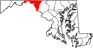 | |
| Towns | ||
| CDPs |
| |
| Other communities | ||