Kensington, Kansas
| Kensington, Kansas | |
|---|---|
| City | |
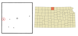 Location within Smith County and Kansas | |
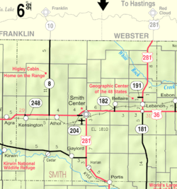 KDOT map of Smith County (legend) | |
| Coordinates: 39°45′58″N 99°1′56″W / 39.76611°N 99.03222°WCoordinates: 39°45′58″N 99°1′56″W / 39.76611°N 99.03222°W | |
| Country | United States |
| State | Kansas |
| County | Smith |
| Government | |
| • Type | Mayor–Council |
| • Mayor | Leland Rajhes[1] |
| • City Clerk | Mary Beach[1] |
| Area[2] | |
| • Total | 0.36 sq mi (0.93 km2) |
| • Land | 0.36 sq mi (0.93 km2) |
| • Water | 0 sq mi (0 km2) |
| Elevation | 1,778 ft (542 m) |
| Population (2010)[3] | |
| • Total | 473 |
| • Estimate (2015)[4] | 452 |
| • Density | 1,300/sq mi (510/km2) |
| Time zone | Central (CST) (UTC-6) |
| • Summer (DST) | CDT (UTC-5) |
| ZIP code | 66951 |
| Area code | 785 |
| FIPS code | 20-36550 [5] |
| GNIS feature ID | 0471944 [6] |
Kensington is a city in Smith County, Kansas, United States. As of the 2010 census, the city population was 473.[7]
History
Kensington was founded circa 1887.[8] It was incorporated as a city in 1900.[9]
Kensington was located on the Chicago, Rock Island and Pacific Railroad.[10]
The first post office in Kensington was established in January 1888.[11]
Geography
Kensington is located at 39°45′58″N 99°1′56″W / 39.76611°N 99.03222°W (39.766110, -99.032308).[12] According to the United States Census Bureau, the city has a total area of 0.36 square miles (0.93 km2), all land.[2]
Demographics
| Historical population | |||
|---|---|---|---|
| Census | Pop. | %± | |
| 1910 | 497 | — | |
| 1920 | 595 | 19.7% | |
| 1930 | 546 | −8.2% | |
| 1940 | 597 | 9.3% | |
| 1950 | 635 | 6.4% | |
| 1960 | 619 | −2.5% | |
| 1970 | 653 | 5.5% | |
| 1980 | 681 | 4.3% | |
| 1990 | 553 | −18.8% | |
| 2000 | 529 | −4.3% | |
| 2010 | 473 | −10.6% | |
| Est. 2015 | 452 | [4] | −4.4% |
| U.S. Decennial Census | |||
2010 census
As of the census[3] of 2010, there were 473 people, 203 households, and 126 families residing in the city. The population density was 1,313.9 inhabitants per square mile (507.3/km2). There were 261 housing units at an average density of 725.0 per square mile (279.9/km2). The racial makeup of the city was 97.7% White, 0.2% Native American, and 2.1% from two or more races. Hispanic or Latino of any race were 0.2% of the population.
There were 203 households of which 23.6% had children under the age of 18 living with them, 53.2% were married couples living together, 4.9% had a female householder with no husband present, 3.9% had a male householder with no wife present, and 37.9% were non-families. 36.5% of all households were made up of individuals and 23.1% had someone living alone who was 65 years of age or older. The average household size was 2.19 and the average family size was 2.78.
The median age in the city was 49.7 years. 21.6% of residents were under the age of 18; 4.2% were between the ages of 18 and 24; 18.6% were from 25 to 44; 26.6% were from 45 to 64; and 29% were 65 years of age or older. The gender makeup of the city was 46.3% male and 53.7% female.
2000 census
As of the census[5] of 2000, there were 529 people, 231 households, and 140 families residing in the city. The population density was 1,652.0 people per square mile (638.3/km²). There were 264 housing units at an average density of 824.5 per square mile (318.5/km²). The racial makeup of the city was 97.35% White, 0.19% African American, 0.19% from other races, and 2.27% from two or more races. Hispanic or Latino of any race were 0.76% of the population.
There were 231 households out of which 23.4% had children under the age of 18 living with them, 54.1% were married couples living together, 3.9% had a female householder with no husband present, and 39.0% were non-families. 37.7% of all households were made up of individuals and 27.3% had someone living alone who was 65 years of age or older. The average household size was 2.16 and the average family size was 2.79.
In the city the population was spread out with 21.6% under the age of 18, 5.5% from 18 to 24, 19.5% from 25 to 44, 21.0% from 45 to 64, and 32.5% who were 65 years of age or older. The median age was 48 years. For every 100 females there were 81.8 males. For every 100 females age 18 and over, there were 78.9 males.
The median income for a household in the city was $29,219, and the median income for a family was $41,250. Males had a median income of $28,333 versus $16,607 for females. The per capita income for the city was $15,131. About 3.4% of families and 5.1% of the population were below the poverty line, including 4.5% of those under age 18 and 3.9% of those age 65 or over.
Government
The Kensington government consists of a mayor and five council members. The council meets the 2nd Monday of each month at 5:30PM.[1]
- City Hall, 101 S Main.
References
- 1 2 3 Kensington - Directory of Public Officials
- 1 2 "US Gazetteer files 2010". United States Census Bureau. Retrieved 2012-07-06.
- 1 2 "American FactFinder". United States Census Bureau. Retrieved 2012-07-06.
- 1 2 "Annual Estimates of the Resident Population for Incorporated Places: April 1, 2010 to July 1, 2015". Retrieved July 2, 2016.
- 1 2 "American FactFinder". United States Census Bureau. Retrieved 2008-01-31.
- ↑ "US Board on Geographic Names". United States Geological Survey. 2007-10-25. Retrieved 2008-01-31.
- ↑ "2010 City Population and Housing Occupancy Status". U.S. Census Bureau. Retrieved April 25, 2011.
- ↑ Kansas State Historical Society (1916). Biennial Report of the Board of Directors of the Kansas State Historical Society. Kansas State Printing Plant. p. 301.
- ↑ Blackmar, Frank Wilson (1912). Kansas: A Cyclopedia of State History. Standard Publishing Company. p. 68.
- ↑ Gannett, Henry (1898). A Gazetteer of Kansas. Govt. Print. Off. p. 123.
- ↑ "Kansas Post Offices, 1828-1961". Kansas Historical Society. Archived from the original on October 9, 2013. Retrieved 23 June 2014.
- ↑ "US Gazetteer files: 2010, 2000, and 1990". United States Census Bureau. 2011-02-12. Retrieved 2011-04-23.
External links
| Wikimedia Commons has media related to Kensington, Kansas. |
- City
- Schools
- USD 110, local school district
- Maps
- Kensington City Map, KDOT
Municipalities and communities of Smith County, Kansas, United States | ||
|---|---|---|
| Cities |  | |
| Unincorporated communities | ||