Kimsa Kunturiri
| Kimsa Kunturiri | |
|---|---|
 Kimsa Kunturiri Location in Bolivia | |
| Highest point | |
| Elevation | 5,020 m (16,470 ft) |
| Coordinates | 19°35′30″S 65°40′12″W / 19.59167°S 65.67000°WCoordinates: 19°35′30″S 65°40′12″W / 19.59167°S 65.67000°W |
| Geography | |
| Location |
Bolivia, Potosí Department |
| Parent range | Andes, Khari Khari mountain range |
Kimsa Kunturiri (Aymara and Quechua kimsa three, kunturi condor,[1][2] -ri a suffix, hispanicized spelling Quimsa Condoriri) is a group of three mountains in the Andes of Bolivia in the Potosí Department at the border of Tomás Frías Province and Cornelio Saavedra Province. The peaks are about 5,020 m, 4,980 m and 4,960 m high.[3] The Kimsa Kunturiri group is situated in the Khari Khari mountain range east of Potosí. It lies north of the Kimsa Waylla group, between the lakes Jatun Wak'ani (Jatun Huacani) and Juch'uy Wak'ani (Juchuy Huacani) in the west and the Jatun Tiyu Lakes in the east.[4]
References
- ↑ Radio San Gabriel, "Instituto Radiofonico de Promoción Aymara" (IRPA) 1993, Republicado por Instituto de las Lenguas y Literaturas Andinas-Amazónicas (ILLLA-A) 2011, Transcripción del Vocabulario de la Lengua Aymara, P. Ludovico Bertonio 1612 (Spanish-Aymara-Aymara-Spanish dictionary)
- ↑ aymara.ucb.edu.bo Félix Layme Payrumani (Spanish-Aymara dictionary)
- ↑ Evelio Echevarría, Cordillera de Potosí, Bolivia, The Alpine Journal, 1995
- ↑ BIGM map 1:50,000 6435-II-1 Potosí (Este)
Capital: Potosí | ||
| Provinces | 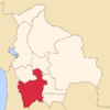 | |
| Municipalities (and seats) |
| |
This article is issued from Wikipedia - version of the 12/6/2015. The text is available under the Creative Commons Attribution/Share Alike but additional terms may apply for the media files.