Kingsdale, Minnesota
| Kingsdale, Minnesota | |
|---|---|
| Unincorporated community | |
 Kingsdale, Minnesota  Kingsdale, Minnesota Location of the community of Kingsdale | |
| Coordinates: 46°14′18″N 92°18′42″W / 46.23833°N 92.31167°WCoordinates: 46°14′18″N 92°18′42″W / 46.23833°N 92.31167°W | |
| Country | United States |
| State | Minnesota |
| County | Pine |
| Township | New Dosey Township |
| Elevation | 1,161 ft (354 m) |
| Time zone | Central (CST) (UTC-6) |
| • Summer (DST) | CDT (UTC-5) |
| ZIP code | 55072 |
| Area code(s) | 320 |
| GNIS feature ID | 646169[1] |
Kingsdale is an unincorporated community in New Dosey Township, Pine County, Minnesota, United States.
The community is located east of Askov; at the junction of Pine County Road 31, Kingsdale Road, and Belden Road.
Rutabaga Road (Pine County 32) is also nearby. Hay Creek flows through the community. The Nemadji State Forest is nearby. The Gandy Dancer Trail passes through Kingsdale.
Kingsdale is located near the Minnesota–Wisconsin state line. Nearby places in Minnesota include Cloverton, Markville, and Duxbury. Nearby places in Wisconsin include Dairyland, Moose Junction, and Cozy Corner.
Kingsdale is located 28 miles east of Askov; and 34 miles east–northeast of Sandstone. Kingsdale is 5 miles north of Cloverton; and 9 miles west of Dairyland, WI.
A post office called Kingsdale was established in 1913, and remained in operation until 1961.[2] Kingsdale had a depot on the Soo Railroad.[3]
References
- ↑ "Kingsdale, Minnesota". Geographic Names Information System. United States Geological Survey.
- ↑ "Pine County". Jim Forte Postal History. Retrieved 30 July 2015.
- ↑ Upham, Warren (1920). Minnesota Geographic Names: Their Origin and Historic Significance. Minnesota Historical Society. p. 412.
- Rand McNally Road Atlas – 2007 edition – Minnesota entry
- Official State of Minnesota Highway Map – 2011/2012 edition
Municipalities and communities of Pine County, Minnesota, United States | ||
|---|---|---|
| Cities | 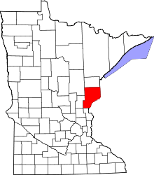 | |
| Townships | ||
| Unincorporated communities | ||
| Ghost towns | ||
| Indian reservation | ||