Kunturiri (Frías)
This article is about the mountain in the Tomás Frías Province, Potosí Department, Bolivia. For other uses, see Kunturiri.
| Kunturiri | |
|---|---|
 Looking west from Potosí to Kunturiri (center, background) | |
| Highest point | |
| Elevation | 4,526 m (14,849 ft) [1] |
| Coordinates | 19°36′03″S 65°52′13″W / 19.60083°S 65.87028°WCoordinates: 19°36′03″S 65°52′13″W / 19.60083°S 65.87028°W |
| Geography | |
 Kunturiri Location in Bolivia | |
| Location |
Bolivia, Potosí Department, Tomás Frías Province |
| Parent range | Andes |
Kunturiri (Aymara kunturi condor,[2] -(i)ri a suffix, Hispanicized spelling Condoriri) is a 4,526-metre-high (14,849 ft) mountain in the Bolivian Andes. It is situated west of Potosí in the Potosí Department, Tomás Frías Province, Yocalla Municipality. Kunturiri lies north-west of the lower mountain Inka Qhata (Aymara for "Inca knee pit", Quechua for "Inca slope", Inca Khata).[1][3]
References
Capital: Potosí | ||
| Provinces | 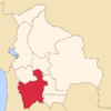 | |
| Municipalities (and seats) |
| |
This article is issued from Wikipedia - version of the 5/5/2016. The text is available under the Creative Commons Attribution/Share Alike but additional terms may apply for the media files.