L'Anse, Michigan
| L'Anse, Michigan | |
|---|---|
| Village | |
|
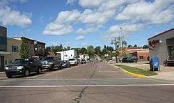
Downtown L'Anse | |
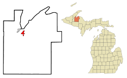 Location of L'Anse in Baraga County, Michigan | |
| Coordinates: 46°45.4′N 88°27.2′W / 46.7567°N 88.4533°WCoordinates: 46°45.4′N 88°27.2′W / 46.7567°N 88.4533°W | |
| Country | United States |
| State | Michigan |
| County | Baraga |
| Township | L'Anse |
| Area[1] | |
| • Total | 2.53 sq mi (6.55 km2) |
| • Land | 2.53 sq mi (6.55 km2) |
| • Water | 0 sq mi (0 km2) |
| Elevation | 620 ft (189 m) |
| Population (2010)[2] | |
| • Total | 2,011 |
| • Estimate (2012[3]) | 1,963 |
| • Density | 794.9/sq mi (306.9/km2) |
| Time zone | Eastern (CST) (UTC-5) |
| • Summer (DST) | EST (UTC-4) |
| ZIP code | 49946 |
| Area code(s) | 906 |
| FIPS code | 26-45540[4] |
| GNIS feature ID | 629897[5] |
L'Anse (/ˈlɑːns/ LAHNS) is a village in northwest Michigan, U.S., and the county seat of Baraga County.[6] The population was 2,011 at the 2010 census. The village is located within L'Anse Township.
In French, L'Anse translates as "the cove" as a reference to its location on Keweenaw Bay, at the base of the Keweenaw Peninsula. French explorers sighted this area in the 17th century. They later established a Jesuit mission there and a fur trading post. The village grew up around it.
The village is located within the L'Anse Indian Reservation, the base of the federally recognized Keweenaw Bay Indian Community, part of the Lake Superior Band of Ojibwa (Chippewa) people.
History
This area was long occupied by people of the Lake Superior Band of Ojibwa (Chippewa). Their village was recorded in the 17th century by French explorers. Later colonists established a fur trading post here and a Jesuit mission, naming it L'Anse. In French, L'Anse translates as "the cove," referring to its location on Keweenaw Bay, at the base of the Keweenaw Peninsula.
Following treaties with the United States in the 19th century, the Ojibwa/Chippewa ceded extensive amounts of land in Michigan. The L'Anse Indian Reservation was established by the US here as the largest and the oldest in Michigan.
Geography
According to the United States Census Bureau, the village has a total area of 2.53 square miles (6.55 km2), all of it land.[1]
Transportation
-
 US 41 runs through the southernmost portion of the village.
 -
 M-38 begins in the Village of Baraga, across the bay from L'Anse.
 - Indian Trails bus lines operates daily intercity bus service between Hancock and Milwaukee, WI with a stop in L'Anse.[7]
Demographics
| Historical population | |||
|---|---|---|---|
| Census | Pop. | %± | |
| 1880 | 1,014 | — | |
| 1890 | 655 | −35.4% | |
| 1900 | 620 | −5.3% | |
| 1910 | 708 | 14.2% | |
| 1920 | 1,013 | 43.1% | |
| 1930 | 2,421 | 139.0% | |
| 1940 | 2,564 | 5.9% | |
| 1950 | 2,376 | −7.3% | |
| 1960 | 2,397 | 0.9% | |
| 1970 | 2,538 | 5.9% | |
| 1980 | 2,500 | −1.5% | |
| 1990 | 2,151 | −14.0% | |
| 2000 | 2,107 | −2.0% | |
| 2010 | 2,011 | −4.6% | |
| Est. 2015 | 1,934 | [8] | −3.8% |
2010 census
As of the census[2] of 2010, there were 2,011 people, 874 households, and 502 families residing in the village. The population density was 794.9 inhabitants per square mile (306.9/km2). There were 988 housing units at an average density of 390.5 per square mile (150.8/km2). The racial makeup of the village was 88.7% White, 1.4% African American, 5.0% Native American, 0.2% Asian, 0.1% from other races, and 4.6% from two or more races. Hispanic or Latino of any race were 0.9% of the population.
There were 874 households of which 28.1% had children under the age of 18 living with them, 40.0% were married couples living together, 12.2% had a female householder with no husband present, 5.1% had a male householder with no wife present, and 42.6% were non-families. 37.9% of all households were made up of individuals and 16.4% had someone living alone who was 65 years of age or older. The average household size was 2.16 and the average family size was 2.82.
The median age in the village was 41.7 years. 22.9% of residents were under the age of 18; 6.8% were between the ages of 18 and 24; 24.3% were from 25 to 44; 24.1% were from 45 to 64; and 21.8% were 65 years of age or older. The gender makeup of the village was 47.6% male and 52.4% female.
2000 census
As of the census[4] of 2000, there were 2,107 people, 894 households, and 540 families residing in the village. The population density was 821.9 per square mile (317.8/km²). There were 981 housing units at an average density of 382.7 per square mile (148.0/km²). The racial makeup of the village was 91.22% White, 0.09% African American, 5.55% Native American, 0.19% Asian, 0.05% Pacific Islander, and 2.90% from two or more races. Hispanic or Latino of any race were 0.57% of the population. 27.9% were of Finnish, 11.6% German, 9.4% French, 7.5% Norwegian, 5.9% French Canadian and 5.1% English ancestry according to Census 2000.
There were 894 households out of which 25.6% had children under the age of 18 living with them, 46.4% were married couples living together, 9.8% had a female householder with no husband present, and 39.5% were non-families. 34.2% of all households were made up of individuals and 16.2% had someone living alone who was 65 years of age or older. The average household size was 2.23 and the average family size was 2.86.
In the village the population was spread out with 21.3% under the age of 18, 7.3% from 18 to 24, 25.6% from 25 to 44, 23.9% from 45 to 64, and 21.9% who were 65 years of age or older. The median age was 42 years. For every 100 females there were 88.8 males. For every 100 females age 18 and over, there were 87.3 males.
The median income for a household in the village was $31,406, and the median income for a family was $38,984. Males had a median income of $31,583 versus $20,929 for females. The per capita income for the village was $15,857. About 6.6% of families and 11.0% of the population were below the poverty line, including 14.6% of those under age 18 and 6.1% of those age 65 or over.
Images
 A park in L'Anse on the shore of Lake Superior
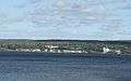 View across Keweenaw Bay to L'Anse
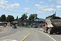 Intersection on US 41
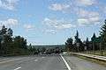 Sign
Sign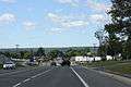 Overlooking L'Anse
 L'Anse Township Hall
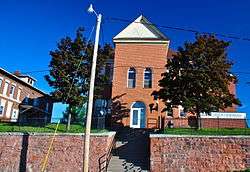 Baraga County Courthouse and Annex located in L'Anse.
References
- 1 2 "US Gazetteer files 2010". United States Census Bureau. Retrieved 2012-11-25.
- 1 2 "American FactFinder". United States Census Bureau. Retrieved 2012-11-25.
- ↑ "Population Estimates". United States Census Bureau. Retrieved 2013-06-03.
- 1 2 "American FactFinder". United States Census Bureau. Retrieved 2008-01-31.
- ↑ U.S. Geological Survey Geographic Names Information System: L'Anse, Michigan
- ↑ "Find a County". National Association of Counties. Retrieved 2011-06-07.
- ↑ "HANCOCK-MARQUETTE-GREEN BAY-MILWAUKEE" (PDF). Indian Trails. January 12, 2012. Retrieved 2013-02-27.
- ↑ "Annual Estimates of the Resident Population for Incorporated Places: April 1, 2010 to July 1, 2015". Retrieved July 2, 2016.
- ↑ "Census of Population and Housing". Census.gov. Retrieved June 4, 2015.
Further reading
- Baragaland Bicentennial 1776-1976. Baraga, Michigan: The Lumberjacks. 1976.
- 100 Years of History: L'Anse/Skanee Centennial. Ishpeming, Michigan: Baraga County Historical Society Pageant Division. 1971.
External links
| Wikimedia Commons has media related to L'Anse, Michigan. |
Municipalities and communities of Baraga County, Michigan, United States | ||
|---|---|---|
| Villages |  | |
| Townships | ||
| Unincorporated communities | ||
| Indian reservation | ||
| Central cities | |
|---|---|
| Counties | |
| Geography | |
| Transportation | |
| Economy | |