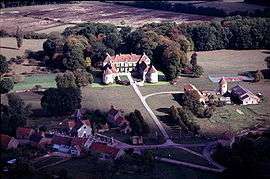
Lacour-d'Arcenay
| Lacour-d’Arcenay | |
|---|---|
 | |
 Lacour-d’Arcenay | |
|
Location within Bourgogne-Franche-Comté region  Lacour-d’Arcenay | |
| Coordinates: 47°21′47″N 4°15′10″E / 47.3631°N 4.2528°E / 47.3631; 4.2528Coordinates: 47°21′47″N 4°15′10″E / 47.3631°N 4.2528°E / 47.3631; 4.2528 | |
| Country | France |
| Region | Bourgogne-Franche-Comté |
| Department | Côte-d'Or |
| Arrondissement | Montbard |
| Canton | Précy-sous-Thil |
| Government | |
| • Mayor (2008–2014) | Isabelle Benoist |
| Area1 | 20.24 km2 (7.81 sq mi) |
| Population (2008)2 | 130 |
| • Density | 6.4/km2 (17/sq mi) |
| Time zone | CET (UTC+1) |
| • Summer (DST) | CEST (UTC+2) |
| INSEE/Postal code | 21335 / 21210 |
| Elevation |
355–503 m (1,165–1,650 ft) (avg. 400 m or 1,300 ft) |
|
1 French Land Register data, which excludes lakes, ponds, glaciers > 1 km² (0.386 sq mi or 247 acres) and river estuaries. 2 Population without double counting: residents of multiple communes (e.g., students and military personnel) only counted once. | |
Lacour-d'Arcenay is a commune in the Côte-d'Or department in eastern France.
Population
| Historical population | ||
|---|---|---|
| Year | Pop. | ±% |
| 1962 | 110 | — |
| 1968 | 133 | +20.9% |
| 1975 | 121 | −9.0% |
| 1982 | 81 | −33.1% |
| 1990 | 87 | +7.4% |
| 1999 | 107 | +23.0% |
| 2008 | 130 | +21.5% |
See also
- Communes of the Côte-d'Or department
- André César Vermare Sculptor of war memorial
- Parc naturel régional du Morvan
References
| Wikimedia Commons has media related to Lacour-d'Arcenay. |
This article is issued from Wikipedia - version of the 2/11/2016. The text is available under the Creative Commons Attribution/Share Alike but additional terms may apply for the media files.