Lanett, Alabama
| Lanett, Alabama | |
|---|---|
| City | |
|
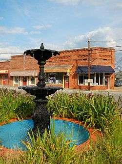
A fountain in Lanett | |
| Motto: "The Gateway to Alabama" | |
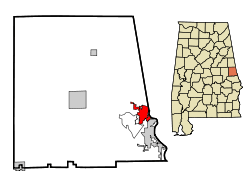 Location in Chambers County and the state of Alabama | |
| Coordinates: 32°51′48″N 85°11′59″W / 32.86333°N 85.19972°W | |
| Country | United States |
| State | Alabama |
| County | Chambers |
| Government | |
| • Type | Mayor – Council Form of Government |
| • Mayor | Kyle McCoy |
| Area | |
| • Total | 6.2 sq mi (16.1 km2) |
| • Land | 6.2 sq mi (16.1 km2) |
| • Water | 0 sq mi (0 km2) |
| Elevation | 591 ft (180 m) |
| Population (2010) | |
| • Total | 6,468 |
| • Density | 1,040/sq mi (401.5/km2) |
| Time zone | Eastern (UTC−5) |
| ZIP code | 36863 |
| Area code | 334 |
| FIPS code | 01-41296 |
| GNIS feature ID | 0151988 |
| Website |
www |
Lanett is a city in Chambers County, Alabama, United States. At the 2010 census the population was 6,468,[1] down from 7,897 in 2000. Lanett, originally called Bluffton, is located in eastern Alabama, on the Chattahoochee River, southwest of Atlanta. The city's name is derived from Lafayette Lanier and Theodore Bennett, founders of the West Point Manufacturing Company.
Geography
Lanett is located on the eastern edge of Chambers County at 32°51'48.326" North, 85°11'58.862" West (32.863424, -85.199684).[2] Its eastern boundary is the Alabama–Georgia state line, with the town of West Point, Georgia, bordering Lanett to the east. Interstate 85 forms the southeast boundary of Lanett, with the city of Valley, Alabama, on the other side of the highway. The unincorporated community of Huguley is along Lanett's southwest border.
The Chattahoochee River forms the state line and eastern boundary of Lanett from I-85 north to the downtown area, at which point the state line turns north-northwest and becomes a land boundary between Lanett and West Point, Georgia.
According to the U.S. Census Bureau, Lanett has a total area of 6.2 square miles (16.1 km2), all land.[1]
Demographics
| Historical population | |||
|---|---|---|---|
| Census | Pop. | %± | |
| 1880 | 655 | — | |
| 1890 | 777 | 18.6% | |
| 1900 | 2,909 | 274.4% | |
| 1910 | 3,820 | 31.3% | |
| 1920 | 4,976 | 30.3% | |
| 1930 | 5,204 | 4.6% | |
| 1940 | 6,141 | 18.0% | |
| 1950 | 7,434 | 21.1% | |
| 1960 | 7,674 | 3.2% | |
| 1970 | 6,908 | −10.0% | |
| 1980 | 8,922 | 29.2% | |
| 1990 | 8,985 | 0.7% | |
| 2000 | 7,897 | −12.1% | |
| 2010 | 6,468 | −18.1% | |
| Est. 2015 | 6,452 | [3] | −0.2% |
| U.S. Decennial Census[4] 2013 Estimate[5] | |||
.JPG)

As of the census[6] of 2010, there were 6,468 people, 2,723 households, and 1,746 families residing in the city. The population density was 1,040 people per square mile (401.5/km²). There were 3,338 housing units at an average density of 538 per square mile (207/km²). The racial makeup of the city was 57.5% Black or African American, 39.3% White, 0.2% Native American, 0.1% Asian, 1.4% from other races, and 1.5% from two or more races. 2.4% of the population were Hispanic or Latino of any race.
There were 2,723 households out of which 23.2% had children under the age of 18 living with them, 32.6% were married couples living together, 25.4% had a female householder with no husband present, and 35.9% were non-families. 32.1% of all households were made up of individuals and 14.6% had someone living alone who was 65 years of age or older. The average household size was 2.34 and the average family size was 2.93.
In the city the age distribution of the population shows 22.3% under the age of 18, 8.8% from 18 to 24, 22.6% from 25 to 44, 28.0% from 45 to 64, and 18.3% who were 65 years of age or older. The median age was 41.8 years. For every 100 females there were 85.1 males. For every 100 females age 18 and over, there were 87.4 males.
The median income for a household in the city was $25,220, and the median income for a family was $27,487. Males had a median income of $32,386 versus $24,794 for females. The per capita income for the city was $14,178. About 22.7% of families and 28.7% of the population were below the poverty line, including 48.0% of those under age 18 and 16.8% of those age 65 or over.
Notable people
- Linton Lomas Barrett, influential educator, administrator, diplomat, editor, Hispanist and translator of Romance languages
- Josh Cooper, professional football defensive end
- John Copeland, former Alabama Crimson Tide All-American who played on 1992 National Champs, NFL player for the Cincinnati Bengals
- Josh Evans, former University of Alabama at Birmingham Blazer and NFL player for the Houston Oilers, Tennessee Titans and New York Jets
- Millard Fuller, founder of Habitat for Humanity, born in nearby Cusseta, graduate of Lanett High School
- Fred Hatfield, former Major League Baseball player
- Hal Herring, former Auburn University and professional football player. He served as the defensive coordinator for Auburn from 1953 to 1965.
- Dave Hill, former Auburn offensive lineman who played for Kansas City Chiefs in first Super Bowl
- Bobby Hunt, former Auburn University and Kansas City Chiefs defensive back who played in the first Super Bowl
- Fob James, 48th governor of Alabama, born here
- Jimmy Johnson, comic strip cartoonist who writes and draws Arlo and Janis
- Walt Landers, former NFL running back
- Jesse Francis McClendon, chemist, zoologist and physiologist, made the first pH measurement of human stomach in situ
- Marcus Pollard, Director of Player Development for the Jacksonville Jaguars
- John Levi Sheppard, U.S. Representative for the Fourth Congressional District of Texas from 1899 to 1902. Listed as being born in Bluffton.[7]
- Dick Wood, former Auburn quarterback, starting quarterback for the New York Titans in (AFL) in 1963. Served many years as assistant coach in the NFL including offensive coordinator for the Cleveland Browns.
References
- 1 2 "Geographic Identifiers: 2010 Demographic Profile Data (G001): Lanett city, Alabama". U.S. Census Bureau, American Factfinder. Retrieved June 3, 2014.
- ↑ "US Gazetteer files: 2010, 2000, and 1990". United States Census Bureau. 2011-02-12. Retrieved 2011-04-23.
- ↑ "Annual Estimates of the Resident Population for Incorporated Places: April 1, 2010 to July 1, 2015". Retrieved July 2, 2016.
- ↑ "U.S. Decennial Census". Census.gov. Retrieved June 6, 2013.
- ↑ "Annual Estimates of the Resident Population: April 1, 2010 to July 1, 2013". Retrieved June 3, 2014.
- ↑ "American FactFinder". United States Census Bureau. Retrieved 2015-07-10.
- ↑ "SHEPPARD, John Levi – Biographical Information". Bioguide.congress.gov. Retrieved 2014-07-18.
External links
Coordinates: 32°51′48″N 85°11′59″W / 32.863424°N 85.199684°W
Municipalities and communities of Chambers County, Alabama, United States | ||
|---|---|---|
| Cities |  | |
| Towns | ||
| CDPs | ||
| Unincorporated communities | ||
| Ghost town | ||
| Footnotes | ‡This populated place also has portions in an adjacent county or counties | |