Chambers County, Alabama
| Chambers County, Alabama | |
|---|---|
.JPG) County Courthouse in Lafayette in 2012 | |
 Location in the U.S. state of Alabama | |
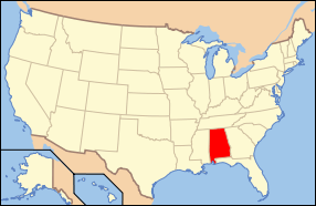 Alabama's location in the U.S. | |
| Founded | December 18, 1832 |
| Named for | Henry H. Chambers |
| Seat | Lafayette |
| Largest city | Valley |
| Area | |
| • Total | 603 sq mi (1,562 km2) |
| • Land | 597 sq mi (1,546 km2) |
| • Water | 6.6 sq mi (17 km2), 1.1% |
| Population (est.) | |
| • (2015) | 34,123 |
| • Density | 57/sq mi (22/km²) |
| Congressional district | 3rd |
| Time zone | Central: UTC-6/-5 |
| Website |
www |
|
Footnotes:
| |
Chambers County is a county of the U.S. state of Alabama. As of the 2010 census the population was 34,215.[1] Its county seat is Lafayette. Its name is in honor of Henry H. Chambers,[2] who served as a United States Senator from Alabama.
Chambers County is included in the Valley, AL Micropolitan Statistical Area and the Columbus-Auburn-Opelika, GA-AL Combined Statistical Area.[3]
History
Prior to contact with people of European descent, what is now Chambers County was inhabited by the Creek nation.[4]
Chambers County was established on December 18, 1832.
Pat Garrett, the lawman famed for killing outlaw Billy the Kid, was born near the town of Cusseta in 1850.
Joe Louis "The Brown Bomber", renowned heavyweight boxing champion, was born near LaFayette, on Buckalew Mountain, May 13, 1914.
Chambers County joined the four mill cities to make The Valley (which is now the largest city). Valley is rapidly increasing in size and located between Montgomery, Alabama and Atlanta, Georgia.
Geography
According to the U.S. Census Bureau, the county has a total area of 603 square miles (1,560 km2), of which 597 square miles (1,550 km2) is land and 6.6 square miles (17 km2) (1.1%) is water.[5]
Major highways
.svg.png) Interstate 85
Interstate 85 U.S. Highway 29
 U.S. Highway 280
 U.S. Highway 431
 State Route 50
 State Route 77
 State Route 147
Adjacent counties
- Randolph County (north)
- Troup County, Georgia (east/EST Border)
- Harris County, Georgia (southeast/EST Border)
- Lee County (south)
- Tallapoosa County (west)
Demographics
| Historical population | |||
|---|---|---|---|
| Census | Pop. | %± | |
| 1840 | 17,333 | — | |
| 1850 | 23,960 | 38.2% | |
| 1860 | 23,214 | −3.1% | |
| 1870 | 17,562 | −24.3% | |
| 1880 | 23,440 | 33.5% | |
| 1890 | 26,319 | 12.3% | |
| 1900 | 32,554 | 23.7% | |
| 1910 | 36,056 | 10.8% | |
| 1920 | 41,201 | 14.3% | |
| 1930 | 39,313 | −4.6% | |
| 1940 | 42,146 | 7.2% | |
| 1950 | 39,528 | −6.2% | |
| 1960 | 37,828 | −4.3% | |
| 1970 | 36,356 | −3.9% | |
| 1980 | 39,191 | 7.8% | |
| 1990 | 36,876 | −5.9% | |
| 2000 | 36,583 | −0.8% | |
| 2010 | 34,215 | −6.5% | |
| Est. 2015 | 34,123 | [6] | −0.3% |
| U.S. Decennial Census[7] 1790–1960[8] 1900–1990[9] 1990–2000[10] 2010–2015[1] | |||
2010
As of the census[11] of 2010, there were 34,215 people, 13,933 households, and 9,391 families residing in the county. The population density was 57 people per square mile (22/km2). There were 17,004 housing units at an average density of 28 per square mile (11/km2). The racial makeup of the county was 58.8% White (non-Hispanic), 38.7% Black or African American, 0.2% Native American, 0.5% Asian, 0.6% from other races, and 1.1% from two or more races. 1.6% of the population were Hispanic or Latino of any race.
There were 13,933 households out of which 24.6% had children under the age of 18 living with them,42.6% were married couples living together, 19.1% had a female householder with no husband present, and 32.6% were non-families. 29.1% of all households were made up of individuals and 12.3% had someone living alone who was 65 years of age or older. The average household size was 2.42 and the average family size was 2.97.
In the county the population was spread out with 22.5% under the age of 18, 8.1% from 18 to 24, 24.1% from 25 to 44, 28.7% from 45 to 64, and 16.7% who were 65 years of age or older. The median age was 41.5 years. For every 100 females there were 91.7 males. For every 100 females age 18 and over, there were 94.7 males.
The median income for a household in the county was $31,467, and the median income for a family was $39,475. Males had a median income of $34,176 versus $29,140 for females. The per capita income for the county was $16,626. About 16.4% of families and 20.3% of the population were below the poverty line, including 30.2% of those under age 18 and 15.7% of those age 65 or over.
2000
As of the census[12] of 2000, there were 36,583 people, 14,522 households, and 10,194 families residing in the county. The population density was 61 people per square mile (24/km2). There were 16,256 housing units at an average density of 27 per square mile (11/km2). The racial makeup of the county was 56.88% White (non-Hispanic), 43.11% Black or African American, 0.13% Native American, 0.19% Asian, 0.12% from other races, and 0.57% from two or more races. 3.7% of the population were Hispanic or Latino of any race.
There were 14,522 households out of which 29.30% had children under the age of 18 living with them, 48.50% were married couples living together, 17.40% had a female householder with no husband present, and 29.80% were non-families. 27.00% of all households were made up of individuals and 12.40% had someone living alone who was 65 years of age or older. The average household size was 2.48 and the average family size was 3.01.
In the county the population was spread out with 24.60% under the age of 18, 8.60% from 18 to 24, 27.00% from 25 to 44, 23.50% from 45 to 64, and 16.20% who were 65 years of age or older. The median age was 38 years. For every 100 females there were 89.60 males. For every 100 females age 18 and over, there were 85.30 males.
The median income for a household in the county was $29,667, and the median income for a family was $36,598. Males had a median income of $28,771 versus $21,159 for females. The per capita income for the county was $15,147. About 14.30% of families and 17.00% of the population were below the poverty line, including 22.50% of those under age 18 and 18.20% of those age 65 or over.
Government
| Year | GOP | DNC | Others |
|---|---|---|---|
| 2016 | 56.4% 7,803 | 41.6% 5,763 | 2.0% 273 |
| 2012 | 52.2% 7,596 | 47.2% 6,853 | 0.8% 113 |
| 2008 | 53.9% 8,067 | 45.5% 6,799 | 0.6% 90 |
| 2004 | 58.5% 7,622 | 41.0% 5,347 | 0.5% 63 |
| 2000 | 51.0% 6,037 | 47.5% 5,616 | 1.5% 181 |
Communities
Cities
Towns
- Waverly (Part of Waverly is in Lee County)
- Five Points
Census-designated places
Unincorporated communities
Ghost town
In popular culture
Chambers County has been the back drop of several movies including Mississippi Burning.
See also
- National Register of Historic Places listings in Chambers County, Alabama
- Properties on the Alabama Register of Landmarks and Heritage in Chambers County, Alabama
References
- 1 2 "State & County QuickFacts". United States Census Bureau. Retrieved May 15, 2014.
- ↑ Gannett, Henry (1905). The Origin of Certain Place Names in the United States. Govt. Print. Off. p. 74.
- ↑ OMB BULLETIN NO. 13-01: Revised Delineations of Metropolitan Statistical Areas, Micropolitan Statistical Areas, and Combined Statistical Areas, and Guidance on Uses of the Delineations of These Areas. Office of Management and Budget. February 28, 2013.
- ↑ The Reason for the Tears: A History of Chambers County, Alabama, 1832-1900 page 2
- ↑ "2010 Census Gazetteer Files". United States Census Bureau. August 22, 2012. Retrieved August 22, 2015.
- ↑ "County Totals Dataset: Population, Population Change and Estimated Components of Population Change: April 1, 2010 to July 1, 2015". Retrieved July 2, 2016.
- ↑ "U.S. Decennial Census". United States Census Bureau. Archived from the original on May 11, 2015. Retrieved August 22, 2015.
- ↑ "Historical Census Browser". University of Virginia Library. Retrieved August 22, 2015.
- ↑ Forstall, Richard L., ed. (March 24, 1995). "Population of Counties by Decennial Census: 1900 to 1990". United States Census Bureau. Retrieved August 22, 2015.
- ↑ "Census 2000 PHC-T-4. Ranking Tables for Counties: 1990 and 2000" (PDF). United States Census Bureau. April 2, 2001. Retrieved August 22, 2015.
- ↑ "American FactFinder". United States Census Bureau. Archived from the original on 2013-09-11. Retrieved 2015-07-10.
- ↑ "American FactFinder". United States Census Bureau. Archived from the original on 2013-09-11. Retrieved 2011-05-14.
- ↑ "Dave Leip's Atlas of U.S. Presidential Elections". Retrieved November 16, 2016.
External links
 |
Randolph County | | ||
| Tallapoosa County | |
Troup County, Georgia | ||
| ||||
| | ||||
| Lee County | Harris County, Georgia |
Municipalities and communities of Chambers County, Alabama, United States | ||
|---|---|---|
| Cities | | |
| Towns | ||
| CDPs | ||
| Unincorporated communities | ||
| Ghost town | ||
| Footnotes | ‡This populated place also has portions in an adjacent county or counties | |
| Central cities/Largest cities |  Location of the Columbus, Georgia-Auburn, Alabama CSA and its counties:
Columbus, Georgia Metropolitan Statistical Area
Auburn, Alabama Metropolitan Statistical Area
Tuskegee, Alabama Micropolitan Statistical Area (defunct) | |
|---|---|---|
| Cities in Georgia | ||
| Cities in Alabama | ||
| Counties in Georgia | ||
| Counties in Alabama | ||
Coordinates: 32°54′40″N 85°23′38″W / 32.91111°N 85.39389°W