Laurel Hill, Virginia
| Laurel Hill, Virginia | |
|---|---|
| Census-designated place | |
|
Laurel Hill house, 2009 | |
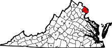
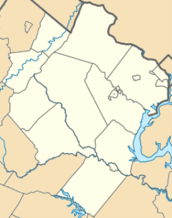 Laurel Hill  Laurel Hill  Laurel Hill Location within Fairfax county | |
| Coordinates: 38°42′50″N 77°14′56″W / 38.71389°N 77.24889°WCoordinates: 38°42′50″N 77°14′56″W / 38.71389°N 77.24889°W | |
| Country | United States |
| State | Virginia |
| County | Fairfax |
| Area | |
| • Total | 4.53 sq mi (11.73 km2) |
| • Land | 4.46 sq mi (11.55 km2) |
| • Water | 0.07 sq mi (0.18 km2) |
| Elevation | 220 ft (70 m) |
| Population (2010) | |
| • Total | 6,855 |
| • Density | 1,537/sq mi (593.5/km2) |
| Time zone | Eastern (EST) (UTC-5) |
| • Summer (DST) | EDT (UTC-4) |
| ZIP code | 22079 |
| FIPS code | 51-44430 |
| GNIS feature ID | 2585798 |

Laurel Hill is a census-designated place in Fairfax County, Virginia, United States. The population as of the 2010 census was 6,855.[1] Formerly part of the Lorton CDP, it comprises most of what was formerly the Lorton Reformatory grounds, which were purchased by Fairfax County in 2002 following the prison's closing and redeveloped as a new suburban community. The name "Laurel Hill" was adopted from Laurel Hill House, an 18th-century structure which had served as the residence of the Superintendent of the Reformatory, and originally was the home of Revolutionary War patriot William Lindsay.[2]
Geography
Laurel Hill is in southern Fairfax County and is bordered to the northwest by Crosspointe, to the north by Newington Forest, to the east by Lorton, and to the south by Prince William County. Via Interstate 95 and Interstate 395 it is 19 miles (31 km) northeast to Washington, D.C.
According to the U.S. Census Bureau, the Laurel Hill CDP has a total area of 4.5 square miles (11.7 km2), of which 4.46 square miles (11.55 km2) is land and 0.069 square miles (0.18 km2), or 1.51%, is water.[1]
References
- 1 2 "Geographic Identifiers: 2010 Demographic Profile Data (G001): Laurel Hill CDP, Virginia". U.S. Census Bureau, American Factfinder. Retrieved October 12, 2016.
- ↑ Laurel Hill History Accessed 2011-06-11.