Hybla Valley, Virginia
| Hybla Valley, Virginia | |
|---|---|
| Census-designated place | |
|
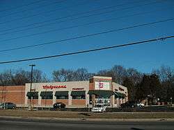
Commercial area along Route 1 in Hybla Valley | |
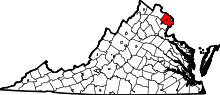
 Location of Hybla Valley in Fairfax County, Virginia | |
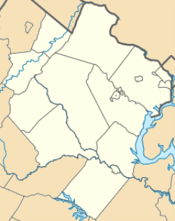 Hybla Valley, Virginia  Hybla Valley, Virginia  Hybla Valley, Virginia Location of Hybla Valley in Fairfax County, Virginia | |
| Coordinates: 38°44′49″N 77°4′37″W / 38.74694°N 77.07694°WCoordinates: 38°44′49″N 77°4′37″W / 38.74694°N 77.07694°W | |
| Country | United States |
| State | Virginia |
| County | Fairfax |
| Area | |
| • Total | 2.0 sq mi (5.3 km2) |
| • Land | 2.0 sq mi (5.3 km2) |
| • Water | 0.0 sq mi (0.0 km2) |
| Elevation | 33 ft (10 m) |
| Population (2010) | |
| • Total | 15,801 |
| • Density | 7,687/sq mi (2,968.0/km2) |
| Time zone | Eastern (EST) (UTC-5) |
| • Summer (DST) | EDT (UTC-4) |
| FIPS code | 51-39304[1] |
| GNIS feature ID | 1495737[2] |
Hybla Valley is a census-designated place (CDP) in Fairfax County, Virginia, United States, south of Alexandria. The population was 15,801 at the 2010 census,[3] down from 16,721 in 2000 due to a reduction in area, resulting from some of the eastward neighborhoods including much of Hollin Hills being moved to the Fort Hunt CDP.[1]
History
.jpg)
The Mason family's Hollin Hall plantation, just south of Alexandria, had become the property of several owners, including Edward Curtis Gibbs and the Wilson family. Thomson Dairy had been founded on the land in the late 19th century, and lasted until Merle Thorpe purchased it in the early 20th century. The various dairy farms, such as Sherwood Farm, Hybla Valley Farm, and Popkins Farm were converted into suburban neighborhoods, while plans for the construction of the George Washington Air Junction and the Hybla Valley Airport began. The civilian airport was proposed to be the largest in the world, yet the land, which had once been dairy farm, was abandoned and is currently Huntley Meadows Park. During World War II, the famous Hollin Hills subdivision, to the east of U.S. Route 1 towards the Potomac River, was completed by designers Charles Goodman and Robert Davenport. Also during the war, the princess of Norway sought refuge from the conflict in Europe and wished to purchase the property of Hollin Hall; President Roosevelt personally inspected the land for her, yet his assistant, Thorpe, became its new owner in the end. The land surrounding it became a turkey farm, and was eventually bought by the Mount Vernon Unitarian Church. Gum Springs, a community first founded by a freed slave from George Washington's plantation, was established along what is now Route 1 (Richmond Highway). In 1978, the Mount Vernon Unitarian Church donated land within Hollin Hills to create the wealthy Mason Hill subdivision. Although still starkly different from the affluent section of the CDP, the west side of Hybla Valley has developed over the years, including the up-scale and modern Mount Vernon Plaza in 2002.
Geography
Hybla Valley is located in southeastern Fairfax County at 38°44′49″N 77°04′37″W / 38.746864°N 77.076964°W (38.746864, −77.076964).[4] According to the United States Census Bureau, the CDP has a total area of 2.0 square miles (5.3 km2), all of it land.[3] It is bordered by Fort Hunt to the east, Mount Vernon and Woodlawn to the southwest, and Groveton to the west and north. Huntley Meadows Park is to the west within the Groveton CDP, and Little Hunting Creek separates Hybla Valley from Mount Vernon and Woodlawn.
It is characterized by rolling hills, parks, forest, and streams. Paul Springs Valley Stream Park winds past the eastern edge of the community.
Demographics
| Historical population | |||
|---|---|---|---|
| Census | Pop. | %± | |
| 1980 | 15,533 | — | |
| 1990 | 15,491 | −0.3% | |
| 2000 | 16,721 | 7.9% | |
| 2010 | 15,801 | −5.5% | |
| source:[5] | |||
As of the census[1] of 2000, there were 16,721 people, 6,362 households, and 4,211 families residing in the CDP. The population density was 5,481.7 people per square mile (2,116.7/km2). There were 6,515 housing units at an average density of 2,135.8/sq mi (824.7/km2). The racial makeup of the CDP was 49.98% White, 28.53% African American, 0.58% Native American, 8.01% Asian, 0.06% Pacific Islander, 9.07% from other races, and 3.77% from two or more races. Hispanic or Latino of any race were 19.22% of the population.
There were 6,362 households out of which 33.3% had children under the age of 18 living with them, 44.8% were married couples living together, 16.6% had a female householder with no husband present, and 33.8% were non-families. 27.4% of all households were made up of individuals and 7.1% had someone living alone who was 65 years of age or older. The average household size was 2.61 and the average family size was 3.18.
In the CDP the population was spread out with 26.2% under the age of 18, 8.9% from 18 to 24, 33.0% from 25 to 44, 21.5% from 45 to 64, and 10.4% who were 65 years of age or older. The median age was 34 years. For every 100 females there were 93.1 males. For every 100 females age 18 and over, there were 90.2 males.
As of 2008, census estimates have claimed that the median income for a household in the CDP was $97,378 [6] and the per capita income was $32,486.[7]
According to U.S. News, Hybla Valley has a high cost of living and an elevated price of homes in regards to the rest of the nation. Relative to the rest of the United States, crime in Hybla Valley is categorized as low, and the median income is categorized as average.
Education
Fairfax County Public Schools operates public schools.
Fairfax County Public Library operates the Sherwood Regional Library in the CDP.[8][9]
References
- 1 2 3 "American FactFinder". United States Census Bureau. Archived from the original on September 11, 2013. Retrieved 2008-01-31.
- ↑ "US Board on Geographic Names". United States Geological Survey. 2007-10-25. Retrieved 2008-01-31.
- 1 2 "Geographic Identifiers: 2010 Demographic Profile Data (G001): Hybla Valley CDP, Virginia". U.S. Census Bureau, American Factfinder. Retrieved October 6, 2016.
- ↑ "US Gazetteer files: 2010, 2000, and 1990". United States Census Bureau. 2011-02-12. Retrieved 2011-04-23.
- ↑ "CENSUS OF POPULATION AND HOUSING (1790–2000)". U.S. Census Bureau. Retrieved 2010-07-17.
- ↑ "City-Data.com – Stats about all US cities – real estate, relocation info, crime, house prices, cost of living, races, home value estimator, recent sales, income, photos, schools, maps, weather, neighborhoods, and more". city-data.com. Retrieved 25 June 2015.
- ↑ http://www.usnews.com/money/best-places/listing/virginia/hybla_valley
- ↑ "Library Branches." Fairfax County Public Library. Retrieved on October 21, 2009.
- ↑ "Hybla Valley CDP, Virginia." U.S. Census Bureau. Retrieved on October 21, 2009.