Leeuwarderadeel
| Leeuwarderadeel Ljouwerteradiel | |||
|---|---|---|---|
| Municipality | |||
|
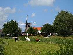
Wind mill in Leeuwarderadeel | |||
| |||
.svg.png) Location in Friesland | |||
| Coordinates: 53°16′N 5°46′E / 53.267°N 5.767°ECoordinates: 53°16′N 5°46′E / 53.267°N 5.767°E | |||
| Country | Netherlands | ||
| Province | Friesland | ||
| Government[1] | |||
| • Body | Municipal council | ||
| • Mayor | Joop Boertjens (VVD) | ||
| Area[2] | |||
| • Total | 41.46 km2 (16.01 sq mi) | ||
| • Land | 40.91 km2 (15.80 sq mi) | ||
| • Water | 0.55 km2 (0.21 sq mi) | ||
| Elevation[3] | 1 m (3 ft) | ||
| Population (May 2014)[4] | |||
| • Total | 10,264 | ||
| • Density | 251/km2 (650/sq mi) | ||
| Time zone | CET (UTC+1) | ||
| • Summer (DST) | CEST (UTC+2) | ||
| Postcode | 9050–9057 9071–9072 | ||
| Area code | 0518, 058 | ||
| Website |
www | ||

Leeuwarderadeel (![]() pronunciation , West Frisian: Ljouwerteradiel) is a municipality in the northern Netherlands. Its capital is Stiens.
pronunciation , West Frisian: Ljouwerteradiel) is a municipality in the northern Netherlands. Its capital is Stiens.
Population centres
Topography
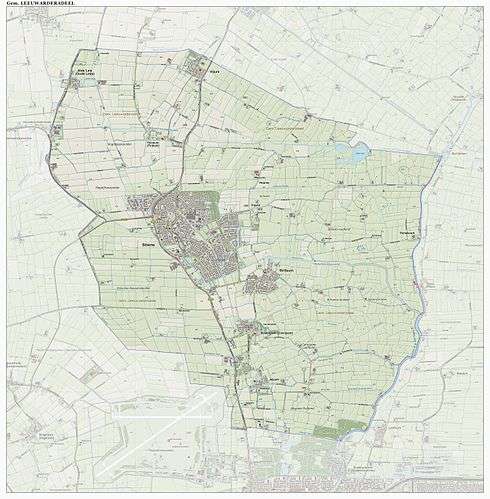
Dutch Topographic map of the municipality of Leeuwarderadeel, June 2015.
Bartlehiem
The hamlet of Bartlehiem is partially in Leeuwarderadeel partially in Ferwerderadiel and partially in Tytsjerksteradiel.
References
- ↑ "Burgemeester J.R.A. Boertjens" [Mayor J.R.A. Boertjens] (in Dutch). Gemeente Leeuwarderadeel. Retrieved 19 September 2013.
- ↑ "Kerncijfers wijken en buurten" [Key figures for neighbourhoods]. CBS Statline (in Dutch). CBS. 2 July 2013. Retrieved 12 March 2014.
- ↑ "Postcodetool for 9051AR". Actueel Hoogtebestand Nederland (in Dutch). Het Waterschapshuis. Retrieved 19 September 2013.
- ↑ "Bevolkingsontwikkeling; regio per maand" [Population growth; regions per month]. CBS Statline (in Dutch). CBS. 26 June 2014. Retrieved 24 July 2014.
External links
-
 Media related to Leeuwarderadeel at Wikimedia Commons
 - Official website
 |
Ferwerderadiel | | ||
| Het Bildt | |
Tytsjerksteradiel | ||
| ||||
| | ||||
| Menameradiel | Leeuwarden |

This article is issued from Wikipedia - version of the 2/9/2016. The text is available under the Creative Commons Attribution/Share Alike but additional terms may apply for the media files.