Menameradiel
| Menameradiel Menaldumadeel | |||
|---|---|---|---|
| Municipality | |||
|
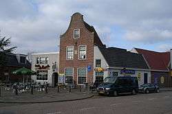
Town square in Berlikum | |||
| |||
.svg.png) Location in Friesland | |||
| Coordinates: 53°13′N 5°40′E / 53.217°N 5.667°ECoordinates: 53°13′N 5°40′E / 53.217°N 5.667°E | |||
| Country | Netherlands | ||
| Province | Friesland | ||
| Government[1] | |||
| • Body | Municipal council | ||
| • Mayor | Tom van Mourik (VVD) | ||
| Area[2] | |||
| • Total | 70.03 km2 (27.04 sq mi) | ||
| • Land | 68.87 km2 (26.59 sq mi) | ||
| • Water | 1.16 km2 (0.45 sq mi) | ||
| Elevation[3] | 1 m (3 ft) | ||
| Population (May 2014)[4] | |||
| • Total | 13,614 | ||
| • Density | 198/km2 (510/sq mi) | ||
| Time zone | CET (UTC+1) | ||
| • Summer (DST) | CEST (UTC+2) | ||
| Postcode | 8816, 9030–9045 | ||
| Area code | 0517, 0518, 058 | ||
| Website |
www | ||


Menameradiel (![]() pronunciation ) (Dutch: Menaldumadeel) is a municipality in Friesland, the Netherlands.
pronunciation ) (Dutch: Menaldumadeel) is a municipality in Friesland, the Netherlands.
Population centres
Population centres with population as of 1 January 2007:
- Beetgum (754)
- Beetgumermolen (944)
- Berlikum (2,492)
- Blessum (92)
- Boksum (449)
- Deinum (1,071)
- Dronryp (3,427)
- Engelum (415)
- Kleaster-Anjum (50)
- Marssum (1,156)
- Menaam (2,612)
- Schingen (108)
- Slappeterp (80)
- Wier (207).
Topography
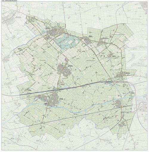
Dutch Topographic map of the municipality of Menaldumadeel, June 2015
References
- ↑ "Burgemeester T. van Mourik" [Mayor T. van Mourik] (in Dutch). Gemeente Menameradiel. Retrieved 22 September 2013.
- ↑ "Kerncijfers wijken en buurten" [Key figures for neighbourhoods]. CBS Statline (in Dutch). CBS. 2 July 2013. Retrieved 12 March 2014.
- ↑ "Postcodetool for 9036MS". Actueel Hoogtebestand Nederland (in Dutch). Het Waterschapshuis. Retrieved 22 September 2013.
- ↑ "Bevolkingsontwikkeling; regio per maand" [Population growth; regions per month]. CBS Statline (in Dutch). CBS. 26 June 2014. Retrieved 24 July 2014.
External links
![]() Media related to Menameradiel at Wikimedia Commons
Media related to Menameradiel at Wikimedia Commons
 |
Het Bildt | Leeuwarderadeel | | |
| Franekeradeel | |
Leeuwarden | ||
| ||||
| | ||||
| Littenseradiel |

This article is issued from Wikipedia - version of the 2/8/2016. The text is available under the Creative Commons Attribution/Share Alike but additional terms may apply for the media files.