Tytsjerksteradiel
| Tytsjerksteradiel Tietjerksteradeel | |||
|---|---|---|---|
| Municipality | |||
|
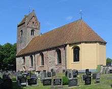
Thirteenth century church in Jistrum | |||
| |||
.svg.png) Location in Friesland | |||
| Coordinates: 53°12′N 6°0′E / 53.200°N 6.000°ECoordinates: 53°12′N 6°0′E / 53.200°N 6.000°E | |||
| Country | Netherlands | ||
| Province | Friesland | ||
| Government[1] | |||
| • Body | Municipal council | ||
| • Mayor | Eric ter Keurs (VVD) | ||
| Area[2] | |||
| • Total | 161.41 km2 (62.32 sq mi) | ||
| • Land | 149.44 km2 (57.70 sq mi) | ||
| • Water | 11.97 km2 (4.62 sq mi) | ||
| Elevation[3] | 1 m (3 ft) | ||
| Population (May 2014)[4] | |||
| • Total | 31,940 | ||
| • Density | 214/km2 (550/sq mi) | ||
| Time zone | CET (UTC+1) | ||
| • Summer (DST) | CEST (UTC+2) | ||
| Postcode | Parts of 9000 range | ||
| Area code | 0511, 0512, 058 | ||
| Website |
www | ||


Tytsjerksteradiel (Dutch: Tietjerksteradeel) is a municipality in the province of Friesland in the Netherlands. It is named after the town of Tytsjerk, whose name is derived from a person named Tiete. Tiete was a daughter of Tryn, after whom the region (Trynwâlden) is named. The other villages in Trynwâlden are also named after Tryn's children: Oentsjerk (Oene), Gytsjerk (Giete), Readtsjerk (Reade), Aldtsjerk (Âlde), Ryptsjerk (Rype). A statue of Tryn and her children is placed in Oentsjerk next to the mainroad (Rengerswei). Tsjerk is the West Frisian word for Church. Until 1989 the official name of the municipality was Tietjerksteradeel (![]() pronunciation ), the Dutch name; the current official name is West Frisian. The largest village in the municipality is Burgum.
pronunciation ), the Dutch name; the current official name is West Frisian. The largest village in the municipality is Burgum.
Population centers
The administrative centre and larged village in the municipality is Burgum.
| Official name | Dutch name | Population (1-1-2014) |
|---|---|---|
| Aldtsjerk | Oudkerk | 656 |
| Bartlehiem (partially) | Bartlehiem | c. 70 |
| Burgum | Bergum | 9990 |
| Earnewâld | Eernewoude | 391 |
| Eastermar | Oostermeer | 1586 |
| Garyp | Garijp | 1916 |
| Gytsjerk | Giekerk | 2344 |
| Hurdegaryp | Hardegarijp | 4828 |
| Jistrum | Eestrum | 945 |
| Mûnein | Moleneind | 689 |
| Noardburgum | Noordbergum | 2228 |
| Oentsjerk | Oenkerk | 1755 |
| Ryptsjerk | Rijperkerk | 786 |
| Sumar | Suameer | 1424 |
| Suwâld | Suawoude | 672 |
| Tytsjerk | Tietjerk | 1569 |
| Wyns | Wijns | 208 |
Hamlets
- Gytsjerksterhoeke (Giekerkerhoek)
- Iniaheide
- It Heechsân (Hoogzand)
- De Lytse Geast (Kleinegeest)
- Quatrebras
- Skûlenboarch (Schuilenburg)
- Sigerswâld (Siegerswoude)
- Sumarreheide (Suameerderheide)
- Feanwâldsterwâl (Veenwoudsterwal)
- It Wytfean (Witveen)
- Zwartewegsend (Zwartewegsend)
- Zevenhuizen
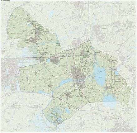
Dutch topographic map of the municipality of Tytsjerksteradiel, June 2015
Main sights
- Wyns, Aldtsjerk, Jistrum, Eastermar, Oentsjerk, Burgum and Gytsjerk are home to medieval churches
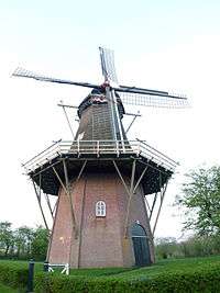
- The villages Aldtsjerk, Earnewâld, Ryptsjerk, Sumar, Tytsjerk (De Lytse Geast and De Himriksmole) and Wyns are home to mills.
- The Burgumer Lake
- The Museum for Folklore in Earnewâld
- The Skûtsje-Museum in Earnewâld
- The Heimatmuseum with an Observatory in Burgum.
Notable residents
Born:
- Henk Stallinga (b. 1962), industrial designer and artist
- Marjon Wijnsma (b. 1965), retired heptathlete.
Residents:
- Piet Bouman (1892–1980), amateur football (soccer) player
- Adriaen van Cronenburg (Ca. 1525–1604), Northern Netherlandish painter
References
- ↑ "Dhr. E.J. ter Keurs" [Mr. E.J. ter Keurs] (in Dutch). Gemeente Tytsjerksteradiel. Retrieved 30 September 2013.
- ↑ "Kerncijfers wijken en buurten" [Key figures for neighbourhoods]. CBS Statline (in Dutch). CBS. 2 July 2013. Retrieved 12 March 2014.
- ↑ "Postcodetool for 9251GH". Actueel Hoogtebestand Nederland (in Dutch). Het Waterschapshuis. Retrieved 30 September 2013.
- ↑ "Bevolkingsontwikkeling; regio per maand" [Population growth; regions per month]. CBS Statline (in Dutch). CBS. 26 June 2014. Retrieved 24 July 2014.
External links
 Media related to Tietjerksteradeel at Wikimedia Commons
- Official website
 |
Ferwerderadiel | Dantumadiel | | |
| Leeuwarderadeel Leeuwarden |
|
Achtkarspelen | ||
| ||||
| | ||||
| Smallingerland |
| Administrative Centre | 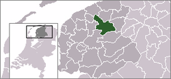 | |
|---|---|---|
| Villages | ||
| Hamlets | ||
| Landmarks | ||
| Lakes |
| |
