Leny (civil parish)
| Leny Léine | |
|---|---|
| Civil parish | |
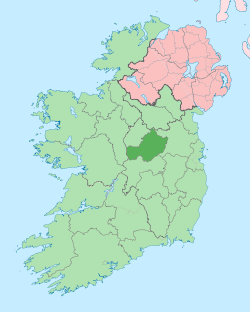
 Leny Location of Leny within County Westmeath in the Republic of Ireland | |
| Coordinates: 53°36′22″N 7°25′32″W / 53.60611°N 7.42556°WCoordinates: 53°36′22″N 7°25′32″W / 53.60611°N 7.42556°W | |
| Country |
|
| Province | Leinster |
| County | County Westmeath |
| Irish grid reference | N380619 |
Leny (Irish: Léine)[1] is a civil parish in County Westmeath, Ireland. It is located about 10.5 kilometres (7 mi) north–west of Mullingar. This name also applies to the townland of Leny; neither should be confused with the Falls of Leny in Scotland.
Leny is one of 8 civil parishes in the barony of Corkaree in the Province of Leinster. The civil parish covers 4,247.8 acres (17.190 km2).
Leny civil parish comprises 15 townlands: Ballinalack (village), Ballinalack, Ballynafid, Ballyvade, Clanhugh Demesne, Culleenabohoge, Culleendarragh, Cullenhugh, Farrow, Glebe, Kilpatrick, Knightswood, Leny, Rathaniska and Rathbennett.
The neighbouring civil parishes are: Russagh, Lackan and Multyfarnham to the north, Tyfarnham to the east, Portloman, Portnashangan and Templeoran to the south and Kilbixy (barony of Moygoish) and Rathaspick (Moygoish) to the west.[2][3]
References
- ↑ Leny civil parish Logainm.ie Retrieved on 10 June 2015.
- ↑ Leny civil parish, Co. Westmeath Townlands.ie Retrieved on 10 June 2015.
- ↑ Leny civil parish, Co. Westmeath The IreAtlas Townland Data Base Retrieved on 10 June 2015.
External links
- Leny civil parish at the IreAtlas Townland Data Base
- Leny civil parish at Townlands.ie
- Leny civil parish at Logainm.ie