Tyfarnham (civil parish)
| Tyfarnham Tigh Farannáin | |
|---|---|
| Civil parish | |
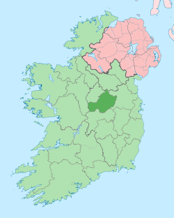
 Tyfarnham Location of Tyfarnham within County Westmeath in the Republic of Ireland | |
| Coordinates: 53°35′33″N 7°20′15″W / 53.59250°N 7.33750°WCoordinates: 53°35′33″N 7°20′15″W / 53.59250°N 7.33750°W | |
| Country |
|
| Province | Leinster |
| County | County Westmeath |
| Irish grid reference | N439605 |
Tyfarnham (Irish: Tigh Farannáin)[1] is a civil parish in County Westmeath, Ireland. It is located about 7.5 kilometres (5 mi) north of Mullingar.
Tyfarnham is one of 8 civil parishes in the barony of Corkaree in the Province of Leinster. The civil parish covers 1,847.2 acres (7.475 km2).
Tyfarnham civil parish comprises 11 townlands: Ballyedward, Ballynagall, Down, Garraree, Kilmaglish, Knockatee, Knockdrin, Lugnagullagh, Multyfarnham or Fearbranagh, Parsonstown and Tyfarnham. The major part of Tyfarnham is split into two parts by Stonehall civil parish but also has two isolated townlands south of Lough Owel, Ballyedward and Lugnagullah.
The neighbouring civil parishes are: Stonehall to the north, Taghmon to the east, Leny, Portnashangan and Rathconnell (barony of Moyashel and Magheradernon) to the south, and Multyfarnham to the west.[2][3]This excludes neighbours of Ballyedward and Lugnagullah.
References
- ↑ Tyfarnham civil parish Logainm.ie Retrieved on 14 June 2015.
- ↑ Tyfarnham civil parish, Co. Westmeath Townlands.ie Retrieved on 14 June 2015.
- ↑ Tyfarnham civil parish, Co. Westmeath The IreAtlas Townland Data Base Retrieved on 14 June 2015.
External links
- Tyfarnham civil parish at the IreAtlas Townland Data Base
- Tyfarnham civil parish at Townlands.ie
- Tyfarnham civil parish at Logainm.ie