Linamon, Lanao del Norte
| Linamon | |
|---|---|
| Municipality | |
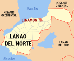 Map of Lanao del Norte with Linamon highlighted | |
.svg.png) Linamon Location within the Philippines | |
| Coordinates: 08°11′N 124°10′E / 8.183°N 124.167°ECoordinates: 08°11′N 124°10′E / 8.183°N 124.167°E | |
| Country | Philippines |
| Region | Northern Mindanao (Region X) |
| Province | Lanao del Norte |
| District | 1st district of Lanao del Norte |
| Founded | January 13, 1960 |
| Barangays | 8 |
| Government[1] | |
| • Mayor | Randy J. Macapil |
| • Vice-Mayor | Che Pestolante-Abundiente |
| Area[2] | |
| • Total | 76.38 km2 (29.49 sq mi) |
| Population (2010)[3] | |
| • Total | 17,484 |
| • Density | 230/km2 (590/sq mi) |
| Time zone | PST (UTC+8) |
| ZIP code | 9201 |
| Dialing code | +63 (0)63 |
| Income class | 5th |
Linamon is a fifth class municipality in the province of Lanao del Norte, Philippines. According to the 2010 census, it has a population of 17,484 people.[3]
Historically, Linamon was a barangay in Iligan City until it became a separate municipality on January 13, 1960.
Geography
Linamon is the Eastern Gateway to Lanao del Norte, located about 11.5 kilometres (7.1 mi) south-west of Iligan City. It is bounded in the east by the Linamon River, the Larapan River and the Municipality of Kauswagan in the west, Municipality of Matungao in the south and facing Iligan Bay in the north.
Barangays
Linamon is politically subdivided into 8 barangays.[2]
- Busque
- Larapan
- Magoong
- Napo
- Poblacion
- Purakan
- Robocon
- Samburon
Tourism
Linamon is a coastal town of Lanao del Norte, where five of its eight barangays are situated along the Iligan Bay area, and is considered as the “Beach Capital of Lanao del Norte”, with beaches spanning from Barangay Poblacion to Barangay Samburon that comprises 16 established beach resorts.
Demographics
| Population census of Linamon | ||
|---|---|---|
| Year | Pop. | ±% p.a. |
| 1990 | 50,100 | — |
| 1995 | 14,529 | −20.70% |
| 2000 | 14,959 | +0.63% |
| 2007 | 16,340 | +1.23% |
| 2010 | 17,484 | +2.49% |
| Source: National Statistics Office[3] | ||
References
- ↑ "Official City/Municipal 2013 Election Results". Intramuros, Manila, Philippines: Commission on Elections (COMELEC). 1 July 2013. Retrieved 5 September 2013.
- 1 2 "Province: LANAO DEL NORTE". PSGC Interactive. Makati City, Philippines: National Statistical Coordination Board. Retrieved 7 July 2014.
- 1 2 3 "Total Population by Province, City, Municipality and Barangay: as of May 1, 2010" (PDF). 2010 Census of Population and Housing. National Statistics Office. Retrieved 7 July 2014.
External links
- Philippine Standard Geographic Code
- Philippine Census Information
- Official website of Linamon, Lanao del Norte
- Local Governance Performance Management System
 |
Iligan Bay | | ||
| Kauswagan | |
Iligan City | ||
| ||||
| | ||||
| Poona Piagapo | Matungao |
Tubod (capital) | |
| Municipalities | |
| Highly urbanized city |
|