Sultan Naga Dimaporo, Lanao del Norte
| Sultan Naga Dimaporo | |
|---|---|
| Municipality | |
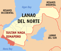 Map of Lanao del Norte with Sultan Naga Dimaporo highlighted | |
.svg.png) Sultan Naga Dimaporo Location within the Philippines | |
| Coordinates: 07°47′N 123°45′E / 7.783°N 123.750°ECoordinates: 07°47′N 123°45′E / 7.783°N 123.750°E | |
| Country | Philippines |
| Region | Northern Mindanao (Region X) |
| Province | Lanao del Norte |
| District | 2nd district of Lanao del Norte |
| Founded | April 10, 1953 |
| Barangays | 37 |
| Government[1] | |
| • Mayor | Ulwan M. Dimaporo |
| • Vice-Mayor | Motalib M. Dimaporo |
| Area[2] | |
| • Total | 230.99 km2 (89.19 sq mi) |
| Population (2010)[3] | |
| • Total | 52,430 |
| • Density | 230/km2 (590/sq mi) |
| Time zone | PST (UTC+8) |
| ZIP code | 9215 |
| Dialing code | +63 (0)63 |
| Income class | 5th |
Sultan Naga Dimaporo (formerly Karomatan) is a fifth class municipality in the province of Lanao del Norte, Philippines. According to the 2010 census, it has a population of 52,430 people.[3]
Geography
Sultan Naga Dimaporo or Karomatan is located at the south-western part of the province of Lanao del Norte. It is bordered on the southeast by the municipality of Picong in Lanao del Sur, and on the west by the municipalities of Tukuran and Aurora, both in Zamboanga del Sur. To the south is the tip of Illana Bay, part of the Celebes Sea.
Barangays
Sultan Naga Dimaporo is politically subdivided into 37 barangays.[2]
- Bangaan
- Bangko
- Bansarvil II
- Bauyan
- Cabongbongan
- Calibao
- Calipapa
- Calube
- Campo Islam
- Capocao
- Dableston
- Dalama
- Dangolaan
- Ditago
- Ilian
- Kauswagan
- Kirapan
- Koreo
- Lantawan
- Mabuhay
- Maguindanao
- Mahayahay
- Mamagum
- Mina
- Pandanan
- Payong
- Piraka
- Pikalawag
- Pikinit
- Poblacion
- Ramain
- Rebucon
- Sigayan
- Sugod
- Tagulo
- Tantaon
- Topocon
Demographics
| Population census of Sultan Naga Dimaporo | ||
|---|---|---|
| Year | Pop. | ±% p.a. |
| 1990 | 13,206 | — |
| 1995 | 36,131 | +20.75% |
| 2000 | 41,865 | +3.21% |
| 2007 | 46,004 | +1.31% |
| 2010 | 52,430 | +4.87% |
| Source: National Statistics Office[3] | ||
References
- ↑ "Official City/Municipal 2013 Election Results". Intramuros, Manila, Philippines: Commission on Elections (COMELEC). 1 July 2013. Retrieved 5 September 2013.
- 1 2 "Province: LANAO DEL NORTE". PSGC Interactive. Makati City, Philippines: National Statistical Coordination Board. Retrieved 7 July 2014.
- 1 2 3 "Total Population by Province, City, Municipality and Barangay: as of May 1, 2010" (PDF). 2010 Census of Population and Housing. National Statistics Office. Retrieved 7 July 2014.
External links
- Official site of Sultan Naga Dimaporo
- Philippine Standard Geographic Code
- Philippine Census Information
- Local Governance Performance Management System
 |
Aurora, Zamboanga del Sur | Kapatagan / Sapad | Nunungan | |
| Tukuran, Zamboanga del Sur | |
Picong, Lanao del Sur | ||
| ||||
| | ||||
| Illana Bay |
Tubod (capital) | |
| Municipalities | |
| Highly urbanized city |
|
This article is issued from Wikipedia - version of the 11/1/2016. The text is available under the Creative Commons Attribution/Share Alike but additional terms may apply for the media files.