Lincoln Township, Hendricks County, Indiana
| Lincoln Township | |
|---|---|
| Township | |
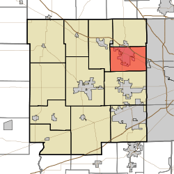 Location in Hendricks County | |
| Coordinates: 39°49′47″N 86°22′56″W / 39.82972°N 86.38222°WCoordinates: 39°49′47″N 86°22′56″W / 39.82972°N 86.38222°W | |
| Country | United States |
| State | Indiana |
| County | Hendricks |
| Government | |
| • Type | Indiana township |
| Area | |
| • Total | 23.91 sq mi (61.94 km2) |
| • Land | 23.82 sq mi (61.7 km2) |
| • Water | 0.09 sq mi (0.24 km2) 0.39% |
| Elevation | 879 ft (268 m) |
| Population (2010) | |
| • Total | 28,665 |
| • Density | 1,203.4/sq mi (464.6/km2) |
| GNIS feature ID | 0453570 |
Lincoln Township is one of twelve townships in Hendricks County, Indiana, United States. As of the 2010 census, its population was 28,665.[1]
History
Lincoln Township was organized in 1863.[2]
Geography
Lincoln Township covers an area of 23.91 square miles (61.9 km2); of this, 0.09 square miles (0.23 km2) or 0.39 percent is water. The streams of Bullard Creek, Hughes Branch and West Fork White Lick Creek run through this township.
Cities and towns
- Brownsburg (southeast three-quarters)
Unincorporated towns
- Clermont Heights
(This list is based on USGS data and may include former settlements.)
Adjacent townships
- Brown Township (north)
- Pike Township, Marion County (east)
- Wayne Township, Marion County (southeast)
- Washington Township (south)
- Middle Township (northwest)
Cemeteries
The township contains twelve cemeteries: Bell, Brown, Brownsburg, Greenlawn, Hoadley, Lingeman, McDaniels, Prebster, Saint Malachy East, Turpin, Walker and Ward (historical).
Major highways
Airports and landing strips
- Brownsburg Airport
References
- "Lincoln Township, Hendricks County, Indiana". Geographic Names Information System. United States Geological Survey. Retrieved 2009-09-24.
- United States Census Bureau cartographic boundary files
- ↑ United States Census Bureau American FactFinder
- ↑ Hadley, John Vestal (1914). History of Hendricks County, Indiana: Her People, Industries and Institutions. B.F. Bowen. p. 88.
External links
Municipalities and communities of Hendricks County, Indiana, United States | ||
|---|---|---|
| Towns | ||
| Townships | ||
| Unincorporated communities |
| |
| Footnotes | ‡This populated place also has portions in an adjacent county or counties | |
This article is issued from Wikipedia - version of the 10/28/2016. The text is available under the Creative Commons Attribution/Share Alike but additional terms may apply for the media files.