Guilford Township, Hendricks County, Indiana
| Guilford Township | |
|---|---|
| Township | |
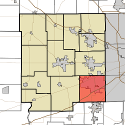 Location in Hendricks County | |
| Coordinates: 39°40′28″N 86°22′56″W / 39.67444°N 86.38222°WCoordinates: 39°40′28″N 86°22′56″W / 39.67444°N 86.38222°W | |
| Country | United States |
| State | Indiana |
| County | Hendricks |
| Government | |
| • Type | Indiana township |
| Area | |
| • Total | 35.93 sq mi (93.06 km2) |
| • Land | 35.8 sq mi (92.72 km2) |
| • Water | 0.13 sq mi (0.34 km2) 0.37% |
| Elevation | 725 ft (221 m) |
| Population (2010) | |
| • Total | 27,844 |
| • Density | 777.8/sq mi (300.3/km2) |
| GNIS feature ID | 0453358 |
Guilford Township is one of twelve townships in Hendricks County, Indiana, United States. As of the 2010 census, its population was 27,844.[1]
History
The Joel Jessup Farm, Noah and Hannah Hadley Kellum House, Kellum-Jessup-Chandler Farm, and Sugar Grove Meetinghouse and Cemetery are listed on the National Register of Historic Places.[2]
Geography
Guilford Township covers an area of 35.93 square miles (93.1 km2); of this, 0.13 square miles (0.34 km2) or 0.37 percent is water. The streams of Black Creek, Clarks Creek, Guilford Branch, Hendricks Creek, Leg Creek, Middle Creek, Moore Creek, Penns Run, Rail Run, Rock Creek, Rogers Creek and West Fork Hendricks Creek run through this township.
Cities and towns
- Plainfield (vast majority)
Unincorporated towns
(This list is based on USGS data and may include former settlements.)
Adjacent townships
- Washington Township (north)
- Wayne Township, Marion County (northeast)
- Decatur Township, Marion County (east)
- Madison Township, Morgan County (southeast)
- Brown Township, Morgan County (south)
- Monroe Township, Morgan County (southwest)
- Liberty Township (west)
Cemeteries
The township contains seven cemeteries: Fairfield Friends, Indiana Boys School, Lick Branch, Maple Hill, Ramsey, Sugar Grove and White Lick Friends.
Major highways
References
- "Guilford Township, Hendricks County, Indiana". Geographic Names Information System. United States Geological Survey. Retrieved 2009-09-24.
- United States Census Bureau cartographic boundary files
- ↑ United States Census Bureau American FactFinder
- ↑ National Park Service (2010-07-09). "National Register Information System". National Register of Historic Places. National Park Service.
External links
Municipalities and communities of Hendricks County, Indiana, United States | ||
|---|---|---|
| Towns | ||
| Townships | ||
| Unincorporated communities |
| |
| Footnotes | ‡This populated place also has portions in an adjacent county or counties | |