Meridian (geography)
A (geographical) meridian (or line of longitude) is the half of an imaginary great circle on the Earth's surface, terminated by the North Pole and the South Pole, connecting points of equal longitude. The position of a point along the meridian is given by its latitude nub how many degrees north or south of the Equator the point is. Each meridian is perpendicular to all circles of latitude. Each is also the same length, being half of a great circle on the Earth's surface and therefore measuring 20,003.93 km (12,429.9 miles).
Geographic
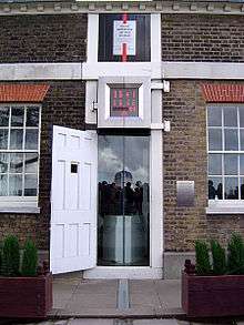
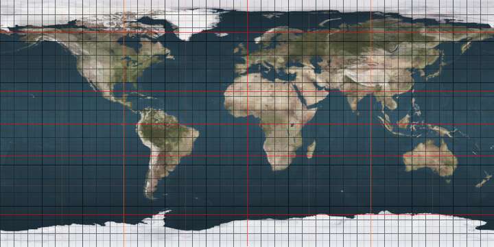
The meridian through Greenwich (inside Greenwich Park), England, also called the Prime Meridian, was set at zero degrees of longitude, while other meridians were defined by the angle at the center of the earth between where it and the prime meridian cross the equator. As there are 360 degrees in a circle, the meridian on the opposite side of the earth from Greenwich, the International Date Line forms the other half of a circle with the one through Greenwich, is 180° longitude. The meridians from West of Greenwich (0°) to the International Date Line (180°) define the Western Hemisphere and the meridians from East of Greenwich (0°) to the International Date Line (180°) define the Eastern Hemisphere. Most maps show the lines of longitude.
The position of the meridian has changed a few times throughout history, mainly due to the transit observatory being built next door to the previous one (to maintain the service to shipping). Such changes had no significant effect. Historically, the average error in the determination of longitude was much larger than the change in position. The adoption of WGS84 as the positioning system has moved the meridian 102.5 metres east of its last position (measured at Greenwich). The position of the current meridian is not identified at all in Greenwich but is located using a GPS receiver.
The term "meridian" comes from the Latin meridies, meaning "midday"; the sun crosses a given meridian midway between the times of sunrise and sunset on that meridian. The same Latin stem gives rise to the terms a.m. (ante meridiem) and p.m. (post meridiem) used to disambiguate hours of the day when utilizing the 12-hour clock.
Magnetic
The magnetic meridian is an equivalent imaginary line connecting the magnetic south and north poles and can be taken as the horizontal component of magnetic force lines along the surface of the earth.BB[1] Therefore, a compass needle will be parallel to the magnetic meridian. The angle between the magnetic and the true meridian is the magnetic declination, which is relevant for navigating with a compass.[2]
See also
- Meridian (astronomy)
- Meridian arc
- Prime meridian
- Principal meridian
- Public Land Survey System, United States
- Dominion Land Survey, Canada
References
- ↑ "Geomagnetism". met.gov.pk. Archived from the original on 22 June 2007. Retrieved 10 November 2008.
- ↑ "Magnetic meridian". Museo Galileo. Retrieved 12 September 2015.
External links
| Wikimedia Commons has media related to Longitudes. |
- The Principal Meridian Project (US)
- Note: This is a large file, approximately 46MB. Searchable PDF prepared by the author, C. A. White.
- Resources page of the U.S. Department of the Interior, Bureau of Land Management
 "Meridian". The New Student's Reference Work. 1914.
|