10th parallel north

10°
10th parallel north
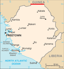
The 10th parallel north defines part of the border between Sierra Leone and Guinea.

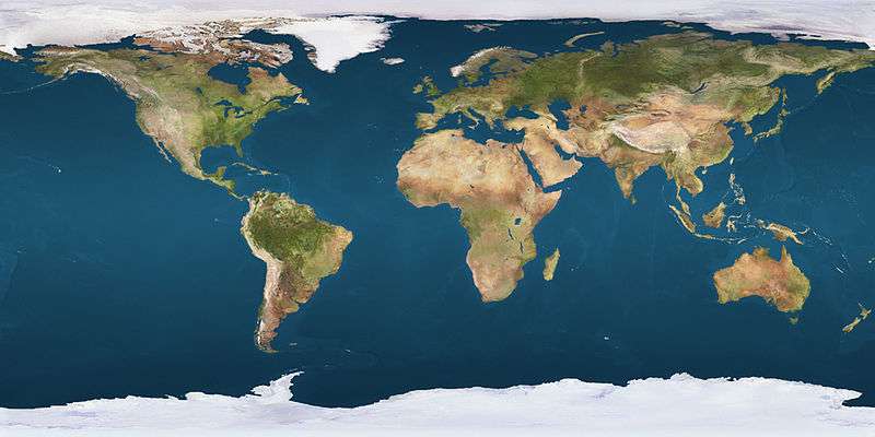
The 10th parallel north is a circle of latitude that is 10 degrees north of the Earth's equatorial plane. It crosses Africa, the Indian Ocean, the Indian Subcontinent, Southeast Asia, the Pacific Ocean, Central America, South America and the Atlantic Ocean.

At this latitude the sun is visible for 12 hours, 43 minutes during the summer solstice and 11 hours, 33 minutes during the winter solstice.[1]

A section of the border between Guinea and Sierra Leone is defined by the parallel.

The Ten Degree Channel in the Indian Ocean is named after the parallel.

Around the world

Starting at the Prime Meridian and heading eastwards, the parallel 10° north passes through:

Co-ordinates Country, territory or sea Notes
10°0′N 0°0′E / 10.000°N 0.000°E / 10.000; 0.000 (Prime Meridian)  Ghana
10°0′N 0°21′E / 10.000°N 0.350°E / 10.000; 0.350 (Togo)  Togo
10°0′N 1°21′E / 10.000°N 1.350°E / 10.000; 1.350 (Benin)  Benin
10°0′N 3°37′E / 10.000°N 3.617°E / 10.000; 3.617 (Nigeria)  Nigeria
10°0′N 13°15′E / 10.000°N 13.250°E / 10.000; 13.250 (Cameroon)  Cameroon
10°0′N 14°17′E / 10.000°N 14.283°E / 10.000; 14.283 (Chad)  Chad
10°0′N 14°32′E / 10.000°N 14.533°E / 10.000; 14.533 (Cameroon)  Cameroon
10°0′N 15°41′E / 10.000°N 15.683°E / 10.000; 15.683 (Chad)  Chad
10°0′N 21°23′E / 10.000°N 21.383°E / 10.000; 21.383 (Central African Republic)  Central African Republic
10°0′N 23°36′E / 10.000°N 23.600°E / 10.000; 23.600 (Sudan)  Sudan
10°0′N 25°0′E / 10.000°N 25.000°E / 10.000; 25.000 (South Sudan)  South Sudan
10°0′N 26°7′E / 10.000°N 26.117°E / 10.000; 26.117 (Sudan)  Sudan
10°0′N 27°50′E / 10.000°N 27.833°E / 10.000; 27.833 (Abyei) Abyei Area controlled by  Sudan, and claimed by  South Sudan
10°0′N 29°0′E / 10.000°N 29.000°E / 10.000; 29.000 (Sudan)  Sudan
10°0′N 29°32′E / 10.000°N 29.533°E / 10.000; 29.533 (South Sudan)  South Sudan
10°0′N 30°28′E / 10.000°N 30.467°E / 10.000; 30.467 (Sudan)  Sudan
10°0′N 31°30′E / 10.000°N 31.500°E / 10.000; 31.500 (South Sudan)  South Sudan
10°0′N 34°0′E / 10.000°N 34.000°E / 10.000; 34.000 (Sudan)  Sudan
10°0′N 34°13′E / 10.000°N 34.217°E / 10.000; 34.217 (Ethiopia)  Ethiopia
10°0′N 43°3′E / 10.000°N 43.050°E / 10.000; 43.050 (Somalia)  Somalia Passing through Somaliland
10°0′N 50°54′E / 10.000°N 50.900°E / 10.000; 50.900 (Indian Ocean) Indian Ocean Arabian Sea
Passing just south of the island of Kalpeni,  India
Laccadive Sea
10°0′N 76°13′E / 10.000°N 76.217°E / 10.000; 76.217 (India)  India Kerala — passing through Kochi
Tamil Nadu
10°0′N 79°13′E / 10.000°N 79.217°E / 10.000; 79.217 (Indian Ocean) Indian Ocean Bay of Bengal
Ten Degree Channel (between the Andaman and Nicobar Islands,  India)
Andaman Sea
10°0′N 98°10′E / 10.000°N 98.167°E / 10.000; 98.167 (Myanmar)  Myanmar (Burma) Island of Zadetkyi Kyun in the Mergui Archipelago
10°0′N 98°15′E / 10.000°N 98.250°E / 10.000; 98.250 (Indian Ocean) Indian Ocean Andaman Sea
10°0′N 98°32′E / 10.000°N 98.533°E / 10.000; 98.533 (Myanmar)  Myanmar (Burma) The southernmost tip of the Burmese mainland
10°0′N 98°35′E / 10.000°N 98.583°E / 10.000; 98.583 (Thailand)  Thailand
10°0′N 99°9′E / 10.000°N 99.150°E / 10.000; 99.150 (Gulf of Thailand) Gulf of Thailand Passing just south of the island of Ko Tao,  Thailand
Passing just south of the island of Phú Quốc,  Vietnam
10°0′N 105°5′E / 10.000°N 105.083°E / 10.000; 105.083 (Vietnam)  Vietnam
10°0′N 106°39′E / 10.000°N 106.650°E / 10.000; 106.650 (South China Sea) South China Sea Passing through the disputed Spratly Islands
10°0′N 118°38′E / 10.000°N 118.633°E / 10.000; 118.633 (Philippines)  Philippines Island of Palawan
10°0′N 119°0′E / 10.000°N 119.000°E / 10.000; 119.000 (Sulu Sea) Sulu Sea
10°0′N 122°42′E / 10.000°N 122.700°E / 10.000; 122.700 (Philippines)  Philippines Island of Negros
10°0′N 123°13′E / 10.000°N 123.217°E / 10.000; 123.217 (Tañon Strait) Tañon Strait
10°0′N 123°14′E / 10.000°N 123.233°E / 10.000; 123.233 (Philippines)  Philippines Island of Cebu
10°0′N 123°37′E / 10.000°N 123.617°E / 10.000; 123.617 (Cebu Strait) Cebu Strait
10°0′N 124°3′E / 10.000°N 124.050°E / 10.000; 124.050 (Philippines)  Philippines Island of Bohol
10°0′N 124°34′E / 10.000°N 124.567°E / 10.000; 124.567 (Bohol Sea) Bohol Sea Passing just south of the island of Leyte,  Philippines
10°0′N 125°12′E / 10.000°N 125.200°E / 10.000; 125.200 (Philippines)  Philippines Island of Panaon
10°0′N 125°17′E / 10.000°N 125.283°E / 10.000; 125.283 (Surigao Strait) Surigao Strait
10°0′N 125°30′E / 10.000°N 125.500°E / 10.000; 125.500 (Philippines)  Philippines Islands of Sibanac and Dinagat
10°0′N 125°40′E / 10.000°N 125.667°E / 10.000; 125.667 (Dinagat Sound) Dinagat Sound
10°0′N 126°2′E / 10.000°N 126.033°E / 10.000; 126.033 (Philippines)  Philippines Island of Siargao
10°0′N 126°5′E / 10.000°N 126.083°E / 10.000; 126.083 (Pacific Ocean) Pacific Ocean
10°0′N 139°37′E / 10.000°N 139.617°E / 10.000; 139.617 (Federated States of Micronesia)  Federated States of Micronesia Passing through Ulithi Atoll
10°0′N 139°48′E / 10.000°N 139.800°E / 10.000; 139.800 (Pacific Ocean) Pacific Ocean Passing just north of Ujelang Atoll,  Marshall Islands
Passing just south of Wotho Atoll,  Marshall Islands
10°0′N 169°1′E / 10.000°N 169.017°E / 10.000; 169.017 (Marshall Islands)  Marshall Islands Passing through Likiep Atoll
10°0′N 169°7′E / 10.000°N 169.117°E / 10.000; 169.117 (Pacific Ocean) Pacific Ocean
10°0′N 85°43′W / 10.000°N 85.717°W / 10.000; -85.717 (Costa Rica)  Costa Rica Passing through the Gulf of Nicoya
Passing just north of San José
10°0′N 83°2′W / 10.000°N 83.033°W / 10.000; -83.033 (Caribbean Sea) Caribbean Sea
10°0′N 75°34′W / 10.000°N 75.567°W / 10.000; -75.567 (Colombia)  Colombia
10°0′N 72°58′W / 10.000°N 72.967°W / 10.000; -72.967 (Venezuela)  Venezuela Passing through Lake Maracaibo
10°0′N 62°8′W / 10.000°N 62.133°W / 10.000; -62.133 (Atlantic Ocean) Atlantic Ocean Passing just south of the island of Trinidad,  Trinidad and Tobago
10°0′N 14°2′W / 10.000°N 14.033°W / 10.000; -14.033 (Guinea)  Guinea
10°0′N 11°53′W / 10.000°N 11.883°W / 10.000; -11.883 (Guinea / Sierra Leone border)  Guinea /  Sierra Leone border
10°0′N 11°12′W / 10.000°N 11.200°W / 10.000; -11.200 (Guinea)  Guinea
10°0′N 8°8′W / 10.000°N 8.133°W / 10.000; -8.133 (Côte d'Ivoire)  Ivory Coast
10°0′N 4°59′W / 10.000°N 4.983°W / 10.000; -4.983 (Burkina Faso)  Burkina Faso
10°0′N 2°46′W / 10.000°N 2.767°W / 10.000; -2.767 (Ghana)  Ghana

See also

References

This article is issued from Wikipedia - version of the 10/29/2016. The text is available under the Creative Commons Attribution/Share Alike but additional terms may apply for the media files.