List of Cultural Properties of the Philippines in Calabarzon
This list contains an overview of the government recognized Cultural Properties of the Philippines in Calabarzon. The list is based on the official lists provided by the National Commission on Culture and the Arts, National Historical Commission of the Philippines and the National Museum of the Philippines.
| Cultural Property wmph identifier |
Site name | Description | Province | City/Municipality | Address/Location | Coordinates | Image |
|---|---|---|---|---|---|---|---|
| PH-40-0001 | Luz-Katigbak House | Also known as Casa de Segunda, this ancestral house was built in the 1880s by Segunda Katigbak and her husband Manuel Metra Luz. Katigbak is mentioned as the first love of Rizal in his biography.[1] | Batangas | Lipa | 198 Rizal St. | 13°56′19″N 121°09′43″E / 13.938677°N 121.162006°ELuz-Katigbak House) | 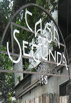 |
| PH-40-0002 | Punta de Malabrigo Lighthouse | The lighthouse, originally equipped with a 3rd-order Fresnel light, have been actively guiding ships plying the Verde Island Passage since 1896.[2] | Batangas | Lobo | Lobo-Malabrigo Rd. | 13°35′56″N 121°15′46″E / 13.598858°N 121.262772°E | 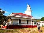 |
| PH-40-0003 | Jose P. Laurel Monument | The monument of Jose P. Laurel, president of the Second Philippine Republic, is a designated National Historical Landmark.[3] | Batangas | Santo Tomas | Junction of Pan-Philippine Highway and General Malvar Ave. | 14°06′51″N 121°08′31″E / 14.114159°N 121.141984°E |  |
| PH-40-0004 | Miguel Malvar Monument | The shrine in front of the municipal hall in honor of Sto. Tomas native Miguel Malvar, a revolutionary hero during the Philippine revolution and the Philippine–American War. | Batangas | Santo Tomas | Sto. Tomas Municipal Hall Rd. | 14°06′37″N 121°08′34″E / 14.110323°N 121.142723°E | 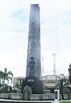 |
| PH-40-0005 | Marcela Agoncillo House | This is the birthplace of Marcela Agoncillo, the maker of the first Philippine Flag. The house contains memorabilia and the evolution of the Philippine Flag display.[4] | Batangas | Taal | Calle Marcela Mariño Agoncillo | 13°52′42″N 120°55′05″E / 13.878395°N 120.918093°E | 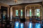 |
| PH-40-0006 | Goco Ancestral House | The heritage house was built in 1876 by the family of Juan Cabrera Goco and restored in 1999.[5] | Batangas | Taal |  | ||
| PH-40-0007 | Taal Historical Landmark | Batangas | Taal | 13°52′48″N 120°55′22″E / 13.88004°N 120.922780°E | 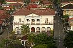 | ||
| PH-40-0008 | Ylagan-de la Rosa House | The house of a popular lawyer and educator in the 19th century, it was restored by the descendants of the family between 1995–1997. It is currently a private home.[6][7] | Batangas | Taal | Calle Jose P. Rizal | 13°52′41″N 120°55′29″E / 13.878053°N 120.924725°E |  |
| PH-40-0009 | Apolinario Mabini Shrine | Birthplace and resting place of Apolinario Mabini, a patriot and hero of the Philippine Revolution.[8] | Batangas | Tanauan | Talisay-Tanuan Rd. | 14°06′05″N 121°05′58″E / 14.101369°N 121.099410°E | 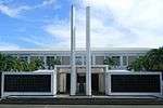 |
| PH-40-0010 | Balayan Church | The present church of the Immaculate Conception was constructed in 1748, at that time, by the Jesuits.[9] | Batangas | Balayan | Plaza Mabini St. | 13°56′17″N 120°43′43″E / 13.937986°N 120.728549°EBalayan Church) | 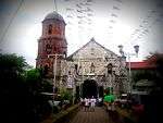 |
| PH-40-0011 | Bauan Church | The Parish Church of the Immaculate Conception was built by the Augustinians in the 18th century and remodeled by the 19th century.[10] | Batangas | Bauan | Kap Ponso St. | 13°47′22″N 121°00′28″E / 13.789519°N 121.007794°EBauan Church) | 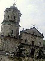 |
| PH-40-0012 | Ibaan Church | Construction of the present St. James the Greater Parish Church was started in 1854 by the Augustinians and completed 1869, fifteen years later.[11] | Batangas | Ibaan | Lipa-Ibaan Rd. | 13°49′08″N 121°07′58″E / 13.818896°N 121.132774°EIbaan Church) | 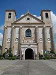 |
| PH-40-0013 | Lipa Cathedral | The San Sebastian Cathedral is the seat of the Archdiocese of Lipa. | Batangas | Lipa | L. Katigbak St. | 13°56′27″N 121°09′49″E / 13.940916°N 121.163518°ELipa Cathedral) | 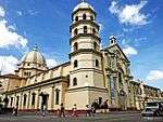 |
| PH-40-0014 | San Jose Church | The present St. Joseph Parish Church was constructed in 1812 under the leadership of famous botanist Francisco Manuel Blanco of the Augustinian order.[12] | Batangas | San Jose | Makalintal Ave. | 13°52′47″N 121°06′15″E / 13.879620°N 121.104199°ESan Jose Church) |  |
| PH-40-0015 | San Juan Church | The present Church of Saint John Nepomucene was built between 1890–1894 after the previous church got flooded in 1863.[13] | Batangas | San Juan | Burgos St. | 13°49′43″N 121°23′39″E / 13.828559°N 121.394230°E | 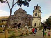 |
| PH-40-0016 | Escuela Pia | The building of the Pious School for the poor & orphans of Taal was constructed in 1885.[14] | Batangas | Taal | Calle Jose W. Diokno | 13°52′50″N 120°55′25″E / 13.880514°N 120.923680°E |  More images |
| PH-40-0017 | Apacible House | The house of Leon Apacible, a delegate to the Malolos Congress, was built in the 18th century. During the 1890s this house became a meeting place for the resistance leaders in the community.[15] | Batangas | Taal | Calle Marcela Mariño Agoncillo | 13°52′46″N 120°55′11″E / 13.879455°N 120.919712°E | 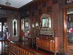 |
| PH-40-0018 | Taal Basilica | The present Basilica of Saint Martin of Tours, constructed in 1856, is allegedly the largest church in the Far East. | Batangas | Taal | Calle Camilo Ilagan | 13°52′50″N 120°55′29″E / 13.880611°N 120.924630°ETaal Basilica) |  |
| PH-40-0019 | Tanauan Church | The church was moved to the present location after the 1754 eruption of Taal Volcano. The present Church of St. John the Baptist was constructed in 1881.[16] | Batangas | Tanauan | F. Laurena St. | 14°05′10″N 121°09′13″E / 14.086074°N 121.153535°E | 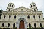 |
| PH-40-0020 | Fort San Felipe Historical Site | Cavite | Cavite City | 14°28′55″N 120°55′00″E / 14.481905°N 120.916651°EFort San Felipe Historical Site) | 
| ||
| PH-40-0021 | Corregidor | A heavily fortified island at the entrance of Manila Bay; site of heavy battles during World War II | Cavite | Cavite City | Entrance of Manila Bay | 14°22′50″N 120°34′32″E / 14.380675°N 120.575440°ECorregidor) | 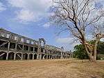 |
| PH-40-0022 | Sarayba House | Built in the late 18th century, the houses exemplifies the architecture during the Spanish era. It was the home of Maria Dolores Gomes-Trias, sister of Fr. Gomes, one of the martyred priest of the 1872 Cavite mutiny.[17] | Cavite | General Trias |
| ||
| PH-40-0023 | Site of the Battle of Imus | The former site of the Estate House (Casa Hacienda de Imus) of the Recollects, now the Imus Cuartel (Barracks) of the Cavite Provincial Police. | Cavite | Imus | General E. Topacio St. | 14°25′47″N 120°56′25″E / 14.429710°N 120.940248°EBattle of Imus) | 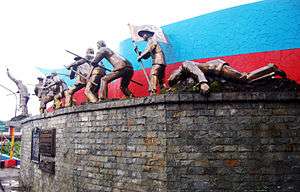 More images |
| PH-40-0024 | Battle of Alapan site | Site of the battle on May 28, 1898 that led to a Filipino victory and the first unfurling of the Philippine flag. | Cavite | Imus | Alapan St. | 14°24′56″N 120°55′07″E / 14.415593°N 120.918690°EBattle of Alapan site) |  |
| PH-40-0025 | Aguinaldo Shrine | House of Emilio Aguinaldo, the first president of the Philippines. and site of the Philippine Declaration of Independence on June 12, 1898 | Cavite | Kawit | Tirona Highway | 14°26′42″N 120°54′25″E / 14.445000°N 120.906944°EAguinaldo Shrine) | .JPG) More images |
| PH-40-0026 | Baldomero Aguinaldo Shrine | House of the Magdalo faction leader of the Katipunan and cousin of Emilio Aguinaldo | Cavite | Kawit | Bisita St. | 14°26′52″N 120°55′25″E / 14.447709°N 120.923573°EBaldomero Aguinaldo Shrine) | 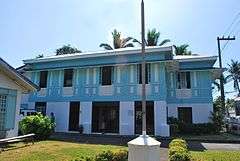 |
| PH-40-0027 | Bonifacio Trial House | The house of Teodorico Reyes where the controversial trial of Andres Bonifacio was held in May 1897. | Cavite | Maragondon | Colonel C. Riel St. | 14°16′27″N 120°44′13″E / 14.274279°N 120.736978°EBonifacio Trial House) |  More images |
| PH-40-0028 | Casa Hacienda and its Environs (Site of the Tejeros Convention) | Former site of the Augustinian Estate House; Site of the historic March 22, 1897 Tejeros Convention | Cavite | Rosario | General Trias Drive | 14°24′04″N 120°51′38″E / 14.401036°N 120.860532°E | 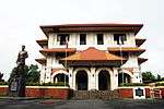 More images |
| PH-40-0029 | Santa Cruz Parish Convent | On March 23, 1897, Emilio Aguinaldo and Mariano Trias took their oaths at this convent as president and vice-president of the revolutionary government.[18] | Cavite | Tanza | San Agustin St. | 14°24′03″N 120°51′25″E / 14.400922°N 120.856903°E | 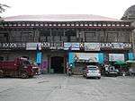 |
| PH-40-0030 | Sta. Maria Magdalena Parish | The Spanish colonial Parish Church of Amadeo was used as a Japanese garrison during World War II.[19] | Cavite | Amadeo | F. Laviña St. | 14°10′13″N 120°55′18″E / 14.170230°N 120.921545°E | 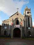 |
| PH-40-0031 | Cañacao Navy Hospital | A naval hospital established by the Spaniards in 1871 and managed by the Sisters of Charity, which the Americans took over during their occupation of the country. It was destroyed in 1942 during World War II.[20] | Cavite | Cavite City |
| ||
| PH-40-0032 | Astronomical Observatory of Cavite | Cavite | Cavite City |
| |||
| PH-40-0033 | Astronomical Observatory of Joseph Lepaute D’Agelet | A temporary observatory at the garden of the Cavite commandant was set up by the French astronomer and member of the Lapérouse expedition during the expedition's stop in the city from February 28 to April 10, 1787.[21] | Cavite | Cavite City | Jurado St. |
| |
| PH-40-0034 | Ermita de Porta Vaga | The original shrine of Our Lady of Solitude of Porta Vaga, the patron saint of the province of Cavite that was destroyed in World War II> | Cavite | Cavite City | Plaza Soledad St. | 14°28′57″N 120°54′33″E / 14.482452°N 120.909176°E | 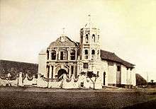 More images |
| PH-40-0035 | Ladislao Diwa Elementary School | The Caridad Elementary School was renamed Ladislao Diwa Elementary School in November 1964 in honor of Ladislao Diwa, one of the founders of Katipunan. | Cavite | Cavite City | P. Burgos Avenue | 14°28′37″N 120°53′32″E / 14.476925°N 120.892344°E |
|
| PH-40-0036 | Cavite National High School | The former Cavite High School was established in 1902, and is considered as one of the oldest national secondary schools in the country. | Cavite | Cavite City | Garcia St. | 14°28′59″N 120°53′51″E / 14.483078°N 120.897466°ECavite National High School) |
|
| PH-40-0037 | Fort San Felipe | The quadrilateral fort with four bastions at each corner was constructed between 1609–1616. Only two bastions and one wall remains after the stronghold was demolished during the early American Colonial period.[22] | Cavite | Cavite City (Cavite Naval Base) | Jurado St. | 14°28′55″N 120°55′00″E / 14.481905°N 120.916651°EFort San Felipe) |
|
| PH-40-0038 | Plaza Olivia Salamanca | Cavite | Cavite City |
| |||
| PH-40-0039 | Dasmariñas Church | The Immaculate Conception Parish Church, constructed in the 19th century, was the site of bloodshed when several revolutionists were defeated and killed in the church and convent.[23] | Cavite | Dasmariñas | Don Placido Campos Ave. | 14°19′37″N 120°56′10″E / 14.326975°N 120.936034°EDasmariñas Church) | 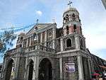 |
| PH-40-0040 | General Trias Church | The Church of St. Francis of Assisi was erected by the Franciscans in 1769. | Cavite | General Trias | 14°23′08″N 120°52′48″E / 14.385518°N 120.880060°EGeneral Trias Church) | .JPG) | |
| PH-40-0041 | Tomas Mascardo Bridge | Commonly known as the Imus Toll Bridge | Cavite | Imus | Aguinaldo Highway | 14°25′27″N 120°56′34″E / 14.424076°N 120.942899°E | 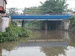 |
| PH-40-0042 | Tirona House | Cavite | Imus | 12 Maestro G. Tirona St. |
| ||
| PH-40-0043 | Imus Cathedral | Parish church of Imus built around 1821 by Fr. Nicolas Becerra of the Recollects; and a place of combat during the Battle of Imus | Cavite | Imus | Gen. Castañeda St. | 14°25′47″N 120°56′10″E / 14.429722°N 120.936056°EImus Cathedral) | 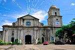 More images |
| PH-40-0044 | Imus Arsenal | Site of the revolutionists' arsenal headed by Filipino-Chinese blacksmith, later general, Jose Ignacio Paua[24][25] | Cavite | Imus | Corner of Gen. E. Topacio and Capt. B. Paredes Sts.[26] |  | |
| PH-40-0045 | Bridge of Isabel II | Built by the Recollects during the Spanish era, it was the site of the Battle of Imus on September 3, 1896 during which a span was dismantled by Aguinaldo and his men to trap the marching Spanish troops. | Cavite | Imus | Gen. E. Topacio St. | 14°25′49″N 120°56′25″E / 14.430292°N 120.940264°EBridge of Isabel II) | 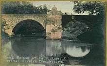 More images |
| PH-40-0046 | Pilar Lodge Building F & AM | Cavite | Imus (Municipal Hall) | Maestro G. Tirona St. | 14°25′43″N 120°56′10″E / 14.428712°N 120.935980°E |  | |
| PH-40-0047 | Kawit Church | The present Church of St. Mary Magdalene was constructed 1737. In 1899 during the Philippine–American War, it was bombed by the Americans, targeting the Filipino leaders using the church for protection.[27] | Cavite | Kawit | Tanggulan St. | 14°26′41″N 120°54′13″E / 14.444739°N 120.903590°EKawit Church) |  More images |
| PH-40-0048 | Kawit Municipal Hall | Site of the former municipal hall captured by Emilio Aguinaldo and Candido Tirona on August 31, 1896 that eventually started the revolution in Cavite.[28] | Cavite | Kawit | Tirona Highway | 14°26′39″N 120°54′12″E / 14.444276°N 120.903357°E | 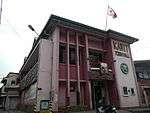 More images |
| PH-40-0049 | Maragondon Church | The Parish Church of the Assumption of Our Lady in Marogondon was constructed in the early 18th century by the Jesuits, with later additions by the seculars and the Augustinian Recollects. The church was designated as a National Cultural Treasure by the National Museum of the Philippines.[29][30] | Cavite | Maragondon | Colonel C. Riel St | 14°16′26″N 120°44′01″E / 14.274003°N 120.733517°EMaragondon Church) | 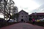 More images |
| PH-40-0050 | Casa Hacienda de Naic | The former Estate House (Casa Hacienda) of the Dominicans is now the present Naic Elementary School.[31] | Cavite | Naic | Rizal St. | 14°19′14″N 120°45′49″E / 14.320500°N 120.763524°E |  |
| PH-40-0051 | Emilio Aguinaldo Monument | Monument of Aguinaldo at the Tejeros Convention site | Cavite | Rosario | Gen Trias Dr. | 14°24′04″N 120°51′39″E / 14.401056°N 120.860752°E | |
| PH-40-0052 | Silang Church | Constructed in 1640 | Cavite | Silang | J. Rizal St. | 14°13′26″N 120°58′28″E / 14.223972°N 120.974379°ESilang Church) | 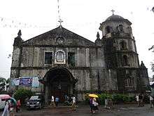 |
| PH-40-0053 | Rizal Shrine | Birthplace of Jose Rizal, national hero of the Philippines | Laguna | Calamba | J.P. Rizal St. | 14°12′49″N 121°10′00″E / 14.213708°N 121.166739°ERizal Shrine) | 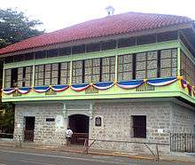 |
| PH-40-0054 | Calamba Church | St. John the Baptist Parish Church | Laguna | Calamba | J.P. Rizal St. | 14°12′49″N 121°10′03″E / 14.213498°N 121.167531°ECalamba Church) | 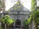 |
| PH-40-0055 | Paciano Rizal Shrine | Locate along the shore of Laguna de Gay, it is the house and tomb of Paciano Rizal. | Laguna | Los Baños | 14°10′54″N 121°13′26″E / 14.181699°N 121.223972°E |  More images | |
| PH-40-0056 | Nagcarlan Underground Cemetery | Laguna | Nagcarlan | 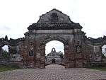 | |||
| PH-40-0057 | Pila Historical Landmark | The historic town center of Pila was declared as a National Historical Landmark on May 17, 2000. | Laguna | Pila | 14°14′04″N 121°21′51″E / 14.234451°N 121.364061°E | 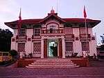 | |
| PH-40-0058 | Cuartel de Santo Domingo | Built in 1877 as barracks (cuartel) of the police force (Guardia Civil) on the former Estate of the Dominicans[32] | Laguna | Santa Rosa | Santa Rosa-Tagaytay Rd | 14°13′50″N 121°03′00″E / 14.230668°N 121.049978°ECuartel de Santo Domingo) |
|
| PH-40-0059 | Bay Church | The first stone St. Augustine Church was built in 1804 but was destroyed during WWII. The present church was completed in 1953.[33] | Laguna | Bay | J.P. Rizal Ave. | 14°10′50″N 121°17′03″E / 14.180643°N 121.284217°EBay Church) |  |
| PH-40-0060 | Jose Rizal Monument | Laguna | Calamba | Bacnotan Road | 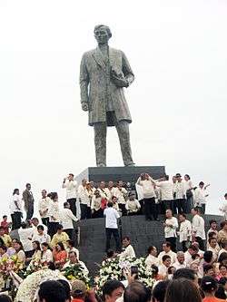 | ||
| PH-40-0061 | Cavinti Church | The Church of the Transfiguration | Laguna | Cavinti | Oliveros St | 14°14′42″N 121°30′27″E / 14.245128°N 121.507419°ECavinti Church) | 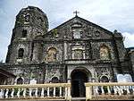 |
| PH-40-0062 | Lilio (Liliw) Church | Laguna | Liliw |  | |||
| PH-40-0063 | Los Baños Church | Church of the Immaculate Conception | Laguna | Los Baños | 14°10′44″N 121°13′19″E / 14.178764°N 121.221846°ELos Baños Church) | 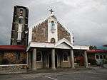 | |
| PH-40-0064 | Hospital de Aguas Santos | Laguna | Los Baños |
| |||
| PH-40-0065 | International Rice Research Institute (IRRI) | A rice research and training organization formed in 1960 to develop new rice varieties and rice crop management techniques to find sustainable "green" ways to improve the well-being of poor rice farmers and consumers. | Laguna | Los Baños | National Highway | 14°10′11″N 121°15′30″E / 14.169816°N 121.258464°EInternational Rice Research Institute (IRRI)) | 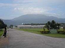 |
| PH-40-0066 | Baker Memorial Hall | Used by the Japanese as an internment camp for captured American and Filipino soldiers during World War II. | Laguna | Los Baños | Mangga St. (Mariano Mondenado Ave.) | 14°09′42″N 121°14′34″E / 14.161798°N 121.242740°EBaker Memorial Hall) | 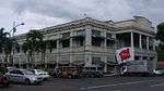 |
| PH-40-0067 | Lumban Church | St. Sebastian Parish Church | Laguna | Lumban | J.P. Rizal St. | 14°17′51″N 121°27′34″E / 14.297396°N 121.459368°ELumban Church) | 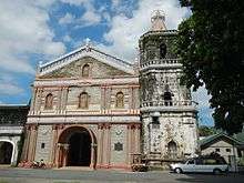 |
| PH-40-0068 | Mabitac Church | Laguna | Mabitac | 14°25′42″N 121°25′34″E / 14.4282°N 121.4260°EMabitac Church) | 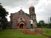 | ||
| PH-40-0069 | Majayjay Church | St. Gregory the Great Parish Church | Laguna | Majayjay | Lopez Jaena St. | 14°08′47″N 121°28′17″E / 14.146346°N 121.471318°EMajayjay Church) | 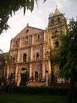 |
| PH-40-0070 | Nagcarlan Church | St. Bartholomew Parish Church | Laguna | Nagcarlan |  | ||
| PH-40-0071 | Paete Church | St. James the Apostle Parish Church | Laguna | Paete | Ed Reyes St. | 14°21′52″N 121°28′54″E / 14.364557°N 121.481638°EPaete Church) | 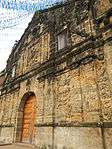 |
| PH-40-0072 | Pagsanjan Church | Our Lady of Guadalupe Church of Pagsanjan or the Diocesan Shrine of Our Lady of the Guadalupe | Laguna | Pagsanjan | General Taino St. | 14°16′22″N 121°27′22″E / 14.272819°N 121.456174°EPagsanjan Church) | 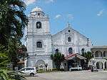 |
| PH-40-0073 | Pagsanjan Municipal Building | The building was originally constructed in mid 19th century housing the Tribunal del Gremio de Naturales and became the first public elementary school in Pagsanjan from 1864–1911.[34][35] | Laguna | Pagsanjan | National Hway cor General Taino St. | 14°16′21″N 121°27′21″E / 14.272469°N 121.455764°EPagsanjan Municipal Building) | 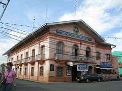 |
| PH-40-0074 | Pakil Church | St. Peter of Alcantara Parish Church; Shrine of Our Lady of Sorrows of Turumba | Laguna | Pakil | Tavera St. | 14°22′51″N 121°28′44″E / 14.380911°N 121.478905°EPakil Church) | 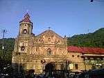 More images |
| PH-40-0075 | Pila Church | The Parish Church of St. Anthony of Padua was constructed in the early 19th century after the previous church was frequently flooded in its old location. The convent was completed in 1849. Both were seriously damaged by the Luzon earthquakes of 1880.[36] | Laguna | Pila | San Antonio St. | 14°14′02″N 121°21′52″E / 14.233808°N 121.364477°EPila Church) | 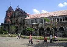 |
| PH-40-0076 | San Pablo Cathedral | Laguna | San Pablo | A. Flores St. | 14°04′11″N 121°19′37″E / 14.069647°N 121.326814°ESan Pablo Cathedral) |  | |
| PH-40-0077 | Fule-Malvar Mansion | Laguna | San Pablo | Rizal Avenue | 14°04′17″N 121°19′21″E / 14.07131°N 121.32248°E | 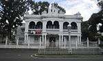 | |
| PH-40-0078 | Villa Escudero Plantations | A hacienda and coconut plantation established by the family of Don Placido Escudero in 1872. | Laguna and Quezon | San Pablo, Laguna; Tiaong and Dolores in Quezon | Pan-Philippine Highway | 13°59′42″N 121°20′32″E / 13.995133°N 121.342092°EVilla Escudero Plantations) | 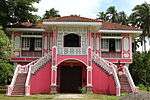 More images |
| PH-40-0079 | Siniloan Church | Church of Sts. Peter and Paul | Laguna | Siniloan | Paete-Pakil-Famy Diversion Rd. | 14°25′19″N 121°26′46″E / 14.421999°N 121.446129°ESiniloan Church) |  |
| PH-40-0080 | Santa Cruz Church | Immaculate Conception Parish Church of Santa Cruz, Laguna | Laguna | Santa Cruz | P. Guevarra St. | 14°16′57″N 121°24′53″E / 14.282542°N 121.414813°ESanta Cruz Church) | 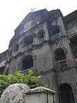 |
| PH-40-0081 | Site of the Battle of Santa Cruz | Laguna | Santa Cruz |
| |||
| PH-40-0082 | Gala-Rodriguez House | Built in the early 1930s by Dr. Isidro Rodriguez as gift to his ailing wife Doña Gregoria Gala. Designed by architect Juan Nakpil. | Quezon | Sariaya | 44 Rizal St. | 13°57′43″N 121°31′29″E / 13.961964°N 121.524837°EGala-Rodriguez House) | 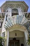 |
| PH-40-0083 | Tayabas Provincial Capitol Building | Quezon | Tayabas | 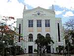 | |||
| PH-40-0084 | Claro M. Recto Shrine | Quezon | Tiaong |  | |||
| PH-40-0085 | Atimonan Church | The present Parish Church of Our Lady of the Angels and its adjoining convent were constructed between 1687 and 1700.[37] | Quezon | Atimonan | Manuel L. Quezon Blvd. | 14°00′05″N 121°55′17″E / 14.001499°N 121.921494°E | 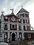 More images |
| PH-40-0086 | Iskong Bantay Watchtower | The only lookout and defense watchtower existing of the seven built around 1752 to guard the town against pirates.[38] | Quezon | Atimonan |
| ||
| PH-40-0087 | Fort San Diego | Built in the late 18th century, Fort San Diego is the only remaining of the four fortifications at each corner of town forming a quadrilateral.[39] | Quezon | Gumaca | 13°55′23″N 122°06′01″E / 13.922920°N 122.100278°E | 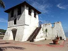 More images | |
| PH-40-0088 | Gumaca Church | Its first establishment was in 1582 by the Franciscans. It was transferred to Silangan in the island of Alabat, Quezon in 1638. It was burned by the Dutch forces in 1665, then transferred back in Gumaca. The church was reconstructed and beautified in 1846. Known as one of the biggest and oldest Catholic churches in the province of Quezon, this Baroque church is made out of coral stone blocks and bricks. | Quezon | Gumaca | 13°55′18″N 122°05′58″E / 13.921785°N 122.099371°E |  | |
| PH-40-0089 | La Casa de Doña Ana | The heritage house was built after the marriage of Pedro Nepomucino Villaseñor and Ana Maria Herrera De La Concepcion in 1842.[40] | Quezon | Lucban | Quezon Avenue | 14°06′50″N 121°33′19″E / 14.113917°N 121.555334°E |
|
| PH-40-0090 | Lucban Church | The present Parish Church of Saint Louis of Toulouse was completed in 1738 with the convent, in 1743.[41] | Quezon | Lucban | La Purisima Concepcion St. | 14°06′53″N 121°33′13″E / 14.114846°N 121.553686°ELucban Church) | 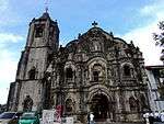 More images |
| PH-40-0091 | Site of Battle of Barrio Piis | Battle fought on December 26, 1941 between American-Filipino forces and the encroaching Japanese soldiers in the early part of World War II.[42] | Quezon | Lucban | Lucban-Sampaloc Road | 14°08′55″N 121°35′45″E / 14.148583°N 121.595916°E |
|
| PH-40-0092 | Colegio Sagrado Corazon de Jesus | Quezon | Lucena |
| |||
| PH-40-0093 | Lucena Cathedral | The Cathedral of Saint Ferdinand is the seat of the Diocese of Lucena. It was built between May 1882 to July 1884.[43] | Quezon | Lucena | Quezon Ave. | 13°56′09″N 121°36′45″E / 13.935949°N 121.612422°E | 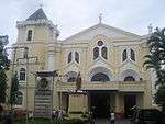 More images |
| PH-40-0094 | Quezon Provincial Capitol | The neoclassical Art Deco capitol building of the former Tayabas province, designed by Juan Arellano, was constructed in 1908.[44] | Quezon | Lucena | Quezon Ave. | 13°55′42″N 121°36′48″E / 13.928450°N 121.613286°E |  |
| PH-40-0095 | Sacred Heart College | It is the oldest Catholic educational institution for men and women in Quezon Province founded on April 27, 1884. | Quezon | Lucena | Merchan St. | 13°56′24″N 121°36′54″E / 13.940126°N 121.614927°ESacred Heart College) |
|
| PH-40-0096 | Mauban Church | First church and convent were constructed in 1647 and demolished in 1769. The second church collapsed during the 1880 earthquakes. Third church was built in 1891. Historical marker was placed in 1939.[45] Present church looks recently built. | Quezon | Mauban | 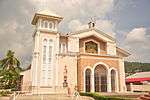 More images | ||
| PH-40-0097 | Rizal Hill Park | Highest point in Gumaca, lookout point during the Spanish era, military headquarters during the American period | Quezon | Mauban | 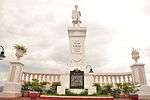 More images | ||
| PH-40-0098 | Pagbilao Church | The present Church of St. Catherine of Alexandria was constructed in 1845 under Fr. Victorino Peralija. Together with the convent and belfry, it was completed in 1877 under Fr. Eugenio Gomez. After it was destroyed during liberation from World War II, it was repaired in 1954 under Fr. Vicente Urlanda in 1954.[46] | Quezon | Pagbilao | Pan-Philippines Highway | 13°58′20″N 121°41′12″E / 13.972116°N 121.686608°E |  |
| PH-40-0099 | Natalio Enriquez House | Beaux-Arts mansion of former provincial governor Natalio Enriquez. | Quezon | Sariaya | Pan-Philippine Highway | 13°57′48″N 121°31′28″E / 13.963417°N 121.524417°E | 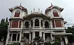 |
| PH-40-0100 | Rodriguez House (Villa Sariaya) | Ancestral house owned by Don Catalino Rodriguez, town mayor of Sariaya from 1908–1909. Opened to the public as Villa Sariaya.[47] | Quezon | Sariaya | Rizal St. cor. Daliz St. | 13°57′47″N 121°31′30″E / 13.962932°N 121.524999°ERodriguez House (Villa Sariaya)) |  |
| PH-40-0101 | St. Francis of Assisi Church (Sariaya) | The present Church of Saint Francis of Assisi was constructed in 1748 after the previous church were destroyed by earthquakes and floods from its previous locations.[48] | Quezon | Sariaya | Pan-Philippine Highway | 13°57′49″N 121°31′26″E / 13.963551°N 121.523883°ESt. Francis of Assisi Church (Sariaya)) | 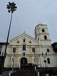 |
| PH-40-0102 | Malagonlong Bridge | A 445-foot (136 m) long stone arch bridge over the Dumaca-a River built during the Spanish colonial period, between 1840–1850.[49] | Quezon | Tayabas City | Tayabas-Pagbilao Rd. | 14°00′47″N 121°37′01″E / 14.012940°N 121.616844°EMalagonlong Bridge) |  More images |
| PH-40-0102 | Casa Comunidad de Tayabas | Originally built with light materials in 1776 as a Casa Tribunal (courthouse) and later, a guesthouse for travelers; it was reconstructed in stone in 1831. After it burned down in World War II, it was reconstructed by the NHI and declared a National Historical Landmark in 1978.[50] | Quezon | Tayabas City | P. Silang St. | 14°01′32″N 121°35′30″E / 14.025637°N 121.591778°E |  More images |
| PH-40-0103 | Tayabas Basilica | Quezon | Tayabas City | P. Silang St. | 14°01′33″N 121°35′27″E / 14.025942°N 121.590831°ETayabas Basilica) |  More images | |
| PH-40-0104 | Vicente Manansala Shrine | Rizal | Binangonan | 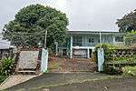 | |||
| PH-40-0105 | Pamitinan Cave Shrine | Rizal | Rodriguez | M.H. del Pilar St. | 14°43′55″N 121°11′20″E / 14.731827°N 121.188804°EPamitinan Cave Shrine) |
| |
| PH-40-0106 | Antipolo Cathedral | Rizal | Antipolo | M.L. Quezon St. | 14°35′16″N 121°10′36″E / 14.587639°N 121.176667°EAntipolo Cathedral) | 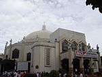 More images | |
| PH-40-0107 | Boso-Boso Church | The Church of Our Lady of the Annunciation was established by the Jesuits in the 17th century and transferred to the secular clergy in 1768. It was damaged during the 1880 earthquake, burned down in 1943 during WWII and restored in 1995.[51] | Rizal | Antipolo (Boso-Boso) | Sitio Old (Lower) Boso-Boso | 14°38′22″N 121°14′18″E / 14.639514°N 121.238211°EBoso-Boso Church) | 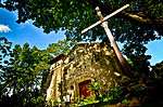 More images |
| PH-40-0108 | Baras Church | Rizal | Baras | A. Bonifacio St. | 14°31′22″N 121°16′03″E / 14.522877°N 121.267613°EBaras Church) | 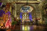 | |
| PH-40-0109 | Cainta Church | Rizal | Cainta | Bonifacio Ave. | 14°34′40″N 121°06′56″E / 14.577747°N 121.115599°ECainta Church) |  More images | |
| PH-40-0110 | Morong Church | The present Church of Saint Jerome was constructed in the 17th century, its frontispiece and belfry were built by Bartolome Palatino of Paete from 1850–1853.[52] | Rizal | Morong | Turentigue St. | 14°30′52″N 121°14′16″E / 14.514341°N 121.237640°EMorong Church) | 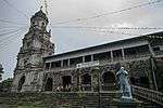 More images |
| PH-40-0111 | Morong High School Building | Rizal | Morong | Manila East Rd cor. Sumulong St. | 14°31′01″N 121°14′20″E / 14.516975°N 121.238757°EMorong High School Building) | 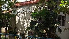 | |
| PH-40-0112 | Tomas Claudio Intermediate School | Rizal | Morong | T.Claudio St. | 14°31′04″N 121°14′19″E / 14.517889°N 121.238534°ETomas Claudio Intermediate School) |  | |
| PH-40-0113 | Tanay Church | Rizal | Tanay | M.H.del Pilar St. | 14°29′55″N 121°17′05″E / 14.498502°N 121.284690°ETanay Church) |  More images | |
| PH-40-0114 | Taytay Church | Rizal | Taytay | Kadalagahan St. | 14°34′15″N 121°07′57″E / 14.570883°N 121.132396°ETaytay Church) | 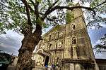 | |
| PH-40-0115 | Jose Rizal Monument | Rizal | Taytay | J. Sumulong St. | 14°34′14″N 121°07′54″E / 14.570511°N 121.131680°E | 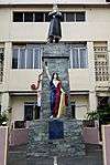 | |
| PH-40-0116 | Pililla Church | Rizal | Pililla | J.P. Rizal St. | 14°28′48″N 121°18′24″E / 14.480135°N 121.306699°EPililla Church) | 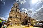 |
See also
References
- ↑ "Casa de Segunda". Lipa City Tourism and Museum Council. Retrieved on 2013-07-03.
- ↑ NHCP Historic Preservation Division. "Malabrigo Lighthouse". National Registry of Historical Sites & Structures in the Philippines. Retrieved on 2013-06-29.
- ↑ NHCP Historic Preservation Division. "Jose P. Laurel Monument, Batangas". National Registry of Historical Sites & Structures in the Philippines. Retrieved on 2013-07-03.
- ↑ NHCP Historic Preservation Division. "Marcela Agoncillo Historical Landmark". National Registry of Historical Sites & Structures in the Philippines. Retrieved on 2013-07-02.
- ↑ Sangoyo, Christian Lucas (2011-08-27). "Taal Town: Goco Anvestral House". Lakad Pilipinas. Retrieved on 2013-06-29.
- ↑ De AnDA (2010-11-20). "Taal 'Pride in History'". With One's Past. Retrieved on 2013-07-03.
- ↑ "Casas de Taal". Taal.ph. Retrieved on 2013-07-03.
- ↑ NHCP Historic Preservation Division. "Label – Apolinario Mabini". National Registry of Historical Sites & Structures in the Philippines. Retrieved on 2013-06-29.
- ↑ NHCP Historic Preservation Division. "Simbahan ng Balayan". National Registry of Historical Sites and Structures of the Philippines. Retrieved on 2013-06-29.
- ↑ Cambay, Cesar. "Historical Marker of Church of Bauan". Panoramio. Retrieved on 2013-06-29.
- ↑ Pransism (2011-02-13). "Back Trails at Ibaan, Batangas 2: Ibaan Church". Back Trails. Retrieved on 2013-06-29.
- ↑ NHCP Historic Preservation Division. "Church of San Jose, Batangas". National Registry of Historical Sites and Structures of the Philippines. Retrieved on 2013-06-29.
- ↑ NHCP Historic Preservation Division. "Simbahan ng San Juan". National Registry of Historical Sites and Structures of the Philippines. Retrieved on 2013-06-29.
- ↑ NHCP Historic Preservation Division. "Escuela Pia". National Registry of Historic Sites & Structures of the Philippines. Retrieved on 2013-06-28.
- ↑ "Leon Apacible Historical Landmark". National Historical Commission of the Philippines. Retrieved on 2013-07-02.
- ↑ Pepe (2011-07-31). "A quick stop in Tanauan (Tanauan, Batangas)". Filipino eScribbles. Retrieved on 2013-06-29.
- ↑ (2005-10-06). "Resolution no. 6, S. 2005". National Historical Commission of the Philippines. Retrieved on 2013-07-08.
- ↑ NHCP Historic Preservation Division. "Convent of Tanza Church". National Registry of Historic Sites & Structures of the Philippines. Retrieved on 2013-07-01.
- ↑ cyndymc (2009-03-04). "Amadeo Travel Guide". Virtual Tourist. Retrieved on 2013-06-29.
- ↑ Stiegelmar, Loren (2001). "A Brief History of Sangley Point". U.S. Naval Station Sangley Point. Retrieved on 2013-06-29.
- ↑ Arenas, Don Rafael Diaz (1830). "Memorias Historicas Y Estadisticas de Filipinas", pg. 3. Imprenta del Diario, Manila.
- ↑ NHCP Historic Preservation Division. "Kuta ng San Felipe Neri". National Registry of Historical Sites & Structures in the Philippines. Retrieved on 2013-07-03.
- ↑ RamonFVelasquez (2013-06-07). "Dasmariñas Church marker". Wikimedia Commons.
- ↑ NHCP Historic Preservation Division. "Arsenal ng Imus". National Register of Historic Sites and Structures of the Philippines. Retrieved on 2013-06-29.
- ↑ Maranga, Anthony (2011-08-09). "General Ignacio Paua Park". Philippines Travel Guide. Retrieved on 2013-06-29.
- ↑ "Towns and Cities – Imus". Biyahero Philippine Travel Portal. Retrieved on 2013-07-05.
- ↑ "Old Cavite church near Manila". Library of Congress. Retrieved on 2013-07-01.
- ↑ NHCP Historic Preservation Division. "Pamahalaang Bayan ng Kawit (1896)". National Registry of Historical Sites & Structures in the Philippines. Retrieved on 2013-06-29.
- ↑ De AnDA (2010-08-09). "Maragondon’s Heritage Sites Today". With one's past. Retrieved on 2013-07-03.
- ↑ Cultura, Ivan (2012-05-10). "Maragondon Heritage Tour". Batang Lakwatsero. Retrieved on 2013-07-03.
- ↑ Velasquez, Romeo F. (2013-07-18). "Casa Hacienda de Naic historical marker". Wikimedia Commons. Retrieved on 2013-11-15.
- ↑ (2008-01-28). "Cuartel de Santo Domingo • Santa Rosa, Laguna". Muog. Retrieved on 2013-06-30.
- ↑ NHCP (2004-06-01). "Simbahan ng Bay". National Registry of Historic sites and Structures in the Philippines. Retrieved on 2014-03-29.
- ↑ (2012-04-13). "Old Houses Galore: Pagsanjan". Pondering Paodaolei. Retrieved on 2013-07-05.
- ↑ Zaide, Gregorio (1975). "Pagsanjan, In History and Legend, Chapter 5". pg. 3. Pagsanjan Official Website. Retrieved on 2013-07-05.
- ↑ NHCP Historic Preservation Division. "Church of Pila". National Registry of Historical Sites & Structures in the Philippines. Retrieved on 2013-07-09.
- ↑ NHCP Historic Preservation Division. "Church of Atimonan". National Registry of Historical Sites & Structures in the Philippines. Retrieved on 2013-06-29.
- ↑ (2008-01-28). "Iskong bantay • Atimonan, Quezon". Muog. Retrieved on 2013-06-30.
- ↑ (2008-01-28). "Fuerza de San Diego de Alcala • Gumaca, Quezon". Muog. Retrieved on 2013-07-01.
- ↑ Lakwatserongsulit (2013-07-13). "". Lakwatserong Sulit. Retrieved on 2013-09-12.
- ↑ Toliretti (2009-09-04). "Lucban Church Historical Tablet". Panoramio. Retrieved on 2013-09-12.
- ↑ Villa, Leonardo (2013-05-10). "Battle of Piis_Lucban, Quezon December 26, 1941". Lucban Historical Society. Retrieved on 2013-09-12.
- ↑ (2012-06-10). "Cathedral of Saint Ferdinand". Pinoy Churches. Retrieved on 2013-07-01.
- ↑ (2013-02-10). "Quezon Provincial Capitaol". Lucenahin. Retrieved on 2013-07-01.
- ↑ "Mauban Things to Do – Picture of Mauban Church Historical markder". Virtual Tourist. Retrieved on 2014-11-15.
- ↑ NHCP Historic Preservation Division. "Simbahan ng Pagbilao". National Registry of Historical Sites & Structures in the Philippines. Retrieved on 2013-07-02.
- ↑ "Sariaya". Traveler on Foot. Retrieved on 2013-09-15.
- ↑ NHCP Historic Preservation Division. "Church of Sariaya". National Registry of Historical Sites & Structures in the Philippines. Retrieved on 2013-07-02.
- ↑ Jayson (2010-03-10). "Puente de Malagonlong". Tayabas Quezon Province. Retrieved on 2013-07-02.
- ↑ NHCP Historic Preservation Division. "Casa de Comunidad de Tayabas". National Registry of Historic Sites & Structures of the Philippines. Retrieved on 2013-07-02.
- ↑ NHCP Historic Preservation Division. "Simbahan ng Boso-Boso". National Registry of Historical Sites & Structures in the Philippines. Retrieved on 2013-07-09.
- ↑ NHCP Historic Preservation Division. "Church of Morong". National Registry of Historical Sites & Structures in the Philippines. Retrieved on 2013-07-09.
| Wikimedia Commons has media related to Cultural heritage monuments in CALABARZON. |
This article is issued from Wikipedia - version of the 11/5/2016. The text is available under the Creative Commons Attribution/Share Alike but additional terms may apply for the media files.