List of inclines in Pittsburgh
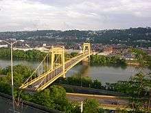
The city of Pittsburgh, Pennsylvania once had a number of inclined railways. Most have been removed; only two - the Duquesne Incline and Monongahela Incline - are still in operation, carrying passengers between Mount Washington and the Monongahela River.
| Name | Opened | Closed | Lower end | Upper end | Owner | Notes |
|---|---|---|---|---|---|---|
| Bellevue Incline | 1887 | 1892 | ||||
| Castle Shannon Incline | 1890 | 1964 | South Shore: Carson Street near Arlington Avenue | Mount Washington: Bailey Avenue near Haberman Avenue | Pittsburgh Railways (Pittsburgh and Castle Shannon Railroad) | |
| Castle Shannon Incline No. 2 | 1892 | c. 1919 | Mount Washington: Warrington Avenue west of Haberman Avenue | Mount Washington: Bailey Avenue west of Haberman Avenue | Pittsburgh Railways (Pittsburgh and Castle Shannon Railroad) | |
| Clifton Incline | 1889 | 1905 | Perry Hilltop: Strauss Street near Metcalf Street | Perry Hilltop: Irwin Avenue near Chautauqua Street | Clifton Avenue Incline Plane Company | |
| Duquesne Incline | 1877 | — | South Shore: Carson Street | Mount Washington: Grandview Avenue near Oneida Place | Duquesne Incline Plane Company Now Society for the Preservation of the Duquesne Heights Incline |
|
| Fort Pitt Incline | 1882 | 1900 | Bluff: Second Avenue near Tenth Street Bridge | Bluff: Bluff Street near Magee Street | Fort Pitt Incline Plane Company | |
| Knoxville Incline | 1890 | 1960 | South Side Flats: Bradish Street between 11th and 12th Streets | Allentown: Brosville Street near Warrington Avenue | Pittsburgh Railways (Pittsburgh Incline Plane Company) | |
| Monongahela Incline | 1870 | — | South Shore: Carson Street near Smithfield Street Bridge | Mount Washington: Grandview Avenue near Wyoming Street | Monongahela Incline Plane Company Now Port Authority of Allegheny County |
|
| Monongahela Freight Incline | 1884 | 1935 | South Shore: Carson Street near Smithfield Street Bridge | Mount Washington: Grandview Avenue near Wyoming Street | Monongahela Incline Plane Company Now Port Authority of Allegheny County |
|
| Pittsburgh and Castle Shannon Plane | before 1864 | c. 1912 | Carson Street | Bailey | Pittsburgh Coal Company | |
| Mount Oliver Incline | 1872 | 1951 | South Side Flats: Freyburg Street near 12th Street | South Side Slopes: Warrington Avenue near Mount Oliver Street | Pittsburgh Railways (Mount Oliver Incline Railway) | |
| Norwood Incline | 1901 | 1923 | Island Avenue | Norwood Place | ||
| Nunnery Hill Incline | 1888 | 1895 | Fineview: Federal Street near Henderson Street | Fineview: Meadville Street near Catoma Street | Nunnery Hill Incline Plane Company | |
| Penn Incline | 1884[1] | 1953 | Strip District: Spring Way near 17th Street | Hill District: Arcena Street near Ledlie Street | Pittsburgh Railways (Seventeenth Street Incline Plane Company) | |
| Ridgewood Incline | 1886[2] | 1887[3] | Perry Hilltop: North Charles Street near Nublock Street | Perry Hilltop: Yale Street near Ridgewood Street | Ridgewood Incline Plane Company | |
| St. Clair Incline | 1888 | c. 1932 | South Side Flats: Josephine Street near Greeley Street | South Side Slopes: Salisbury Street between Fernleaf and Sterling Streets | St. Clair Incline Plane Company | |
| Troy Hill Incline | 1888 | 1898 | Troy Hill: Ohio Street | Troy Hill: Lowrie Street near Froman Street | Troy Hill Incline Plane Company |
Further: H.B. Hays and Brothers Coal Railroad
This list is incomplete; you can help by expanding it.
External links
- A video of the Monongahela and Knoxville inclines operating in Pittsburgh during 1926. The Monongahela Freight incline can also be seen in the video.[4]
References
| Wikimedia Commons has media related to Inclines of Pittsburgh. |
- ↑ Diescher, Samuel (June 1897). "American Inclined Plane Railways". Cassier's Magazine. 12 (2): 86–87.
- ↑ "A New Allegheny Incline". Pittsburgh Daily Post. 17 December 1886. p. 3 – via Newspapers.com.

- ↑ "An Incline Burned". The Post. Pittsburgh. 31 May 1887. p. 2 – via Newspapers.com.
Real estate plat-book of the city of Allegheny (Map). G. M. Hopkins & Co. 1890. Vol. 1, Plate 6.Old Incline Plane (Burned)
- ↑ https://www.facebook.com/video.php?v=1647951442115391
| Light rail (List of stations) | ||
|---|---|---|
| Inclines (Historical list) | ||
| Buses and busways (List of routes) | ||
| Former lines | ||
| Other | ||
| |||||||||||||||||||||||||||||||
| |||||||||||||||||||||||||||||||
| |||||||||||||||||||||||||||||||
This article is issued from Wikipedia - version of the 10/10/2016. The text is available under the Creative Commons Attribution/Share Alike but additional terms may apply for the media files.