List of mountain peaks of Central America
| Part of a series on |
| Central America |
|---|
 |
|
Countries |
|
Culture |
|
Economy |
|
Education |
|
Politics and government |
|
Transportation |
|
Related topics |
This article comprises three sortable tables of major mountain peaks[1] of Central America. This article defines Central America as the seven nations of Belize, Costa Rica, El Salvador, Guatemala, Honduras, Nicaragua, and Panamá.
The summit of a mountain or hill may be measured in three principal ways:
- The topographic elevation of a summit measures the height of the summit above a geodetic sea level.[2] The first table below ranks the 25 highest major summits of Central America by elevation.
- The topographic prominence of a summit is a measure of how high the summit rises above its surroundings.[3][2] The second table below ranks the 25 most prominent summits of Central America.
- The topographic isolation (or radius of dominance) of a summit measures how far the summit lies from its nearest point of equal elevation.[4] The third table below ranks the 25 most isolated major summits of Central America.
Highest major summits
Of the 25 highest major summits of Central America, Volcán Tajumulco and Volcán Tacaná exceed 4000 meters (13,123 feet) elevation, 11 peaks exceed 3000 meters (9843 feet), and 24 peaks exceed 2000 meters (6562 feet) elevation.
Of these 25 peaks, nine are located in Honduras, eight in Guatemala, four in El Salvador, three in Costa Rica, two in Panama, and one in Nicaragua. Volcán Tacaná lies on the Guatemala-Mexico border, Cerro El Pital lies on the El Salvador-Honduras border, and Pico Mogotón lies on the Nicaragua-Honduras border.
Most prominent summits
Of the 25 most prominent summits of Central America, Volcán Tajumulco and Chirripó Grande exceed 3000 meters (9843 feet) of topographic prominence, four peaks exceed 2000 meters (6562 feet), and 23 peaks are ultra-prominent summits with at least 1500 meters (4921 feet) of topographic prominence.
Of these 25 peaks, eight are located in Honduras, five in Guatemala, four in El Salvador, three in Costa Rica, three in Nicaragua, and two in Panamá. Cerro El Pital lies on the El Salvador-Honduras border and Pico Mogotón lies on the Nicaragua-Honduras border.
Most isolated major summits
Of the 25 most isolated major summits of Central America, Chirripó Grande and Volcán Tajumulco exceed 500 kilometers (310.7 miles) of topographic isolation and 11 peaks exceed 100 kilometers (62.14 miles) of topographic isolation.
Of these 25 peaks, nine are located in Honduras, four in Guatemala, four in El Salvador, three in Panamá, three in Nicaragua, three in Costa Rica, and one in Belize. Pico Mogotón lies on the Nicaragua-Honduras border and Cerro El Pital lies on the El Salvador-Honduras border.
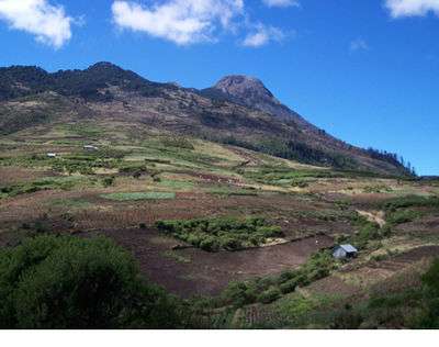
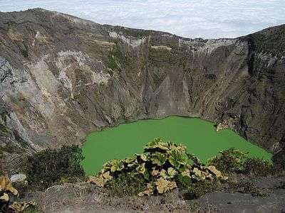
Gallery

 Volcán Tacaná on the border between Guatemala and México is the second highest major summit of Central America.
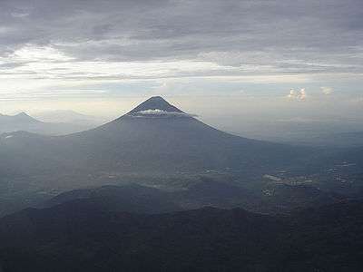
See also
- List of mountain peaks of North America
- Central America
- Geography of Central America
- Geology of Central America
- Category:Mountains of Central America
- Physical geography
References
- ↑ This article defines a significant summit as a summit with at least 100 meters (328.1 feet) of topographic prominence, and a major summit as a summit with at least 500 meters (1640 feet) of topographic prominence. All summits in this article have at least 500 meters of topographic prominence. An ultra-prominent summit is a summit with at least 1500 meters (4921 feet) of topographic prominence.
- 1 2 If the elevation or prominence of a summit is calculated as a range of values, the arithmetic mean is shown.
- ↑ The topographic prominence of a summit is the topographic elevation difference between the summit and its highest or key col to a higher summit. The summit may be near its key col or quite far away. The key col for Denali in Alaska is the Isthmus of Rivas in Nicaragua, 7642 kilometers (4749 miles) away.
- ↑ The topographic isolation of a summit is the great-circle distance to its nearest point of equal elevation.
- 1 2 3 The summit of Volcán Tajumulco is the highest point of the Sierra de las Nubes, the Republic of Guatemala, and all of Central America.
- 1 2 3 Volcán Tajumulco is the southernmost and easternmost 4000-meter (13,123-foot) summit of greater North America.
- 1 2 3 "Volcán Tajumulco". Peakbagger.com. Retrieved 5 May 2016.
- ↑ Volcán Tacaná on the international border with Guatemala is the highest point of Estado Libre y Soberano de Chiapas.
- ↑ "Volcán Tacaná". Peakbagger.com. Retrieved 5 May 2016.
- ↑ "Volcán Tacaná". Bivouac.com. Retrieved 5 May 2016.
- 1 2 3 Volcán Acatenango is the southernmost and easternmost summit of its elevation in Central America and greater North America.
- 1 2 3 "Volcán Acatenango". Peakbagger.com. Retrieved 5 May 2016.
- 1 2 3 Alto Cuchumatanes is the northernmost 3000-meter (9843-foot) summit of Central America.
- 1 2 3 "Alto Cuchumatanes". Peakbagger.com. Retrieved 5 May 2016.
- 1 2 3 The summit of Chirripó Grande is the highest point of the Republic of Costa Rica.
- 1 2 3 Chirripó Grande is the southernmost and easternmost summit of its elevation in Central America and greater North America.
- 1 2 3 "Chirripó Grande". Peakbagger.com. Retrieved 5 May 2016.
- 1 2 "Volcán Santa María". Peakbagger.com. Retrieved 5 May 2016.
- 1 2 "Volcán de Agua". Peakbagger.com. Retrieved 5 May 2016.
- 1 2 "Volcán Atitlán". Peakbagger.com. Retrieved 5 May 2016.
- 1 2 "Montañas Peña Blanca". Peakbagger.com. Retrieved 5 May 2016.
- 1 2 3 The summit of Volcán Barú is the highest point of the Rebublic of Panama.
- 1 2 3 Volcán Barú is the southernmost 3000-meter (9843-foot) summit of Central America and greater North America.
- 1 2 3 "Volcán Barú". Peakbagger.com. Retrieved 5 May 2016.
- 1 2 3 "Volcán Irazú". Peakbagger.com. Retrieved 5 May 2016.
- 1 2 3 The summit of Cerro Las Minas is the highest point of the Republic of Honduras.
- 1 2 3 "Cerro Las Minas". Peakbagger.com. Retrieved 5 May 2016.
- 1 2 3 "Montaña de Santa Bárbara". Peakbagger.com. Retrieved 5 May 2016.
- 1 2 3 Cerro El Pital on the international border with Honduras is the highest point of the Republic of El Salvador.
- 1 2 3 "Cerro El Pital". Peakbagger.com. Retrieved 5 May 2016.
- 1 2 3 Pico Bonito is the northernmost 2000-meter (6562-foot) summit of Central America.
- 1 2 3 "Pico Bonito". Peakbagger.com. Retrieved 5 May 2016.
- 1 2 3 "Montaña los Comayagua". Peakbagger.com. Retrieved 5 May 2016.
- 1 2 3 "Volcán de Santa Ana". Peakbagger.com. Retrieved 5 May 2016.
- 1 2 3 "Sierra de Agalta high point". Peakbagger.com. Retrieved 5 May 2016.
- 1 2 3 "Pico Pijol". Peakbagger.com. Retrieved 5 May 2016.
- 1 2 3 "Montaña San Ildefonso". Peakbagger.com. Retrieved 5 May 2016.
- 1 2 3 "Volcán de San Vicente". Peakbagger.com. Retrieved 5 May 2016.
- 1 2 3 "Volcán San Miguel". Peakbagger.com. Retrieved 5 May 2016.
- 1 2 3 Pico Mogotón on the international border with Honduras is the highest point of the Republic of Nicaragua.
- 1 2 3 "Pico Mogotón". Peakbagger.com. Retrieved 5 May 2016.
- 1 2 3 "Volcán Miravalles". Peakbagger.com. Retrieved 5 May 2016.
- 1 2 3 Cerro Tacarcuna is the southernmost ultra-prominent summit of Central America and greater North America.
- 1 2 3 "Cerro Tacarcuna". Peakbagger.com. Retrieved 5 May 2016.
- 1 2 "Volcán San Cristóbal". Peakbagger.com. Retrieved 5 May 2016.
- 1 2 "Volcán Concepción". Peakbagger.com. Retrieved 5 May 2016.
- ↑ The summit of Doyle's Delight is the highest point of Belize and the Yucatán Peninsula.
- ↑ Doyle's Delight is the northernmost 1000-meter (3281-foot) summit of Central America.
- ↑ "Doyle's Delight". Peakbagger.com. Retrieved 5 May 2016.
- ↑ Cerro Hoya is the southernmost 1000-meter (3281-foot) summit of Central America and greater North America.
- ↑ "Cerro Hoya". Peakbagger.com. Retrieved 5 May 2016.
External links
Coordinates: 15°02′35″N 91°54′13″W / 15.0430°N 91.9037°W