Lordsburg, New Mexico
| Lordsburg, New Mexico | |
|---|---|
| City | |
|
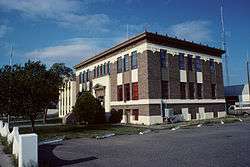
Hidalgo County Courthouse in Lordsburg | |
 Location of Lordsburg in New Mexico | |
 Lordsburg, New Mexico Location in the United States | |
| Coordinates: 32°20′49″N 108°42′26″W / 32.34694°N 108.70722°WCoordinates: 32°20′49″N 108°42′26″W / 32.34694°N 108.70722°W | |
| Country | United States |
| State | New Mexico |
| County | Hidalgo |
| Founded | 1880 |
| Government | |
| • Mayor | Arthur Clark Smith |
| Area | |
| • Total | 8.4 sq mi (21.7 km2) |
| • Land | 8.4 sq mi (21.7 km2) |
| • Water | 0.0 sq mi (0.0 km2) |
| Elevation | 4,250 ft (1,295 m) |
| Population (2000) | |
| • Total | 3,379 |
| • Density | 400/sq mi (160/km2) |
| Time zone | MST (UTC-7) |
| • Summer (DST) | MDT (UTC-6) |
| ZIP codes | 88009, 88045 |
| Area code(s) | 575 |
| FIPS code | 35-42180 |
| GNIS feature ID | 0891335 |
Lordsburg is a city in and the county seat of Hidalgo County, New Mexico, United States.[1] The population was 3,379 at the 2000 census.
History
Lordsburg was founded in 1880 on the route of the Southern Pacific Railroad.
New Mexico state song
Lordsburg is the birthplace of the official New Mexico State song, O Fair New Mexico.[2] It was written by Lordsburg resident Elizabeth Garrett, the blind daughter of famed sheriff Pat Garrett. In 1917, Governor Washington Ellsworth Lindsey signed the legislation making it the official state song. In 1928, John Philip Sousa presented Governor Arthur T. Hannett and the people of New Mexico an arrangement of the state song embracing a musical story of the Indian, the cavalry, the Spanish and the Mexican.[3]
Lordsburg Municipal Airport
In December 1938, the Lordsburg Municipal Airport (KLSB) began operation.[4] It was the first airport in New Mexico.[5] In 1927, Lordsburg was one of the stops on Charles Lindbergh's transcontinental "Spirit of Saint Louis" air tour. In the early 1950s the airport was served by the original Frontier Airlines (1950-1986) which flew DC-3's on a route from El Paso to Phoenix that included stops at Las Cruces, Deming, and Lordsburg, NM as well as Clifton, Safford, and Tucson, AZ.[6] It is owned by the City of Lordsburg and is southeast, about one mile outside the city limits.[7]
World War II
Lordsburg held as many as 1,500 Japanese Americans in a Japanese American internment camp operated by the U.S. Army during World War II. On July 27, 1942, shortly after the Lordsburg Internment Camp was opened, Private First Class Clarence Burleson, a sentry at the facility, allegedly shot two Japanese American internees under questionable circumstances. One of the victims, Hirota Isomura, apparently died instantly. The other, Toshiro Kobata, died before dawn. After a military investigation and courtmartial, Burleson was found to have lawfully killed the two men. The camp operated until July 1943.[8][9] The incident inspired an episode of the new Hawaii 5-0 series, "Ho'oani Makuakane," Episode 4/9 (original air date December 13, 2013).
The camp at Lordsburg also held captured German and Italian soldiers.[10]
Rest stop
For many years, Lordsburg has been a popular rest stop for people traveling to and from the West Coast by car on Interstate 10 and its precursor highway, U.S. Route 80. At just over 600 miles from Los Angeles, Lordsburg can comfortably be reached by car in less than one day. As Lordsburg had one of the few motels in the Southwest that would accept black guests (El Paso being a notable exception), it was especially popular with African American travelers in the mid-20th century during the end of legal segregation.
There are currently 12 motels and hotels located in Lordsburg. Over 300 rooms are available to guests.[5]
Geography
According to the United States Census Bureau, the city has a total area of 8.4 square miles (22 km2), all land.
Climate
Lordsburg has a cool semi-arid climate (Köppen BSk), just avoiding designation as a cool desert climate (BWk).
Typically for the more southerly and lower elevations of the Intermountain West, summers are extremely hot during the daytime, with maxima above 90 °F or 32.2 °C for over four months an on an average of 111.4 afternoons during a full year. 100 °F or 37.8 °C is exceeded on average during 22.8 afternoons each year, and the record high of 114 °F (45.6 °C) was set during a notorious southwestern heatwave on June 27 of 1994. Humidity in early summer is very low, but increases in late summer due to the monsoon, which, between July and early October brings the majority of the year’s limited precipitation. From October temperatures cool off rapidly, and by November most mornings are below 32 °F or 0 °C, but afternoons remains comfortable to warm all though the winter, with only 10.1 afternoons failing to reach 50 °F or 10 °C and only one afternoon every two years not topping freezing. Minima fall below freezing on an average of 121.3 mornings, but 0 °F or −17.8 °C has been reached only during two exceptional cold waves in January 1962 and December 1978, when the record low of −14 °F or −25.6 °C was reached on the 9th.
Except for the freakishly wet December 1991 when 4.55 inches (115.6 mm) fell from a series of subtropical cyclones, monthly rainfalls above 4.00 inches or 101.6 millimetres are restricted to the monsoon season: the wettest month between 1971 and 2000 was July 1981 with 5.34 inches (135.6 mm). The wettest day has been June 28 of 1981 with 3.00 inches or 76.2 millimetres. Snowfall is very rare; the median for the year is zero and the mean only 3.5 inches or 0.09 metres; with the heaviest snowfall between 1971 and 2000 being of 11.0 inches or 0.28 metres during Christmas and Boxing Days, 1987.
| Climate data for Lordsburg 4 SE, New Mexico (1971 to 2000; extremes 1948 to 2001) | |||||||||||||
|---|---|---|---|---|---|---|---|---|---|---|---|---|---|
| Month | Jan | Feb | Mar | Apr | May | Jun | Jul | Aug | Sep | Oct | Nov | Dec | Year |
| Record high °F (°C) | 80 (27) |
85 (29) |
93 (34) |
100 (38) |
106 (41) |
114 (46) |
110 (43) |
109 (43) |
104 (40) |
98 (37) |
86 (30) |
76 (24) |
114 (46) |
| Average high °F (°C) | 59.3 (15.2) |
64.5 (18.1) |
70.9 (21.6) |
79.6 (26.4) |
88.8 (31.6) |
98.1 (36.7) |
97.9 (36.6) |
95.1 (35.1) |
90.5 (32.5) |
80.5 (26.9) |
67.7 (19.8) |
59.1 (15.1) |
79.3 (26.3) |
| Average low °F (°C) | 25.1 (−3.8) |
27.6 (−2.4) |
32.1 (0.1) |
37.6 (3.1) |
46.9 (8.3) |
57.0 (13.9) |
63.9 (17.7) |
62.3 (16.8) |
55.3 (12.9) |
42.7 (5.9) |
30.1 (−1.1) |
25.2 (−3.8) |
42.2 (5.7) |
| Record low °F (°C) | −9 (−23) |
3 (−16) |
11 (−12) |
12 (−11) |
24 (−4) |
35 (2) |
49 (9) |
42 (6) |
36 (2) |
19 (−7) |
8 (−13) |
−14 (−26) |
−14 (−26) |
| Average rainfall inches (mm) | 0.92 (23.4) |
0.76 (19.3) |
0.80 (20.3) |
0.26 (6.6) |
0.38 (9.7) |
0.48 (12.2) |
1.99 (50.5) |
1.90 (48.3) |
1.26 (32) |
1.33 (33.8) |
0.84 (21.3) |
1.29 (32.8) |
12.21 (310.2) |
| Average rainy days (≥ 0.01 inch) | 4.7 | 4.2 | 4.2 | 1.7 | 2.1 | 2.2 | 8.0 | 7.5 | 4.8 | 4.6 | 2.9 | 4.2 | 51.1 |
| Source: National Oceanic and Atmospheric Administration[11] | |||||||||||||
Demographics
| Historical population | |||
|---|---|---|---|
| Census | Pop. | %± | |
| 1920 | 1,325 | — | |
| 1930 | 2,069 | 56.2% | |
| 1940 | 3,101 | 49.9% | |
| 1950 | 3,525 | 13.7% | |
| 1960 | 3,436 | −2.5% | |
| 1970 | 3,429 | −0.2% | |
| 1980 | 3,195 | −6.8% | |
| 1990 | 2,951 | −7.6% | |
| 2000 | 3,379 | 14.5% | |
| 2010 | 2,797 | −17.2% | |
| Est. 2015 | 2,531 | [12] | −9.5% |
As of the census[14] of 2000, there were 3,379 people, 1,220 households, and 854 families residing in the city. The population density was 403.1 people per square mile (155.7/km²). There were 1,414 housing units at an average density of 168.7 per square mile (65.1/km²). The racial makeup of the city was 80.70% White, 0.56% African American, 0.77% Native American, 0.50% Asian, 13.97% from other races, and 3.49% from two or more races. Hispanic or Latino of any race were 74.43% of the population.
There were 1,220 households out of which 36.9% had children under the age of 18 living with them, 46.5% were married couples living together, 18.6% had a female householder with no husband present, and 30.0% were non-families. 27.3% of all households were made up of individuals and 12.4% had someone living alone who was 65 years of age or older. The average household size was 2.70 and the average family size was 3.31.
In the city the population was spread out with 31.9% under the age of 18, 8.5% from 18 to 24, 25.6% from 25 to 44, 18.9% from 45 to 64, and 15.0% who were 65 years of age or older. The median age was 33 years. For every 100 females there were 94.8 males. For every 100 females age 18 and over, there were 89.4 males.
The median income for a household in the city was $21,036, and the median income for a family was $28,026. Males had a median income of $25,952 versus $18,177 for females. The per capita income for the city was $10,877. About 28.6% of families and 32.7% of the population were below the poverty line, including 47.5% of those under age 18 and 19.3% of those age 65 or over.
Cultural references
Lordsburg is the final destination in Stagecoach, the 9th greatest Western film of all time according to the American Film Institute, starring John Wayne in his breakthrough role as the Ringo Kid, and directed by John Ford.
In 1995, this film was deemed "culturally, historically, or aesthetically significant" by the United States Library of Congress and selected for preservation in their National Film Registry.
The town of Lordsburg is mentioned some 20 times in the movie Comanche Station, but not visited once.
Lordsburg is also cited in the 1954 film, "Dawn at Socorro." In it, the character played by Piper Laurie tells the Rory Calhoun character that she had seen him in Lordsburg killing someone in a shoot-out.
Education
Lordsburg High School's mascot is the Maverick. Its school colors are orange and black. Students compete in football, volleyball, boys' basketball, girls' basketball, cheer, and boys' and girls' track and field, baseball and softball.
Transportation
Public transportation
Greyhound lines maintains a terminal in Lordsburg. Amtrak has two train lines which stop at the Lordsburg station.
Airports
- Lordsburg Municipal Airport, private, charter and military. (First airport in NM)
- El Paso International Airport, 160 miles (260 km) east of Lordsburg, is the nearest public airport with scheduled passenger flights.
- Tucson International Airport, 155 miles (249 km) west of Lordsburg.
Major highways
Rail
- Amtrak's Sunset Limited and Texas Eagle routes stop at Lordsburg Train Station.
- The Union Pacific Railroad's mainline and the Arizona Eastern Railway with its branch to Clifton, Arizona serve Lordsburg.
References
- ↑ "Find a County". National Association of Counties. Retrieved 2011-06-07.
- ↑ Lordsburg, New Mexico Tourism Department
- ↑ New Mexico State Song
- ↑ http://www.airnav.com/airport/KLSB AirNav website
- 1 2 http://www.newmexico.org/place/loc/bymap/page/DB-place/place/1444.html New Mexico Tourism Department
- ↑ Frontier Airlines timetable: November 1, 1950
- ↑ http://www.nmtourism.org/place/loc/hunting/page/DB-place/category/105/place/588.html New Mexico Tourism Department
- ↑ Department of Justice and U.S. Army Facilities
- ↑ Lordsburg Revisited: A Closer Look at the Lordsburg Courtmartial
- ↑ New Mexico's Prisoner of War Camps
- ↑ "Climatography of the United States No. 20 – 1971-2000: Lordsburg 4 SE, NM" (PDF). National Oceanic and Atmospheric Administration. Retrieved October 30, 2016.
- ↑ "Annual Estimates of the Resident Population for Incorporated Places: April 1, 2010 to July 1, 2015". Retrieved July 2, 2016.
- ↑ "Census of Population and Housing". Census.gov. Retrieved June 4, 2015.
- ↑ "American FactFinder". United States Census Bureau. Retrieved 2008-01-31.
External links
| Wikimedia Commons has media related to Lordsburg, New Mexico. |
Municipalities and communities of Hidalgo County, New Mexico, United States | ||
|---|---|---|
| City | 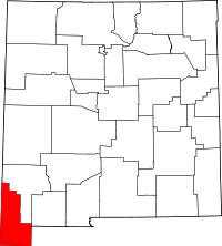 | |
| Village | ||
| CDPs | ||
| Other unincorporated communities | ||
| Ghost towns |
| |