Lower Kinnerton
| Lower Kinnerton | |
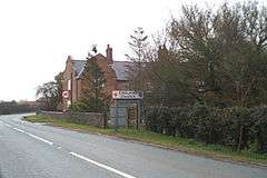 Bridge Farm, Lower Kinnerton, at the Wales-England border |
|
 Lower Kinnerton |
|
| Population | 136 (2011) |
|---|---|
| OS grid reference | SJ338621 |
| Civil parish | Lower Kinnerton |
| Unitary authority | Cheshire West and Chester |
| Ceremonial county | Cheshire |
| Region | North West |
| Country | England |
| Sovereign state | United Kingdom |
| Post town | CHESTER |
| Postcode district | CH4 |
| Dialling code | 01244 |
| Police | Cheshire |
| Fire | Cheshire |
| Ambulance | North West |
| EU Parliament | North West England |
| UK Parliament | City of Chester |
Coordinates: 53°09′09″N 2°59′27″W / 53.15248°N 2.99088°W
Lower Kinnerton is a village and civil parish in the unitary authority of Cheshire West and Chester and the ceremonial county of Cheshire, situated on the border between England and Wales. It has a population of 119,[1] increasing to 136 at the 2011 census.[2] The village is located south of Broughton and to the north west of the parish and village of Dodleston. The neighbouring village of Higher Kinnerton is across the border in Flintshire.
Lower Kinnerton has a few houses and farms. It also is home to a local Kennel and Cattery, Warren Wood Kennels and Cattery.
The population was 97 in 1801, 94 in 1851, 127 in 1901 and 142 in 1951.[3]
See also
References
- ↑ Office for National Statistics : Census 2001 : Parish headcounts : Chester Retrieved 2009-12-21
- ↑ "Parish population 2011". Retrieved 27 May 2015.
- ↑ "Cheshire Towns & Parishes: Lower Kinnerton". GENUKI UK & Ireland Genealogy. Retrieved 18 November 2007.
External links
![]() Media related to Lower Kinnerton at Wikimedia Commons
Media related to Lower Kinnerton at Wikimedia Commons
Cheshire Portal | |
| Unitary authorities | |
| Major settlements | |
| Rivers | |
| Topics | |