Méhtelek
| Méhtelek | |
|---|---|
| Country |
|
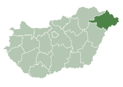
| County | Szabolcs-Szatmár-Bereg |
| Area | |
| • Total | 8.62 km2 (3.33 sq mi) |
| Population (2015) | |
| • Total | 759[1] |
| • Density | 87.9/km2 (228/sq mi) |
| Time zone | CET (UTC+1) |
| • Summer (DST) | CEST (UTC+2) |
| Postal code | 4975 |
| Area code(s) | 44 |
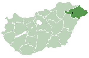
Location of Szabolcs-Szatmar-Bereg county in Hungary
Méhtelek is a village in Szabolcs-Szatmár-Bereg county, in the Northern Great Plain region of eastern Hungary.
Geography
It covers an area of 8.62 km2 (3 sq mi) and has a population of 759 people (2015).[1]
History
The village was put on the map somewhat after catastrophic floods in the region in late 1960s. Valuable archeological finds---possibly going back to 5000---BC were uncovered during the reconstruction of the settlement. [2]
References
- 1 2 Gazetteer of Hungary, 1st January 2015. Hungarian Central Statistical Office. 03/09/2015
- ↑ village web site (Hungarian only).
Coordinates: 47°56′N 22°51′E / 47.933°N 22.850°E
This article is issued from Wikipedia - version of the 5/17/2016. The text is available under the Creative Commons Attribution/Share Alike but additional terms may apply for the media files.