Szatmárcseke
| Szatmárcseke | |
|---|---|
 Szatmárcseke | |
| Coordinates: 48°5′9.28″N 22°37′51.74″E / 48.0859111°N 22.6310389°E | |
| Country |
|
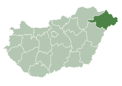
| County | Szabolcs-Szatmár-Bereg |
| Area | |
| • Total | 36.31 km2 (14.02 sq mi) |
| Population (2010) | |
| • Total | 1,558 |
| • Density | 39.14/km2 (101.4/sq mi) |
| Time zone | CET (UTC+1) |
| • Summer (DST) | CEST (UTC+2) |
| Postal code | 4945 |
| Area code(s) | 44 |
| Website | http://szatmarcseke.hu/ |
Szatmárcseke is a village in Szabolcs-Szatmár-Bereg county, in the Northern Great Plain region of eastern Hungary.[1]
Geography
It lies at a distance of 94 km from Nyíregyháza, 29 km from Vásárosnamény, 17 km from Fehérgyarmat, 18 km from Tiszabecs, and 11 km from Tiszacsécse.
History
The first written mention of the village arose in 1181 as Cseke. This time it was a thriving village that owned a temple.[2]
References
- ↑ "Szatmárcseke". Retrieved 2012-08-27. (Hungarian)
- ↑ "Szatmárcseke, "Történelem"". Retrieved 2012-08-27. (Hungarian)
This article is issued from Wikipedia - version of the 5/23/2015. The text is available under the Creative Commons Attribution/Share Alike but additional terms may apply for the media files.