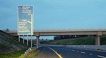
M9 motorway (Ireland)
| |
|---|---|
.png)
 | |
| Route information | |
Part of  | |
| Length: | 119 km (74 mi) |
| Existed: | 1993 – present |
| History: | Completed in 2010 |
| Major junctions | |
| From: | M7 Junction 11 |
|
| |
| To: | Waterford |
| Location | |
| Primary destinations: | Athy, Carlow, Kilkenny |
| Road network | |

The M9 motorway (Irish: Mótarbhealach M9) is a motorway in Ireland linking the M7 at Kilcullen to Waterford. Opened in sections between 1994 and 2010, the final section opened on 9 September 2010.
Prior to July 2008, the majority of the M9 – from Junction 2 onwards – was to be built as High Quality Dual Carriageway (HQDC). Due to the passing of a Statutory Instrument in that month, a large section of the route was re-designated to motorway standard. The section included the motorway under construction between Kilcullen and Powerstown and the (then) newly opened Carlow bypass. The remainder of the route has since been redesignated.
Route
M7 to Kilcullen
The M9 begins at Junction 11 (previously Junction 9) on the M7 motorway. This junction is a restricted access interchange, allowing traffic from the M9 to enter only the eastbound carriageway. There is no access to the M9 from the M7 eastbound, or to the M7 westbound from the M9. The route continues for 6 km before reaching the Kilcullen to Carlow section. The section runs between Junctions 1 and 2 on the M9 corridor. This section opened in 1994.
Kilcullen to Carlow
Construction of 28 km of motorway linking the Kilcullen bypass with the Carlow bypass began in February 2008. This section was completed and opened on 21 December 2009.[1] It runs between Junctions 2 and 4 on the M9 corridor.
Carlow Bypass
This 18.5 km (11 mi) section of motorway opened on the 29 May 2008 and runs between Junctions 4 and 6 on the M9 corridor. It provides a bypass of Carlow and allows access to the N80 for Rosslare and the R448 for Leighlinbridge.[2]
Carlow to Knocktopher
The first part of this section between Junctions 9 and 10 (Danesfort-Knocktopher) comprising 12 km of motorway was opened on 22 March 2010, in conjunction with the Knocktopher to Waterford section. The remaining section, Leighlinbridge to Danesfort, opened on 9 September 2010, thus completing the entire motorway. The scheme was built by SiskRoadbridge(SRB) Ltd.
Knocktopher to Waterford
The Knocktopher-Waterford section of the M9 route was opened on 22 March 2010.[3] This section is 24 km long and runs between Junctions 10 and 12 on the M9 corridor. The scheme was built by BAM Ltd (formerly Ascon Ltd.). Junction 12 is not a standard motorway junction but is instead a roundabout. The left exit from this roundabout accesses the N9 road which continues to Waterford.
Junctions


| M9 Motorway | |||
| Northbound exit | Junction | Southbound exit | |
| Road merges with M7 | |
Start of motorway | |
| Kilcullen, Athy (R418) | |
Kilcullen, Athy (R448) | |
| Kilcullen Services (Under construction) | |
Kilcullen Services (Under construction) | |
| Parking | |
Parking | |
| Athy, Baltinglass, Moone (N78) | |
Athy, Baltinglass, Moone (N78) | |
| Carlow (R448) | |
Carlow (R448) | |
| Carlow, Rosslare (N80) Carlow Services (In planning) |
|
Carlow, Rosslare (N80) Carlow Services (Im planning) | |
| Leighlinbridge (R448) | |
Leighlinbridge (R448) | |
| [Paulstown]], Gowran (R448) Paulstown Services |
|
[Paulstown]], Gowran (R448) Paulstown Services | |
| Kilkenny | |
Kilkenny | |
| Kilkenny (N10) | |
Kilkenny (N10) | |
| Parking | |
Parking | |
| Knocktopher (R699) | |
Knocktopher (R699) | |
| Parking | |
No exit | |
| Mullinavat (R448) | |
Mullinavat (R448) | |
| No exit | |
Parking | |
| Start of motorway | |
Limerick, Clonmel (N24) (Roundabout - second exit) | |
Proposed Service Areas
The National Roads Authority (NRA) plans to construct Motorway Service Areas at approximately 60 kilometre intervals along each of Ireland's interurban routes. Under this plan, the M9 will have two such areas. The first will be located near the M7/M9 interchange between Junctions 3 and 2. The second will be located south of Carlow near Muine Bheag, between Junctions 7 and 8 (see here, p. 25[4]). The EIS for the M9 Kilcullen Motorway Service Area is now available at the NRA website (scroll down to the bottom here).[5]
As of January 2010, no details regarding the construction of the other M9 service area have been announced.
On 1 August 2013, a planning application for a Motorway Service Areas was lodged with Kilkenny County Council. The proposed service area will be located just off Junction 7 Paulstown. A decision on planning for the services area is due on 25 September 2013. The service area will include vehicle fuelling station, HGV fueling station, shop, two restaurant/drive through. There will be 119 parking spaces as well as 12 HGV parking spaces. In April 2014 construction began on a bridge and access roads to a service area close to Junction 2 near Kilcullen and was completed in early 2015. However as of October 2016, no construction has taken place of the proposed filling station/shop/restaurant. [6]
References
- ↑ "Opening of the M9 Kilcullen to Carlow". Ireland National Roads Authority. Retrieved 2009-12-21.
- ↑ "N9/N10 Carlow Bypass". Ireland national Roads Authority. Retrieved 2009-10-21.
- ↑ "M9 Motorway from Waterford to Knocktopher Opens Today!". Ireland National Roads Authority. Retrieved 2010-03-10.
- ↑ "M1 South Motorway Service Area: Environmental Impact Statement, Vol 2" (PDF). National Roads Authority. February 2008. Retrieved 2009-09-14.
- ↑ "EIS Publications - National Roads Authority". National Roads Authority. 2008-07-01. Retrieved 2009-09-14.
- ↑ http://planning.kilkennycoco.ie/FileRefDetails.aspx?file_number=13373&LASiteID=0