R279 road (Ireland)
| |
|---|---|
|
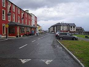
Mullaghmore village at the north end of R279 | |
| Route information | |
| Length: | 4.4 km[1] (2.7 mi) |
| Major junctions | |
| From: |
|
| To: | Mullaghmore pier |
| Road network | |

The R279 road is a regional road in Ireland linking Cliffoney and Mullaghmore in County Sligo.[2] The 19th century Classiebawn Castle is located on this road just before entering Mullaghmore. The entire road is part of the Wild Atlantic Way, which continues around Mullaghmore Head after the end of the R279.[3]
See also
References
- ↑ Google (11 Feb 2016). "R279" (Map). Google Maps. Google. Retrieved 11 Feb 2016.
- ↑ "S.I. No. 54/2012 – Roads Act 1993 (Classification of Regional Roads) Order 2012". Government of Ireland. 28 Feb 2012. Retrieved 11 Feb 2016.
- ↑ "Wild Atlantic Way: Mullaghmore Head". Fáilte Ireland. Retrieved 14 Mar 2016.
This article is issued from Wikipedia - version of the 4/16/2016. The text is available under the Creative Commons Attribution/Share Alike but additional terms may apply for the media files.