Macedonia, Ohio
| Macedonia, Ohio | |
|---|---|
| City | |
|
| |
| Motto: "The Crossroads of Northeast Ohio" | |
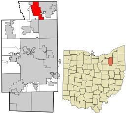 Location in Summit County and the state of Ohio. | |
| Coordinates: 41°19′4″N 81°30′5″W / 41.31778°N 81.50139°WCoordinates: 41°19′4″N 81°30′5″W / 41.31778°N 81.50139°W | |
| Country | United States |
| State | Ohio |
| County | Summit |
| Government | |
| • Mayor | Joseph Migliorini |
| Area[1] | |
| • Total | 9.75 sq mi (25.25 km2) |
| • Land | 9.71 sq mi (25.15 km2) |
| • Water | 0.04 sq mi (0.10 km2) |
| Elevation[2] | 988 ft (301 m) |
| Population (2010)[3] | |
| • Total | 11,188 |
| • Estimate (2012[4]) | 11,350 |
| • Density | 1,152.2/sq mi (444.9/km2) |
| Time zone | Eastern (EST) (UTC-5) |
| • Summer (DST) | EDT (UTC-4) |
| ZIP code | 44056 |
| Area code(s) | 330 |
| FIPS code | 39-45976[5] |
| GNIS feature ID | 1061458[2] |
| Website | http://www.macedonia.oh.us/ |

Macedonia is a city in Summit County, Ohio, United States. The population was 11,188 at the 2010 census. Macedonia is part of the Akron Metropolitan Statistical Area.
History
The city's name is said to derive from a small joke among divinity students at Western Reserve College, which in the early 19th century was in Hudson, Ohio. The students, who were called upon to preach in the small hamlet 6 miles (10 km) to the north, recalled Acts 16:10: "...we sought to go to Macedonia, concluding that the Lord had called us to preach the gospel to them."[6]
Geography
Macedonia is located at 41°19′4″N 81°30′5″W / 41.31778°N 81.50139°W (41.317807, -81.501460).[7]
According to the United States Census Bureau, the city has a total area of 9.75 square miles (25.25 km2), including 9.71 square miles (25.15 km2) of land and 0.04 square miles (0.10 km2) of water.[1]
Demographics
| Historical population | |||
|---|---|---|---|
| Census | Pop. | %± | |
| 1880 | 219 | — | |
| 1910 | 452 | — | |
| 1920 | 581 | 28.5% | |
| 1930 | 734 | 26.3% | |
| 1970 | 6,375 | — | |
| 1980 | 6,571 | 3.1% | |
| 1990 | 7,509 | 14.3% | |
| 2000 | 9,224 | 22.8% | |
| 2010 | 11,188 | 21.3% | |
| Est. 2015 | 11,686 | [8] | 4.5% |
| Sources:[9][5][10] | |||
The median income for a household in the city was $77,866, and the median income for a family was $88,906. The per capita income for the city was $32,960. About 2.1% of the population were below the poverty line. Of the city's population over the age of 25, 41.2% holds a bachelor's degree or higher.[11][12]
2010 census
As of the census[3] of 2010, there were 11,188 people, 4,338 households, and 3,231 families residing in the city. The population density was 1,152.2 inhabitants per square mile (444.9/km2). There were 4,545 housing units at an average density of 468.1 per square mile (180.7/km2). The racial makeup of the city was 83.6% White, 10.4% African American, 0.1% Native American, 3.9% Asian, 0.4% from other races, and 1.6% from two or more races. Hispanic or Latino of any race were 1.3% of the population.
There were 4,338 households of which 31.1% had children under the age of 18 living with them, 63.5% were married couples living together, 8.0% had a female householder with no husband present, 3.0% had a male householder with no wife present, and 25.5% were non-families. 21.3% of all households were made up of individuals and 9.6% were composed of a person 65 years or older living alone. The average household size was 2.58 and the average family size was 3.01.
The median age in the city was 43.4 years. 22.3% of residents were under the age of 18; 6.5% were between the ages of 18 and 24; 24% were from 25 to 44; 32.7% were from 45 to 64; and 14.7% were 65 years of age or older. The gender makeup of the city was 48.5% male and 51.5% female.
Notable people
- Je'Rod Cherry, retired, NFL safety, New England Patriots
- John Lefelhocz, Conceptual artist, Quilter - Variety of Media.
- Ronald Sega, retired NASA Astronaut
- Rob Sims, NFL guard, Detroit Lions, former The Ohio State University Buckeye, former Nordonia Knight
- Jason Trusnik, NFL Player former Cleveland Browns, current Miami Dolphins
- Vonda Ward, female boxer and former University of Tennessee basketball player
References
- 1 2 "US Gazetteer files 2010". United States Census Bureau. Retrieved 2013-01-06.
- 1 2 "US Board on Geographic Names". United States Geological Survey. 2007-10-25. Retrieved 2008-01-31.
- 1 2 "American FactFinder". United States Census Bureau. Retrieved 2013-01-06.
- ↑ "Population Estimates". United States Census Bureau. Retrieved 2013-06-17.
- 1 2 "American FactFinder". United States Census Bureau. Retrieved 2008-01-31.
- ↑ "Macedonia History". City of Macedonia. Retrieved 13 May 2011.
- ↑ "US Gazetteer files: 2010, 2000, and 1990". United States Census Bureau. 2011-02-12. Retrieved 2011-04-23.
- ↑ "Annual Estimates of the Resident Population for Incorporated Places: April 1, 2010 to July 1, 2015". Retrieved July 2, 2016.
- ↑ "Ohio: Population and Housing Unit Counts" (PDF). U.S. Census Bureau. Retrieved 22 November 2013.
- ↑ "Incorporated Places and Minor Civil Divisions Datasets: Subcounty Population Estimates: April 1, 2010 to July 1, 2012". U.S. Census Bureau. Retrieved 25 November 2013.
- ↑ http://quickfacts.census.gov/qfd/states/39/3945976.html
- ↑ http://factfinder2.census.gov/faces/tableservices/jsf/pages/productview.xhtml?pid=ACS_10_5YR_DP03&prodType=table
External links
Municipalities and communities of Summit County, Ohio, United States | ||
|---|---|---|
| Cities | 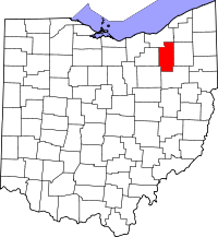 | |
| Villages | ||
| Townships | ||
| CDPs | ||
| Unincorporated communities | ||
| Footnotes | ‡This populated place also has portions in an adjacent county or counties | |