Manchester Township, Dearborn County, Indiana
| Manchester Township | |
|---|---|
| Township | |
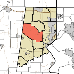 Location of Manchester Township in Dearborn County | |
| Coordinates: 39°08′53″N 85°00′40″W / 39.14806°N 85.01111°WCoordinates: 39°08′53″N 85°00′40″W / 39.14806°N 85.01111°W | |
| Country | United States |
| State | Indiana |
| County | Dearborn |
| Government | |
| • Type | Indiana township |
| Area | |
| • Total | 45.5 sq mi (118 km2) |
| • Land | 45.48 sq mi (117.8 km2) |
| • Water | 0.02 sq mi (0.05 km2) |
| Elevation[1] | 899 ft (274 m) |
| Population (2010) | |
| • Total | 3,215 |
| • Density | 70.7/sq mi (27.3/km2) |
| FIPS code | 18-46368[2] |
| GNIS feature ID | 453601 |
Manchester Township is one of fourteen townships in Dearborn County, Indiana. As of the 2010 census, its population was 3,215 and it contained 1,233 housing units.[3]
History
The Dearborn County Asylum for the Poor was added to the National Register of Historic Places in 2000.[4]
Geography
According to the 2010 census, the township has a total area of 45.5 square miles (118 km2), of which 45.48 square miles (117.8 km2) (or 99.96%) is land and 0.02 square miles (0.052 km2) (or 0.04%) is water.[3]
Unincorporated towns
- Bonnell
- Kirschs Corner
- Kyle
- Manchester
- Wrights Corner
(This list is based on USGS data and may include former settlements.)
Major highways
Cemeteries
The township contains three cemeteries: Lowes, Manchester and McKinstry.
References
- ↑ "US Board on Geographic Names". United States Geological Survey. 2007-10-25. Retrieved 2008-01-31.
- ↑ "American FactFinder". United States Census Bureau. Retrieved 2008-01-31.
- 1 2 "Population, Housing Units, Area, and Density: 2010 - County -- County Subdivision and Place -- 2010 Census Summary File 1". United States Census. Retrieved 2013-05-10.
- ↑ National Park Service (2010-07-09). "National Register Information System". National Register of Historic Places. National Park Service.
External links
 |
Jackson Township | York Township | Miller Township | |
| Franklin Township, Ripley County | |
Lawrenceburg Township | ||
| ||||
| | ||||
| Sparta Township | Hogan Township | Center Township |
Municipalities and communities of Dearborn County, Indiana, United States | ||
|---|---|---|
| Cities | ||
| Towns | ||
| Townships | ||
| CDPs | ||
| Other unincorporated communities | ||
This article is issued from Wikipedia - version of the 9/6/2015. The text is available under the Creative Commons Attribution/Share Alike but additional terms may apply for the media files.