Marondera
| Marondera | ||
|---|---|---|
| City/Town | ||
| ||
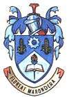
| Motto: Floreat Marondera (May Marondera Flourish) | ||
 Marondera | ||
| Coordinates: 18°11′23″S 31°32′48″E / 18.18972°S 31.54667°ECoordinates: 18°11′23″S 31°32′48″E / 18.18972°S 31.54667°E | ||
| Country |
| |
| Province | Mashonaland East | |
| District | Marondera | |
| Village | 1913 | |
| Town | 1943 | |
| City | 1982 | |
| Government | ||
| Elevation | 1,688 m (5,538 ft) | |
| Population (2013) | ||
| • Total | 68,017 | |
| Time zone | CET (UTC+1) | |
| • Summer (DST) | CEST (UTC+1) | |
| Climate | Cwb | |
Marondera (known as Marandellas until 1982) is a town in Mashonaland East, Zimbabwe, located about 72 km east of Harare; population 39,384 (Central Statistical Office, Zimbabwe. Census of Population, 1992. The population was estimated at 46,000 in 2002. Harare: Government Printer). One of the earliest centres of white settlement in the former colony of Southern Rhodesia, Marondera was one of the centres of Zimbabwe's large forestry and farming district and markets timber, tobacco, corn (maize), beef, and dairy products until the seizure of white-owned farms and redistribution of land began in 2000.
History
It originated in 1890 as a rest house on the road from Salisbury (now Harare) to Umtali (now Mutare). It was first known as Marandella's Kraal, corrupted from Marondera, chief of the ruling Barozwi people. This was later contracted to Marandellas. Later destroyed in the Shona resistance of 1896, the town was moved 4 miles (6 km) north to the Salisbury-Beira railway line. Constituted a village in 1913, it became a town in 1943. During the South African (Boer) War it was used by the British as a staging point for military operations into the Transvaal, and in World War II it was a refuge for displaced Poles.
Climate
| Climate data for Marondera (1961–1990) | |||||||||||||
|---|---|---|---|---|---|---|---|---|---|---|---|---|---|
| Month | Jan | Feb | Mar | Apr | May | Jun | Jul | Aug | Sep | Oct | Nov | Dec | Year |
| Average high °C (°F) | 24.8 (76.6) |
24.2 (75.6) |
24.2 (75.6) |
22.9 (73.2) |
21.5 (70.7) |
19.3 (66.7) |
19.2 (66.6) |
22.0 (71.6) |
25.5 (77.9) |
26.0 (78.8) |
25.8 (78.4) |
24.3 (75.7) |
23.3 (73.9) |
| Average low °C (°F) | 14.8 (58.6) |
14.7 (58.5) |
13.8 (56.8) |
11.5 (52.7) |
8.9 (48) |
6.1 (43) |
5.9 (42.6) |
7.3 (45.1) |
10.5 (50.9) |
12.5 (54.5) |
13.8 (56.8) |
14.5 (58.1) |
11.2 (52.2) |
| Average rainfall mm (inches) | 193.4 (7.614) |
149.1 (5.87) |
90.3 (3.555) |
48.7 (1.917) |
10.1 (0.398) |
5.4 (0.213) |
3.0 (0.118) |
3.0 (0.118) |
6.8 (0.268) |
40.3 (1.587) |
113.1 (4.453) |
187.7 (7.39) |
850.9 (33.5) |
| Average rainy days | 14 | 12 | 9 | 5 | 2 | 1 | 1 | 1 | 1 | 5 | 10 | 15 | 76 |
| Source: World Meteorological Organization[1] | |||||||||||||
Education
It is an educational centre with numerous elite private and government schools in the area. Marondera houses some of the most popular high schools and junior schools in Zimbabwean history such as Bernard Mizeki College, Peterhouse Boys' School and Peterhouse Girls' School, Watershed College, Rakodzi High School, Marondera High School and Wise Owl High School. Junior schools in Marondera include Barnies Junior School (www.barniesgroup.ac.zw), Ruzawi School, Godfrey Huggins, Diggleford School, Lendy Park, Springvale House and Wise Owl Primary School (www.wiseowlschool.co.zw). It also houses an agricultural and commercial college aptly named Kushinga Phikelela and a government research station called Grasslands Research Station.
Demographics
The town is multi-cultural, with a variety of ethnic groups. Within the African population is a proportion of people of Malawian origin whose parents migrated and took employment on the white owned tobacco farms. The main faiths in Marondera are secular traditional Christians, evangelicals and mapostori (a sect of old testament bible followers who live like ancient prophets and may dress in white robes). Islam is practised by a small number of people in Marondera Asians and those people of Malawian descent. The indigenous people of Marondera descend mainly from the Shona royal families of Svosve, and the nearby royal households of Chikwaka , Nyashanu and others royal family lives there the Mashonganyika family etc. They are traditionally farmers. Marondera has several very good schools, which have been in operation for many years. The junior schools include Godfrey Huggins, Tapfuma School, Dombotombo School, Springvale House, Digglefold and Ruzawi School and the senior schools are Marondera High School, Peterhouse Boys' School, Peterhouse Girls' School, Rakodzi High, Watershed College, Bernard Mizeki College, Waddilove High School & Nagle House. The first black mayor of Marondera was T. K. Muronda in 1980.[2]
References
- ↑ "World Weather Information Service – Marondera". World Meteorological Organization. Retrieved 13 May 2016.
- ↑ "Britannica.com". Retrieved 28 December 2007.
