Marseilles, Illinois
| Marseilles | |
| City | |
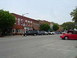 Buildings in the city's business district | |
| Name origin: Marseille, France | |
| Country | United States |
|---|---|
| State | Illinois |
| County | LaSalle |
| Townships | Manlius, Rutland, Brookfield |
| Elevation | 504 ft (154 m) |
| Coordinates | 41°19′40″N 88°42′4″W / 41.32778°N 88.70111°WCoordinates: 41°19′40″N 88°42′4″W / 41.32778°N 88.70111°W |
| Area | 9.21 sq mi (24 km2) |
| - land | 8.72 sq mi (23 km2) |
| - water | 0.49 sq mi (1 km2) |
| Population | 5,032 (2013) |
| Density | 584/sq mi (225/km2) |
| Timezone | CST (UTC-6) |
| - summer (DST) | CDT (UTC-5) |
| Postal code | 61341 |
| Area code | 815 |
  Location of Marseilles within Illinois | |
| Wikimedia Commons: Marseilles, Illinois | |
Marseilles is a city in LaSalle County, Illinois, United States. The population was 5,094 at the 2010 census, and was estimated to be 5,032 by July 2013.[1] It is part of the Ottawa-Peru, IL Micropolitan Statistical Area.
History
.JPG)
Lovell Kimball arrived at the area along the Illinois River known as the Grand Rapids in 1833 from Watertown, New York. Kimball, aware that the Illinois-Michigan Canal Bill had passed and the canal would eventually reach the rapids, hired a surveyor to lay out a town. Kimball called the town Marseilles, under the impression that Marseilles, France was an industrial center the likes of which he hoped to attain in Illinois. Marseilles was officially platted on June 3, 1835; the plat was revised twice for railroad and canal right-of-ways.[2]
Nabisco Building
In 1921 the National Biscuit Company (Nabisco) built an eight-story corrugated cardboard box production plant in Marseilles, the largest industrial building in the state (outside of Chicago) at the time, and the first air-conditioned factory in the Midwest. Nabisco was a major employer in the area but ceased production at the plant in 2002.[3]
Geography
Marseilles is located at 41°19′40″N 88°42′4″W / 41.32778°N 88.70111°W (41.327795, -88.701121).[4] The city is at the head of rapids along the Illinois River historically known as "the Grand Rapids" or the "Rapids of Maninumba".[2]
According to the 2010 census, Marseilles has a total area of 9.206 square miles (23.84 km2), of which 8.72 square miles (22.58 km2) (or 94.72%) is land and 0.486 square miles (1.26 km2) (or 5.28%) is water.[5]
Demographics
| Historical population | |||
|---|---|---|---|
| Census | Pop. | %± | |
| 1870 | 758 | — | |
| 1880 | 1,882 | 148.3% | |
| 1890 | 2,210 | 17.4% | |
| 1900 | 2,559 | 15.8% | |
| 1910 | 3,291 | 28.6% | |
| 1920 | 3,391 | 3.0% | |
| 1930 | 4,292 | 26.6% | |
| 1940 | 4,455 | 3.8% | |
| 1950 | 4,514 | 1.3% | |
| 1960 | 4,347 | −3.7% | |
| 1970 | 4,320 | −0.6% | |
| 1980 | 4,766 | 10.3% | |
| 1990 | 4,811 | 0.9% | |
| 2000 | 4,655 | −3.2% | |
| 2010 | 5,094 | 9.4% | |
| Est. 2015 | 4,963 | [6] | −2.6% |
As of the 2010 Census[8] there were 5,094 people, 2,045 households, and 1,327 families residing in the city. The population density was 584 people per square mile (225/km²). There were 2,422 housing units at an average density of 278 per square mile (107/km²). The racial makeup of the city was 96.2% White, 0.04% African American, 0.4% Native American, 0.5% Asian, 1.4% from other races, and 1.2% from two or more races. Hispanic or Latino of any race were 5.6% of the population.
There were 2,045 households out of which 30.6% had children under the age of 18 living with them, 46.8% were married couples living together, 11.3% had a female householder with no husband present. 29.6% of all households were made up of individuals and 26.0% had someone living alone who was 65 years of age or older. The average household size was 2.45 and the average family size was 3.00.
The city's age distribution consisted of 23.9% under the age of 18, and 14.9% who were 65 years of age or older. The median age was 38.5 years, and females made up 50.7% of the population.
During the period of 2009-2013 the median income for households was $37,558, per capita income was $20,931, and 12.8% of the population was below poverty level.[1]
See also
References
- 1 2 "Marseilles, Illinois". State and County Quick Facts. US Census Bureau. Retrieved 13 December 2014.
- 1 2 Jakupcak, Joseph M. "Chicago, Rock Island and Pacific Depot" (PDF), National Register of Historic Places Registration Form, June 5, 1995, Illinois Historic Preservation Agency, accessed May 20, 2008.
- ↑ Balynas, Joe. "Former Nabisco Plant, located in Marseilles,IL". flicker.com. Flickr. Retrieved 8 October 2015.
- ↑ "US Gazetteer files: 2010, 2000, and 1990". United States Census Bureau. 2011-02-12. Retrieved 2011-04-23.
- ↑ "G001 - Geographic Identifiers - 2010 Census Summary File 1". United States Census Bureau. Retrieved 2015-12-27.
- ↑ "Annual Estimates of the Resident Population for Incorporated Places: April 1, 2010 to July 1, 2015". Retrieved July 2, 2016.
- ↑ "Census of Population and Housing". Census.gov. Retrieved June 4, 2015.
- ↑ "Profile of General Population and Housing Characteristics: 2010". American Factfinder. US Census Bureau. Retrieved 12 December 2014.
Municipalities and communities of LaSalle County, Illinois, United States | ||
|---|---|---|
| Cities | ||
| Villages | ||
| Townships |
| |
| CDPs | ||
| Other unincorporated communities |
| |
| Ghost towns |
| |
| Footnotes | ‡This populated place also has portions in an adjacent county or counties | |